Estimated Value: $135,438 - $162,000
3
Beds
2
Baths
1,255
Sq Ft
$121/Sq Ft
Est. Value
About This Home
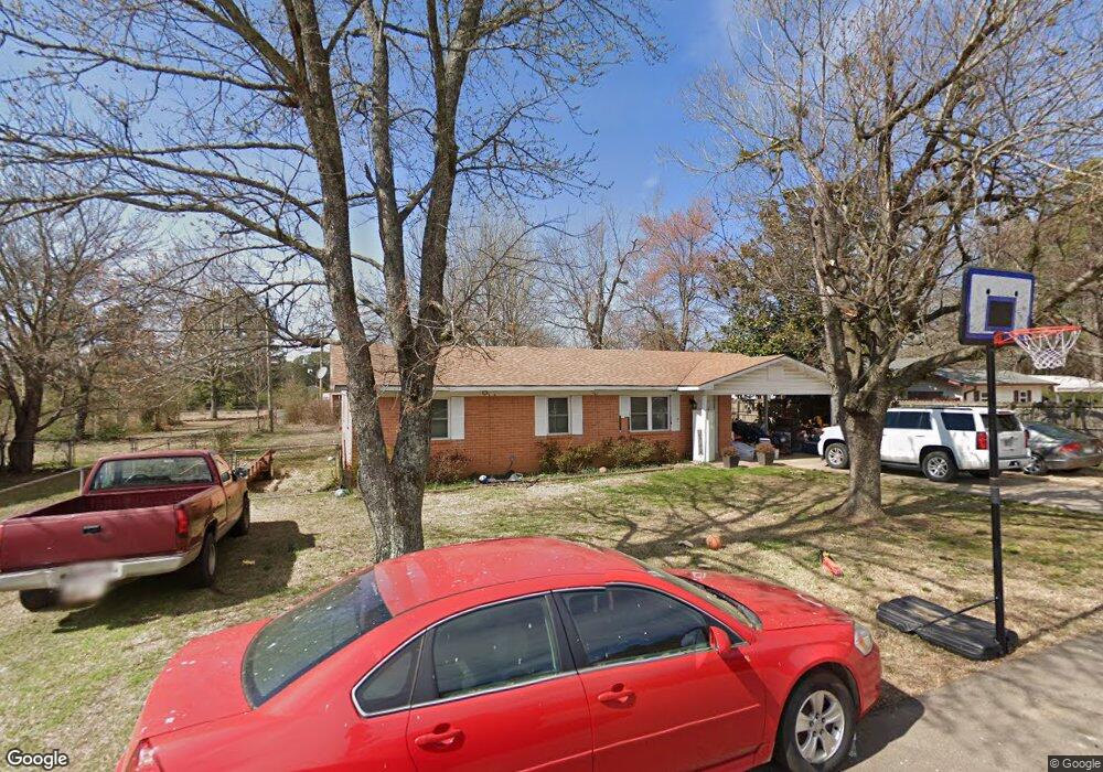
This home is located at 705 Blake St, Mena, AR 71953 and is currently estimated at $151,860, approximately $121 per square foot. 705 Blake St is a home located in Polk County with nearby schools including Holly Harshman Elementary School, Mena Middle School, and Mena High School.
Ownership History
Date
Name
Owned For
Owner Type
Purchase Details
Closed on
Apr 8, 2014
Sold by
Jpmorgan Chase Bank Na
Bought by
Womble James E and Womble Jennifer
Current Estimated Value
Purchase Details
Closed on
Oct 11, 2013
Sold by
Cox Jason L and Cox Nicole
Bought by
Jpmorgan Chase Bank Na
Purchase Details
Closed on
May 23, 2008
Sold by
Cox Jason L and Cox Nicole
Bought by
Cox Jason L and Cox Nicole
Home Financials for this Owner
Home Financials are based on the most recent Mortgage that was taken out on this home.
Original Mortgage
$70,407
Interest Rate
5.86%
Mortgage Type
New Conventional
Purchase Details
Closed on
Nov 3, 2005
Sold by
Thorpe Nora L and Thorpe Guy M
Bought by
Thorpe Nora L
Purchase Details
Closed on
Aug 16, 2005
Sold by
Thorpe Nora L and Thorpe Malcolm
Bought by
Barnes Peggy Ann and Thorpe Nora L
Create a Home Valuation Report for This Property
The Home Valuation Report is an in-depth analysis detailing your home's value as well as a comparison with similar homes in the area
Home Values in the Area
Average Home Value in this Area
Purchase History
| Date | Buyer | Sale Price | Title Company |
|---|---|---|---|
| Womble James E | $51,000 | Mena Title Co Inc | |
| Jpmorgan Chase Bank Na | $58,104 | None Available | |
| Cox Jason L | -- | -- | |
| Cox Jason L | $64,000 | -- | |
| Thorpe Nora L | -- | -- | |
| Barnes Peggy Ann | -- | -- |
Source: Public Records
Mortgage History
| Date | Status | Borrower | Loan Amount |
|---|---|---|---|
| Previous Owner | Cox Jason L | $70,407 |
Source: Public Records
Tax History
| Year | Tax Paid | Tax Assessment Tax Assessment Total Assessment is a certain percentage of the fair market value that is determined by local assessors to be the total taxable value of land and additions on the property. | Land | Improvement |
|---|---|---|---|---|
| 2025 | $788 | $20,030 | $1,970 | $18,060 |
| 2024 | $745 | $20,030 | $1,970 | $18,060 |
| 2023 | $683 | $20,030 | $1,970 | $18,060 |
| 2022 | $635 | $14,570 | $2,000 | $12,570 |
| 2021 | $635 | $14,570 | $2,000 | $12,570 |
| 2020 | $653 | $14,570 | $2,000 | $12,570 |
| 2019 | $653 | $14,570 | $2,000 | $12,570 |
| 2018 | $649 | $14,570 | $2,000 | $12,570 |
| 2017 | $590 | $13,170 | $2,000 | $11,170 |
| 2016 | $590 | $13,170 | $2,000 | $11,170 |
| 2015 | $590 | $13,170 | $2,000 | $11,170 |
| 2014 | $590 | $13,170 | $2,000 | $11,170 |
Source: Public Records
Map
Nearby Homes
- 2602 Reeves Ave
- 209 Finks St
- Unk Eve St S
- 128 Seay Ln
- 1902 Smith Ave
- 164 Polk Road 714
- 9999 Simpson St
- 109 Adams St S
- unk Sutherland Ave
- 1300 Eve St S
- 1611 Hamilton Ave
- 908 Texas St
- 306 Gary Dr
- 2804 Westmoreland Dr
- 1811 Thalia Dr
- 2812 Westmoreland Dr
- 1204 Texas St
- Tract 1-TBD Arkansas 375
- Tract 2-TBD Arkansas 375
- 918 S Reine St
Your Personal Tour Guide
Ask me questions while you tour the home.