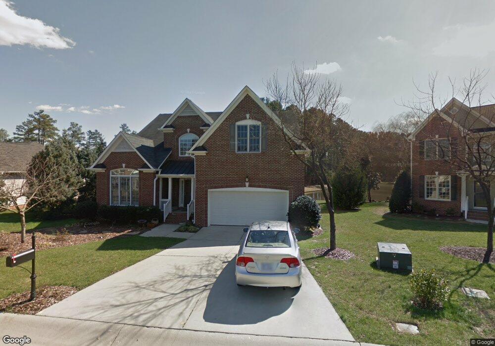
705 Cheselden Dr Durham, NC 27713
Estimated Value: $705,055 - $777,000
4
Beds
4
Baths
3,504
Sq Ft
$214/Sq Ft
Est. Value
About This Home
This home is located at 705 Cheselden Dr, Durham, NC 27713 and is currently estimated at $751,264, approximately $214 per square foot. 705 Cheselden Dr is a home located in Durham County with nearby schools including Lowe's Grove Middle, Hillside High School, and Kestrel Heights School.
Ownership History
Date
Name
Owned For
Owner Type
Purchase Details
Closed on
Dec 23, 2022
Sold by
Khalil Lara and Brice Randall
Bought by
Khalil Ronny
Current Estimated Value
Purchase Details
Closed on
Apr 29, 2020
Sold by
Khalil Wafa Hammoud
Bought by
Khalil Lara
Purchase Details
Closed on
Jun 5, 2015
Sold by
Baxter Lonnie H and Baxter Carol A
Bought by
Khalil Samir and Khalil Wafa Hammoud
Purchase Details
Closed on
Nov 18, 2013
Sold by
Chui Mui Ping
Bought by
Baxter Lonnie H and Baxter Carol A
Purchase Details
Closed on
Nov 26, 2003
Sold by
D R Horton Inc Torrey
Bought by
Chui Mui Ping
Home Financials for this Owner
Home Financials are based on the most recent Mortgage that was taken out on this home.
Original Mortgage
$227,300
Interest Rate
6.04%
Mortgage Type
Purchase Money Mortgage
Create a Home Valuation Report for This Property
The Home Valuation Report is an in-depth analysis detailing your home's value as well as a comparison with similar homes in the area
Purchase History
| Date | Buyer | Sale Price | Title Company |
|---|---|---|---|
| Khalil Ronny | -- | -- | |
| Khalil Lara | -- | None Available | |
| Khalil Samir | $355,500 | None Available | |
| Baxter Lonnie H | $333,000 | None Available | |
| Chui Mui Ping | $303,500 | -- |
Source: Public Records
Mortgage History
| Date | Status | Borrower | Loan Amount |
|---|---|---|---|
| Previous Owner | Chui Mui Ping | $227,300 |
Source: Public Records
Tax History
| Year | Tax Paid | Tax Assessment Tax Assessment Total Assessment is a certain percentage of the fair market value that is determined by local assessors to be the total taxable value of land and additions on the property. | Land | Improvement |
|---|---|---|---|---|
| 2025 | $6,732 | $679,070 | $148,050 | $531,020 |
| 2024 | $5,533 | $396,638 | $69,080 | $327,558 |
| 2023 | $5,196 | $396,638 | $69,080 | $327,558 |
| 2022 | $5,077 | $396,638 | $69,080 | $327,558 |
| 2021 | $5,053 | $396,638 | $69,080 | $327,558 |
| 2020 | $4,934 | $396,638 | $69,080 | $327,558 |
| 2019 | $4,934 | $396,638 | $69,080 | $327,558 |
| 2018 | $5,020 | $370,105 | $56,520 | $313,585 |
| 2017 | $4,983 | $370,105 | $56,520 | $313,585 |
| 2016 | $4,815 | $370,105 | $56,520 | $313,585 |
| 2015 | $5,220 | $377,068 | $57,455 | $319,613 |
| 2014 | -- | $377,068 | $57,455 | $319,613 |
Source: Public Records
Map
Nearby Homes
- 1425 Cherob Ln
- 1 Haycox Ct
- 7 Monteith Ct
- Torino Plan at The Courtyards at Southpoint
- 211 Cool Spring Rd
- 109 Settlers Mill Ln
- 205 Landreth Ct
- 4 Green Springs Ct
- 204 S Bend Dr
- 12 Stonehouse Ct
- 6353 Grandale Dr
- 111 Wenonah Way
- 4517 Grandale Dr
- 1021 Pondfield Way
- 8115 Massey Chapel Rd
- 5504 Pelham Rd
- 27 Sunflower Ct
- 7502 Hedfield Way
- 1304 Seaton Rd Unit 1
- 7907 Massey Chapel Rd
- 707 Cheselden Dr
- 703 Cheselden Dr
- 7604 Leapale Ln
- 709 Cheselden Dr
- 704 Cheselden Dr
- 7606 Leapale Ln
- 708 Cheselden Dr
- 7601 Leapale Ln
- 7605 Leapale Ln
- 7603 Leapale Ln
- 7509 Leapale Ln
- 7510 Leapale Ln
- 7505 Leapale Ln
- 615 Cheselden Dr
- 7508 Leapale Ln
- 208 Bennington Pkwy
- 206 Bennington Pkwy
- 22 Sydenham Rd
- 24 Sydenham Rd
- 204 Bennington Pkwy