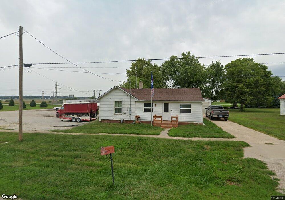
705 Clinton St Dunlap, IA 51529
Estimated Value: $72,000 - $149,000
2
Beds
1
Bath
1,116
Sq Ft
$93/Sq Ft
Est. Value
About This Home
This home is located at 705 Clinton St, Dunlap, IA 51529 and is currently estimated at $104,060, approximately $93 per square foot. 705 Clinton St is a home located in Harrison County with nearby schools including Boyer Valley Elementary School and Boyer Valley Middle/High School.
Ownership History
Date
Name
Owned For
Owner Type
Purchase Details
Closed on
Sep 15, 2014
Sold by
Wendt Edward K and Wendt Beverly J
Bought by
Zehner Brian R and Zehner Tammy S
Current Estimated Value
Purchase Details
Closed on
Mar 4, 2006
Sold by
Estate Pf Francis G Dunkeson
Bought by
Rudd Tina
Home Financials for this Owner
Home Financials are based on the most recent Mortgage that was taken out on this home.
Original Mortgage
$14,234
Interest Rate
6.38%
Mortgage Type
New Conventional
Create a Home Valuation Report for This Property
The Home Valuation Report is an in-depth analysis detailing your home's value as well as a comparison with similar homes in the area
Home Values in the Area
Average Home Value in this Area
Purchase History
| Date | Buyer | Sale Price | Title Company |
|---|---|---|---|
| Zehner Brian R | -- | None Available | |
| Rudd Tina | $18,500 | None Available |
Source: Public Records
Mortgage History
| Date | Status | Borrower | Loan Amount |
|---|---|---|---|
| Previous Owner | Rudd Tina | $14,234 |
Source: Public Records
Tax History Compared to Growth
Tax History
| Year | Tax Paid | Tax Assessment Tax Assessment Total Assessment is a certain percentage of the fair market value that is determined by local assessors to be the total taxable value of land and additions on the property. | Land | Improvement |
|---|---|---|---|---|
| 2025 | $774 | $43,250 | $11,340 | $31,910 |
| 2024 | $774 | $42,970 | $11,340 | $31,630 |
| 2023 | $744 | $42,970 | $11,340 | $31,630 |
| 2022 | $708 | $36,979 | $11,340 | $25,639 |
| 2021 | $708 | $36,979 | $11,340 | $25,639 |
| 2020 | $662 | $32,715 | $11,340 | $21,375 |
| 2019 | $560 | $32,715 | $11,340 | $21,375 |
| 2018 | $558 | $26,033 | $0 | $0 |
| 2017 | $572 | $26,033 | $0 | $0 |
| 2016 | $566 | $26,033 | $0 | $0 |
| 2015 | $566 | $23,453 | $0 | $0 |
| 2014 | $532 | $23,453 | $0 | $0 |
Source: Public Records
Map
Nearby Homes
- 202 Y St
- 1403 Eaton St
- 32055 Spruce Ave
- 1110 Street F16
- 2074 U Ave
- 211 Brookview Dr
- 37 10th St
- 2590 220th St
- 808 Park St
- 42 6th St
- 406 Weare St
- 102 Bluegrass Ln
- 101 Bluegrass Ln
- 907 Harvest Hills Dr
- 106 Bluegrass Ln
- 905 Harvest Hills Dr
- 111 Ridgeline Rd
- 903 Harvest Hills Dr
- 906 Harvest Hills Dr
- 904 Harvest Hills Dr