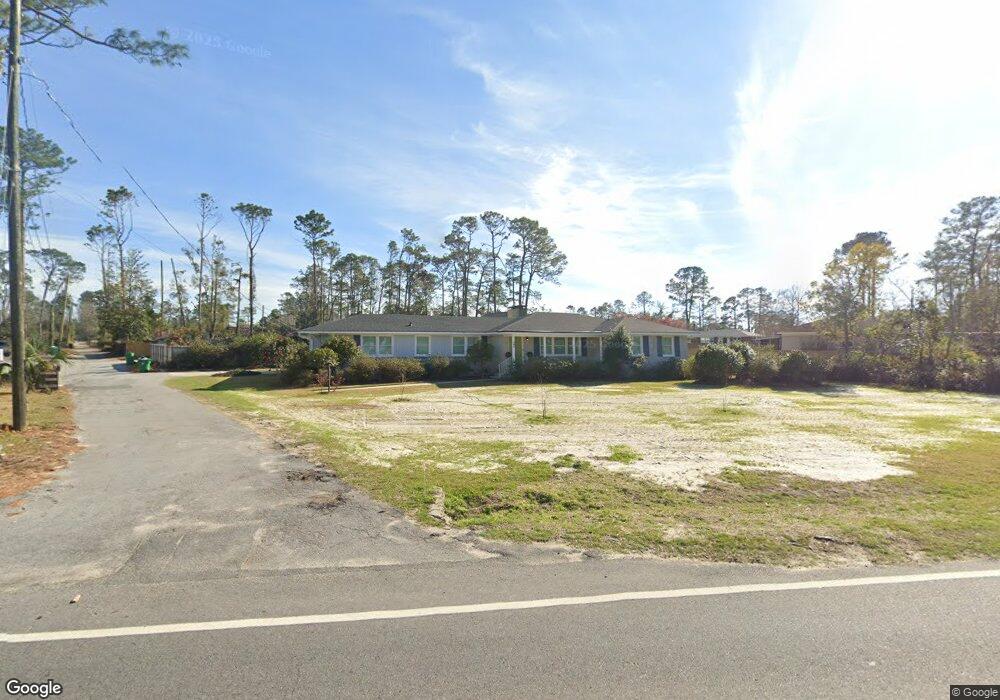
705 Gornto Rd Valdosta, GA 31602
Estimated Value: $221,551 - $263,000
--
Bed
2
Baths
2,362
Sq Ft
$106/Sq Ft
Est. Value
About This Home
This home is located at 705 Gornto Rd, Valdosta, GA 31602 and is currently estimated at $249,388, approximately $105 per square foot. 705 Gornto Rd is a home located in Lowndes County with nearby schools including S.L. Mason Elementary School, Valdosta Middle School, and Valdosta High School.
Ownership History
Date
Name
Owned For
Owner Type
Purchase Details
Closed on
Jan 27, 2012
Sold by
Dodson Duane E
Bought by
Dodson Duane E
Current Estimated Value
Purchase Details
Closed on
Dec 6, 2011
Sold by
Dodson Duane E
Bought by
Dodson Duane E
Purchase Details
Closed on
Dec 5, 2011
Sold by
Dodson Mary W and Dodson Mary Tucker
Bought by
Dodson Duane E
Purchase Details
Closed on
Oct 23, 1996
Bought by
Dodson Mary Tucker
Create a Home Valuation Report for This Property
The Home Valuation Report is an in-depth analysis detailing your home's value as well as a comparison with similar homes in the area
Home Values in the Area
Average Home Value in this Area
Purchase History
| Date | Buyer | Sale Price | Title Company |
|---|---|---|---|
| Dodson Duane E | -- | -- | |
| Dodson Duane E | -- | -- | |
| Dodson Duane E | $60,000 | -- | |
| Dodson Duane E | -- | -- | |
| Dodson Mary Tucker | -- | -- |
Source: Public Records
Tax History Compared to Growth
Tax History
| Year | Tax Paid | Tax Assessment Tax Assessment Total Assessment is a certain percentage of the fair market value that is determined by local assessors to be the total taxable value of land and additions on the property. | Land | Improvement |
|---|---|---|---|---|
| 2024 | $2,001 | $71,636 | $12,561 | $59,075 |
| 2023 | $2,001 | $71,636 | $12,561 | $59,075 |
| 2022 | $1,768 | $52,309 | $12,561 | $39,748 |
| 2021 | $1,819 | $52,309 | $12,561 | $39,748 |
| 2020 | $1,858 | $52,309 | $12,561 | $39,748 |
| 2019 | $1,857 | $52,309 | $12,561 | $39,748 |
| 2018 | $1,665 | $46,290 | $6,542 | $39,748 |
| 2017 | $1,676 | $46,290 | $6,542 | $39,748 |
| 2016 | $1,674 | $46,290 | $6,542 | $39,748 |
| 2015 | $1,536 | $46,290 | $6,542 | $39,748 |
| 2014 | $1,562 | $46,290 | $6,542 | $39,748 |
Source: Public Records
Map
Nearby Homes
- 604 Azalea Cir
- 68 Pineridge Dr
- 2325 White Oak Dr
- 2112 Azalea Dr
- 1 Fox Hollow Cir
- 903 Gornto Rd
- 805 Millpond Rd
- 2206 White Oak Dr
- 908 Maplewood Dr
- 333 Canna Dr
- 1104 Linda Dr
- 1909 Azalea Dr
- 2217 Brighton Place
- 2014 Delvid St
- 2502B Jerry Jones Dr Unit 1
- 309 W Park Ave
- 1108 Kimberly Dr
- 5 Dellwood Cir
- 2208 N Oak St
- 315 Canna Dr