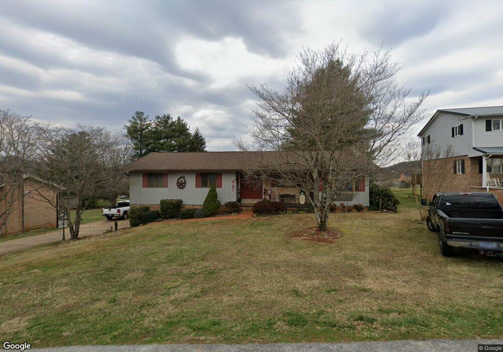
705 N Sherbrooke Cir Mount Carmel, TN 37645
Estimated Value: $267,978 - $311,000
--
Bed
3
Baths
1,753
Sq Ft
$165/Sq Ft
Est. Value
About This Home
This home is located at 705 N Sherbrooke Cir, Mount Carmel, TN 37645 and is currently estimated at $288,995, approximately $164 per square foot. 705 N Sherbrooke Cir is a home located in Hawkins County with nearby schools including Mt. Carmel Elementary School, Church Hill Intermediate School, and Church Hill Middle School.
Ownership History
Date
Name
Owned For
Owner Type
Purchase Details
Closed on
Jun 13, 2005
Sold by
Blair Danny M and Blair Twyla
Bought by
Parsons Jeffrey R and Parsons Amy V
Current Estimated Value
Home Financials for this Owner
Home Financials are based on the most recent Mortgage that was taken out on this home.
Original Mortgage
$88,400
Outstanding Balance
$52,249
Interest Rate
7.88%
Estimated Equity
$236,746
Purchase Details
Closed on
Jan 17, 1978
Bought by
Blair Danny M and Blair Twyla
Purchase Details
Closed on
Aug 29, 1977
Purchase Details
Closed on
Aug 9, 1973
Create a Home Valuation Report for This Property
The Home Valuation Report is an in-depth analysis detailing your home's value as well as a comparison with similar homes in the area
Home Values in the Area
Average Home Value in this Area
Purchase History
| Date | Buyer | Sale Price | Title Company |
|---|---|---|---|
| Parsons Jeffrey R | $110,500 | -- | |
| Blair Danny M | -- | -- | |
| -- | -- | -- | |
| -- | -- | -- |
Source: Public Records
Mortgage History
| Date | Status | Borrower | Loan Amount |
|---|---|---|---|
| Open | Not Available | $88,400 | |
| Closed | Not Available | $22,100 |
Source: Public Records
Tax History Compared to Growth
Tax History
| Year | Tax Paid | Tax Assessment Tax Assessment Total Assessment is a certain percentage of the fair market value that is determined by local assessors to be the total taxable value of land and additions on the property. | Land | Improvement |
|---|---|---|---|---|
| 2024 | $647 | $40,725 | $4,500 | $36,225 |
| 2023 | $947 | $40,725 | $0 | $0 |
| 2022 | $1,510 | $40,725 | $4,500 | $36,225 |
| 2021 | $1,449 | $40,725 | $4,500 | $36,225 |
| 2020 | $889 | $40,725 | $4,500 | $36,225 |
| 2019 | $1,476 | $35,125 | $4,100 | $31,025 |
| 2018 | $1,440 | $34,275 | $4,100 | $30,175 |
| 2017 | $1,341 | $34,275 | $4,100 | $30,175 |
| 2016 | $1,341 | $34,275 | $4,100 | $30,175 |
| 2015 | $1,318 | $34,275 | $4,100 | $30,175 |
| 2014 | $1,311 | $34,100 | $4,100 | $30,000 |
Source: Public Records
Map
Nearby Homes
- 807 Sherbrooke Ct
- 721 S Sherbrooke Cir
- Tbd Santa fe St
- 720 S Sherbrooke Cir
- 5813 Carters Valley Rd
- 508 Carolina St
- 000 Sensabaugh Hollow Rd
- 1111 Independence Ave
- 109 Tranbarger Rd
- 140 Sunrise Meadow Ct
- 116 Tranbarger Rd
- 507 Spruce St
- 514 Spruce St
- 150 Fox Ridge Dr
- 200-201 Fox Ridge Dr
- 907 Ithaca St
- 118 W Ellis Ln
- 235 Wolfe Laurel Dr
- 153 Nicole Dr
- 3901 Rocky Hill Ln
- 707 N Sherbrooke Cir
- 703 N Sherbrooke Cir
- 1516 Mccracken Ln
- 706 N Sherbrooke Cir
- 1518 Mccracken Ln
- 1514 Mccracken Ln
- 701 N Sherbrooke Cir
- 705 Redwood Dr
- 709 N Sherbrooke Cir
- 702 N Sherbrooke Cir
- 703 Redwood Dr
- 1520 Mccracken Ln
- 723 Redwood Dr
- 710 N Sherbrooke Cir
- 0 Mccracken Ln
- 703 Redwood St
- 724 N Sherbrooke Cir
- 182 N Sherbrooke Cir
- TBD N Sherbrooke Cir
- 711 N Sherbrooke Cir