Estimated Value: $488,000 - $561,000
5
Beds
3
Baths
1,692
Sq Ft
$312/Sq Ft
Est. Value
About This Home
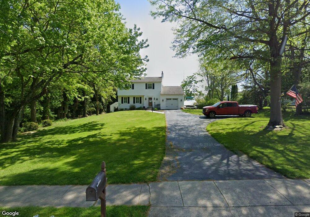
This home is located at 705 N Whitford Rd, Exton, PA 19341 and is currently estimated at $528,412, approximately $312 per square foot. 705 N Whitford Rd is a home located in Chester County with nearby schools including Lionville Elementary School, Lionville Middle School, and Downingtown High School East.
Ownership History
Date
Name
Owned For
Owner Type
Purchase Details
Closed on
Nov 21, 2005
Sold by
Dill Ronald J and Dill Sara Elizabeth
Bought by
Shaffer Robert D and Shaffer Sheri D
Current Estimated Value
Home Financials for this Owner
Home Financials are based on the most recent Mortgage that was taken out on this home.
Original Mortgage
$232,000
Outstanding Balance
$127,272
Interest Rate
6.06%
Mortgage Type
Fannie Mae Freddie Mac
Estimated Equity
$401,140
Create a Home Valuation Report for This Property
The Home Valuation Report is an in-depth analysis detailing your home's value as well as a comparison with similar homes in the area
Home Values in the Area
Average Home Value in this Area
Purchase History
| Date | Buyer | Sale Price | Title Company |
|---|---|---|---|
| Shaffer Robert D | $293,000 | Fidelity Natl Title Ins Co |
Source: Public Records
Mortgage History
| Date | Status | Borrower | Loan Amount |
|---|---|---|---|
| Open | Shaffer Robert D | $232,000 |
Source: Public Records
Tax History Compared to Growth
Tax History
| Year | Tax Paid | Tax Assessment Tax Assessment Total Assessment is a certain percentage of the fair market value that is determined by local assessors to be the total taxable value of land and additions on the property. | Land | Improvement |
|---|---|---|---|---|
| 2025 | $5,078 | $148,340 | $42,230 | $106,110 |
| 2024 | $5,078 | $148,340 | $42,230 | $106,110 |
| 2023 | $4,929 | $148,340 | $42,230 | $106,110 |
| 2022 | $4,806 | $148,340 | $42,230 | $106,110 |
| 2021 | $4,725 | $148,340 | $42,230 | $106,110 |
| 2020 | $4,698 | $148,340 | $42,230 | $106,110 |
| 2019 | $4,698 | $148,340 | $42,230 | $106,110 |
| 2018 | $4,698 | $148,340 | $42,230 | $106,110 |
| 2017 | $4,698 | $148,340 | $42,230 | $106,110 |
| 2016 | $4,349 | $148,340 | $42,230 | $106,110 |
| 2015 | $4,349 | $148,340 | $42,230 | $106,110 |
| 2014 | $4,349 | $148,340 | $42,230 | $106,110 |
Source: Public Records
Map
Nearby Homes
- 109 Glendale Rd
- 30 S Village Ave
- 208 Morris Rd
- 214 Louis Dr
- 510 Woodview Dr
- 701 Worthington Dr Unit 701
- 454 Concord Ave
- 324 Conner Dr
- 100 Brookhollow Dr
- 420 Oakland Dr
- 315 Oak Ln W
- 491 Orchard Cir
- 113 Blue Ribbon Way
- 229 Cambridge Chase Unit 30
- 464 E Radnor Ct
- 312 Green Cir
- 204 Mill Pond Dr
- Santorini Plan at Worthington Farm - Luxury Single-Family Homes
- Monaco Plan at Worthington Farm - Luxury Single-Family Homes
- Lisbon Plan at Worthington Farm - Luxury Single-Family Homes