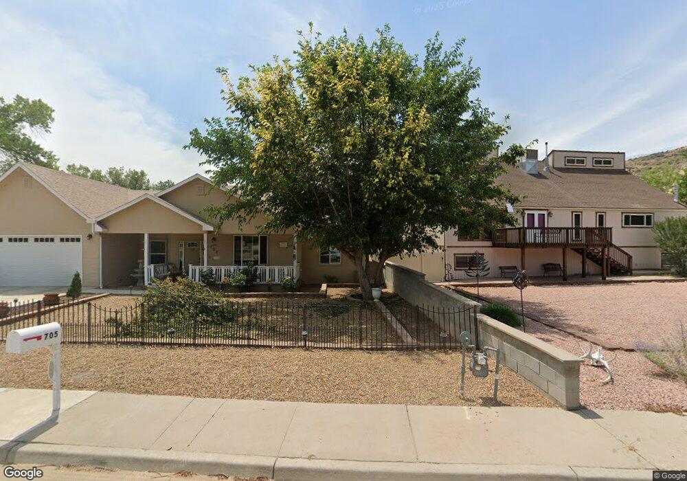
705 W Gladden Dr Farmington, NM 87401
Estimated Value: $287,000 - $436,000
--
Bed
--
Bath
1,672
Sq Ft
$217/Sq Ft
Est. Value
About This Home
This home is located at 705 W Gladden Dr, Farmington, NM 87401 and is currently estimated at $362,962, approximately $217 per square foot. 705 W Gladden Dr is a home with nearby schools including Apache Elementary School, Tibbetts Middle School, and Farmington High School.
Ownership History
Date
Name
Owned For
Owner Type
Purchase Details
Closed on
Oct 25, 2023
Sold by
Mcdaniel Barry
Bought by
Mcdaniel Barry and Wethington Randy B
Current Estimated Value
Purchase Details
Closed on
Jun 9, 2016
Sold by
Thomas Mitzi and Thomas David M
Bought by
Mcdaniel Barry
Purchase Details
Closed on
Nov 2, 2015
Sold by
Thomas Mitzi H and Thomas Manalynn H
Bought by
David C Cy Cooper And Manalynn Copper Re
Purchase Details
Closed on
Aug 1, 2012
Sold by
Manuel C Hastings & Thelma T Hastings Re
Bought by
Manuel C Hastings Family Trust
Create a Home Valuation Report for This Property
The Home Valuation Report is an in-depth analysis detailing your home's value as well as a comparison with similar homes in the area
Home Values in the Area
Average Home Value in this Area
Purchase History
| Date | Buyer | Sale Price | Title Company |
|---|---|---|---|
| Mcdaniel Barry | -- | -- | |
| Mcdaniel Barry | -- | None Available | |
| David C Cy Cooper And Manalynn Copper Re | -- | None Available | |
| Manuel C Hastings Family Trust | -- | None Available |
Source: Public Records
Tax History Compared to Growth
Tax History
| Year | Tax Paid | Tax Assessment Tax Assessment Total Assessment is a certain percentage of the fair market value that is determined by local assessors to be the total taxable value of land and additions on the property. | Land | Improvement |
|---|---|---|---|---|
| 2024 | $2,342 | $100,508 | $0 | $0 |
| 2023 | $2,342 | $76,861 | $0 | $0 |
| 2022 | $1,794 | $74,622 | $0 | $0 |
| 2021 | $1,728 | $72,449 | $0 | $0 |
| 2020 | $1,710 | $71,886 | $0 | $0 |
| 2019 | $1,683 | $71,110 | $0 | $0 |
| 2018 | $1,664 | $11,667 | $0 | $0 |
| 2017 | $316 | $11,667 | $0 | $0 |
| 2016 | $316 | $11,667 | $0 | $0 |
| 2015 | $316 | $11,667 | $0 | $0 |
| 2014 | $316 | $11,667 | $0 | $0 |
Source: Public Records
Map
Nearby Homes
- 636 Ridge Lea Ct
- 1011 N Auburn Ave
- 1805 Brenwood Dr
- XX Brookside Dr
- 1013 N Orchard Dr
- XX W Apache St
- 414 W Comanche St
- 195 McDonald Rd
- 212 W Sunset Place
- 621 W Apache St
- 707 W Apache St
- 2412 Pheasant Place
- LOT 4 XX W 24th St
- 511 N Behrend Ave
- 1108 N Dustin Ave
- 2413 N Municipal Dr
- 602 N Orchard Ave Unit A - F
- 200 W 24th St
- 212 W 25th St
- 712 N Dustin Ave
- 707 W Gladden Dr
- 1214 Mossey Cup Dr
- 1301 Mossey Cup Dr
- 1216 Mossey Cup Dr
- 707 Ashurst Dr
- 1218 Mossey Cup Dr
- 709 Ashurst Dr
- 621 Ashurst Dr
- 619 Ashurst Dr
- 617 Ashurst Dr
- 615 Ashurst Dr
- 700 Ashurst Dr
- 613 Ashurst Dr
- 704 Ashurst Dr
- 702 Ashurst Dr
- 611 Ashurst Dr
- 620 Ashurst Dr
- 616 Ashurst Dr
- 1306 Mossey Cup Dr
- 701 W Boyd Dr