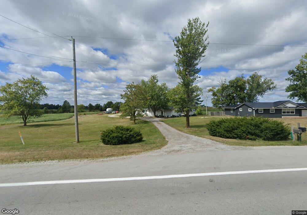
7051 State Route 118 Celina, OH 45822
Estimated Value: $206,000 - $248,338
3
Beds
2
Baths
1,224
Sq Ft
$187/Sq Ft
Est. Value
About This Home
This home is located at 7051 State Route 118, Celina, OH 45822 and is currently estimated at $229,335, approximately $187 per square foot. 7051 State Route 118 is a home located in Mercer County with nearby schools including Celina Middle School and Celina High School.
Ownership History
Date
Name
Owned For
Owner Type
Purchase Details
Closed on
Mar 11, 2008
Sold by
Granger Lynn Karen
Bought by
Heitkamp Rodney S
Current Estimated Value
Home Financials for this Owner
Home Financials are based on the most recent Mortgage that was taken out on this home.
Original Mortgage
$121,686
Outstanding Balance
$74,099
Interest Rate
5.75%
Mortgage Type
Purchase Money Mortgage
Estimated Equity
$155,236
Create a Home Valuation Report for This Property
The Home Valuation Report is an in-depth analysis detailing your home's value as well as a comparison with similar homes in the area
Purchase History
| Date | Buyer | Sale Price | Title Company |
|---|---|---|---|
| Heitkamp Rodney S | $113,500 | Attorney |
Source: Public Records
Mortgage History
| Date | Status | Borrower | Loan Amount |
|---|---|---|---|
| Open | Heitkamp Rodney S | $121,686 |
Source: Public Records
Tax History
| Year | Tax Paid | Tax Assessment Tax Assessment Total Assessment is a certain percentage of the fair market value that is determined by local assessors to be the total taxable value of land and additions on the property. | Land | Improvement |
|---|---|---|---|---|
| 2025 | $2,628 | $64,820 | $15,820 | $49,000 |
| 2024 | $2,630 | $64,820 | $15,820 | $49,000 |
| 2023 | $2,628 | $64,820 | $15,820 | $49,000 |
| 2022 | $2,355 | $50,370 | $14,110 | $36,260 |
| 2021 | $2,361 | $50,370 | $14,110 | $36,260 |
| 2020 | $2,288 | $57,860 | $14,110 | $43,750 |
| 2019 | $2,000 | $47,320 | $12,810 | $34,510 |
| 2018 | $2,078 | $47,320 | $12,810 | $34,510 |
| 2017 | $1,885 | $47,320 | $12,810 | $34,510 |
| 2016 | $1,704 | $39,590 | $7,530 | $32,060 |
| 2015 | $1,643 | $39,280 | $7,530 | $31,750 |
| 2014 | $1,646 | $39,280 | $7,530 | $31,750 |
| 2013 | $1,755 | $39,280 | $7,530 | $31,750 |
Source: Public Records
Map
Nearby Homes
- 4295 William Ave
- 0 Anderson 13&14 & Roadway 12&13 Unit 1044236
- 6764 Silver Lakes Dr
- 0 Springer 1-6 & Roadway 14-16 Unit 1044131
- 0 Anderson Lots 10 11 & 12 Ln Unit 1044138
- 0 Harbor Lots 26 27 & 38 Dr Unit 1044287
- 0 Harbor Lots 24 & 25 Dr Unit 1044267
- 1312 Michael Ave
- 116 S Elm St
- 1001 N Sugar St
- 906 N Sugar St
- 908 N Sugar St
- 905 N Walnut St
- 115 Touvelle St
- 680 N Main St
- 120 E Blake St
- 1125 W Bank Rd Unit 1125 107
- 4978 Buschor Rd
- 206 Magnolia St
- 609 N Cherry St
- 7051 Ohio 118
- 7061 Ohio 118
- 7061 State Route 118
- 7071 State Route 118
- 7044 State Route 118
- 7085 Ohio 118
- 7085 State Route 118
- 7078 Ohio 118
- 7078 State Route 118
- 7097 State Route 118
- 3989 Bunker Hill Rd
- 7097 Ohio 118
- 4004 Mud Pike Rd
- 7109 State Route 118
- 7016 State Route 118
- 4038 Mud Pike Rd
- 6992 State Route 118
- 3996 Mud Pike Rd
- 3986 Mud Pike Rd
- 3986 Mud Pike Rd
Your Personal Tour Guide
Ask me questions while you tour the home.