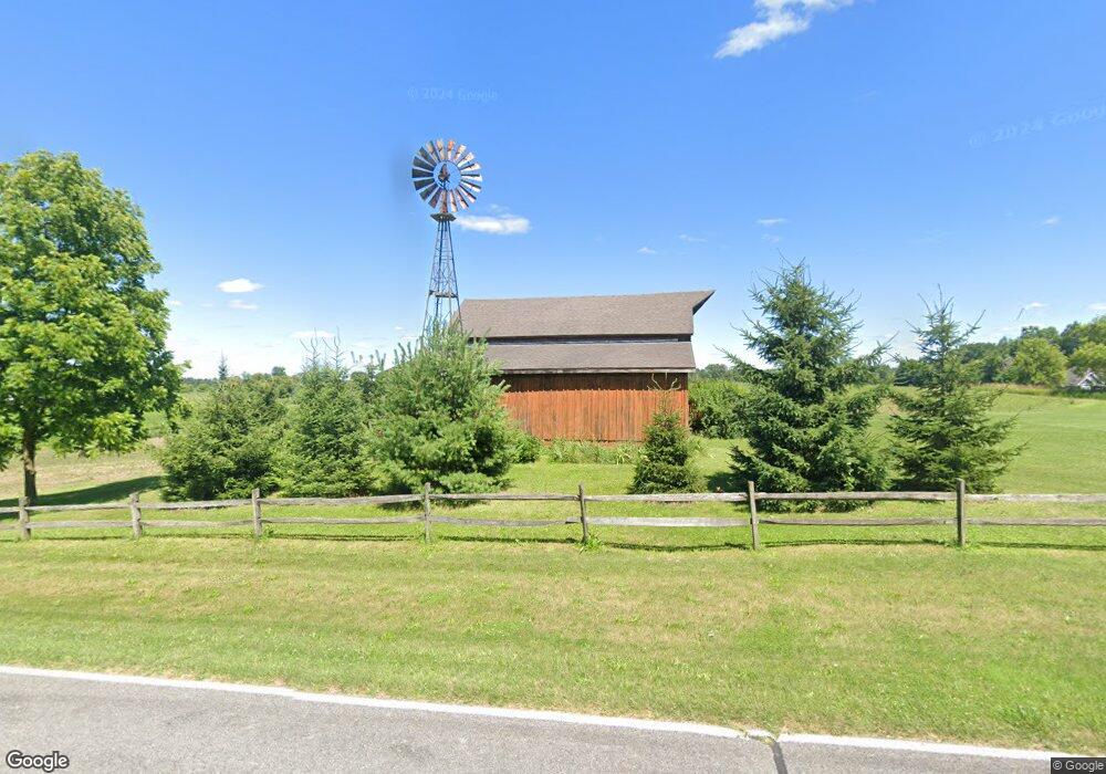
7053 S Krepps Rd Saint Johns, MI 48879
Estimated Value: $324,000 - $407,765
3
Beds
2
Baths
1,570
Sq Ft
$238/Sq Ft
Est. Value
About This Home
This home is located at 7053 S Krepps Rd, Saint Johns, MI 48879 and is currently estimated at $372,922, approximately $237 per square foot. 7053 S Krepps Rd is a home located in Clinton County with nearby schools including St. Johns High School.
Ownership History
Date
Name
Owned For
Owner Type
Purchase Details
Closed on
Dec 28, 2005
Sold by
Mehney Paul L and Olger Susan L
Bought by
Mehney Paul L and Olger Susan L
Current Estimated Value
Purchase Details
Closed on
Dec 9, 2004
Sold by
Mehney Paul L
Bought by
Mehney Paul L and Olger Susan L
Home Financials for this Owner
Home Financials are based on the most recent Mortgage that was taken out on this home.
Original Mortgage
$76,000
Interest Rate
5.71%
Mortgage Type
New Conventional
Purchase Details
Closed on
Jan 26, 2004
Sold by
Olger Susan L
Bought by
Mehney Paul L
Home Financials for this Owner
Home Financials are based on the most recent Mortgage that was taken out on this home.
Original Mortgage
$79,800
Interest Rate
5.88%
Mortgage Type
Purchase Money Mortgage
Create a Home Valuation Report for This Property
The Home Valuation Report is an in-depth analysis detailing your home's value as well as a comparison with similar homes in the area
Home Values in the Area
Average Home Value in this Area
Purchase History
| Date | Buyer | Sale Price | Title Company |
|---|---|---|---|
| Mehney Paul L | -- | -- | |
| Mehney Paul L | -- | -- | |
| Mehney Paul L | $84,000 | -- | |
| Olger Susan L | $90,000 | -- |
Source: Public Records
Mortgage History
| Date | Status | Borrower | Loan Amount |
|---|---|---|---|
| Previous Owner | Mehney Paul L | $76,000 | |
| Previous Owner | Olger Susan L | $79,800 |
Source: Public Records
Tax History Compared to Growth
Tax History
| Year | Tax Paid | Tax Assessment Tax Assessment Total Assessment is a certain percentage of the fair market value that is determined by local assessors to be the total taxable value of land and additions on the property. | Land | Improvement |
|---|---|---|---|---|
| 2025 | $3,385 | $210,400 | $151,900 | $58,500 |
| 2024 | $1,527 | $184,600 | $119,200 | $65,400 |
| 2023 | $1,446 | $175,800 | $0 | $0 |
| 2022 | $3,189 | $185,900 | $124,900 | $61,000 |
| 2021 | $2,935 | $155,200 | $105,700 | $49,500 |
| 2020 | $2,917 | $167,100 | $126,000 | $41,100 |
| 2019 | $2,705 | $151,500 | $113,600 | $37,900 |
| 2018 | $3,205 | $155,100 | $115,700 | $39,400 |
| 2017 | $3,179 | $147,900 | $109,300 | $38,600 |
| 2016 | $3,566 | $143,200 | $102,800 | $40,400 |
| 2015 | -- | $134,900 | $0 | $0 |
| 2011 | -- | $135,500 | $0 | $0 |
Source: Public Records
Map
Nearby Homes
- 2604 Green Rd
- 2615 Alward Rd
- 8235 E Jason Rd
- Integrity 2000 Plan at Woodridge Bingham - Integrity
- Integrity 1880 Plan at Woodridge Bingham - Integrity
- Integrity 2280 Plan at Woodridge Bingham - Integrity
- Elements 2100 Plan at Woodridge Bingham
- Integrity 1530 Plan at Woodridge Bingham - Integrity
- Elements 2070 Plan at Woodridge Bingham
- Integrity 2080 Plan at Woodridge Bingham - Integrity
- Elements 1800 Plan at Woodridge Bingham
- Elements 1680 Plan at Woodridge Bingham
- Elements 2090 Plan at Woodridge Bingham
- Integrity 1610 Plan at Woodridge Bingham - Integrity
- Integrity 1605 Plan at Woodridge Bingham - Integrity
- Elements 2390 Plan at Woodridge Bingham
- Elements 2700 Plan at Woodridge Bingham
- Elements 2200 Plan at Woodridge Bingham
- Integrity 1830 Plan at Woodridge Bingham - Integrity
- Elements 1870 Plan at Woodridge Bingham