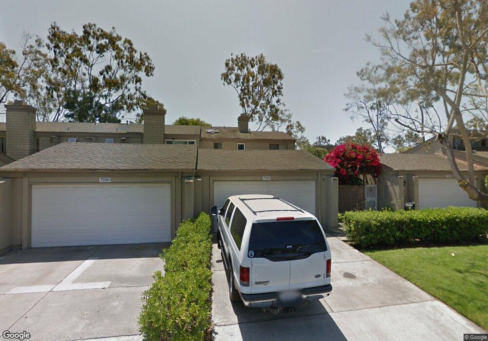
7055 Seal Cir Huntington Beach, CA 92648
Downtown Huntington Beach NeighborhoodEstimated Value: $1,448,000 - $1,739,000
4
Beds
3
Baths
2,260
Sq Ft
$687/Sq Ft
Est. Value
About This Home
This home is located at 7055 Seal Cir, Huntington Beach, CA 92648 and is currently estimated at $1,552,443, approximately $686 per square foot. 7055 Seal Cir is a home located in Orange County with nearby schools including Agnes L. Smith Elementary, Ethel Dwyer Middle, and Huntington Beach High School.
Ownership History
Date
Name
Owned For
Owner Type
Purchase Details
Closed on
Dec 10, 2013
Sold by
Cox Duane D and Cox Sandy Hosun
Bought by
Cox Duane D and Cox Sandy H
Current Estimated Value
Purchase Details
Closed on
Feb 20, 2013
Sold by
Cox Duane D and Cox Sandy Hosun
Bought by
Cox Duane D and Cox Sandy Hosun
Home Financials for this Owner
Home Financials are based on the most recent Mortgage that was taken out on this home.
Original Mortgage
$393,000
Outstanding Balance
$274,093
Interest Rate
3.36%
Mortgage Type
New Conventional
Estimated Equity
$1,278,350
Purchase Details
Closed on
Jan 22, 2008
Sold by
Cox Duane D
Bought by
Cox Duane D and Cox Sandy H
Home Financials for this Owner
Home Financials are based on the most recent Mortgage that was taken out on this home.
Original Mortgage
$417,000
Interest Rate
6.04%
Mortgage Type
New Conventional
Purchase Details
Closed on
Sep 18, 2000
Sold by
Steve Heft and Steve Catherine
Bought by
Cox Duane D
Home Financials for this Owner
Home Financials are based on the most recent Mortgage that was taken out on this home.
Original Mortgage
$288,000
Interest Rate
7.75%
Purchase Details
Closed on
Oct 8, 1998
Sold by
Lockhart Virgil M
Bought by
Lockhart Linda Sue
Home Financials for this Owner
Home Financials are based on the most recent Mortgage that was taken out on this home.
Original Mortgage
$259,900
Interest Rate
6.79%
Purchase Details
Closed on
Sep 15, 1998
Sold by
Sue Fersguson Linda and Sue Linda Sue
Bought by
Heft Steve and Heft Catherine
Home Financials for this Owner
Home Financials are based on the most recent Mortgage that was taken out on this home.
Original Mortgage
$259,900
Interest Rate
6.79%
Purchase Details
Closed on
Apr 23, 1998
Sold by
Ferguson Linda Sue
Bought by
Lockhart Linda Sue and Linda Sue Lockhart Living Trust
Purchase Details
Closed on
Feb 11, 1994
Sold by
Ferguson Linda Sue
Bought by
Ferguson Linda Sue
Purchase Details
Closed on
Nov 1, 1993
Sold by
Ferguson Linda Sue
Bought by
Ferguson Linda Sue
Home Financials for this Owner
Home Financials are based on the most recent Mortgage that was taken out on this home.
Original Mortgage
$150,000
Interest Rate
7.1%
Create a Home Valuation Report for This Property
The Home Valuation Report is an in-depth analysis detailing your home's value as well as a comparison with similar homes in the area
Home Values in the Area
Average Home Value in this Area
Purchase History
| Date | Buyer | Sale Price | Title Company |
|---|---|---|---|
| Cox Duane D | -- | None Available | |
| Cox Duane D | -- | First American Title Company | |
| Cox Duane D | -- | Civic Center Title Services | |
| Cox Duane D | $360,000 | Chicago Title Co | |
| Lockhart Linda Sue | -- | Fidelity National Title Ins | |
| Heft Steve | $300,000 | Fidelity National Title Ins | |
| Lockhart Linda Sue | -- | -- | |
| Ferguson Linda Sue | -- | -- | |
| Ferguson Linda Sue | -- | Chicago Title Company |
Source: Public Records
Mortgage History
| Date | Status | Borrower | Loan Amount |
|---|---|---|---|
| Open | Cox Duane D | $393,000 | |
| Closed | Cox Duane D | $417,000 | |
| Closed | Cox Duane D | $288,000 | |
| Previous Owner | Heft Steve | $259,900 | |
| Previous Owner | Ferguson Linda Sue | $150,000 |
Source: Public Records
Tax History Compared to Growth
Tax History
| Year | Tax Paid | Tax Assessment Tax Assessment Total Assessment is a certain percentage of the fair market value that is determined by local assessors to be the total taxable value of land and additions on the property. | Land | Improvement |
|---|---|---|---|---|
| 2025 | $6,255 | $542,451 | $383,711 | $158,740 |
| 2024 | $6,255 | $531,815 | $376,187 | $155,628 |
| 2023 | $6,114 | $521,388 | $368,811 | $152,577 |
| 2022 | $5,954 | $511,165 | $361,579 | $149,586 |
| 2021 | $5,845 | $501,143 | $354,490 | $146,653 |
| 2020 | $5,806 | $496,005 | $350,855 | $145,150 |
| 2019 | $5,739 | $486,280 | $343,976 | $142,304 |
| 2018 | $5,651 | $476,746 | $337,232 | $139,514 |
| 2017 | $5,576 | $467,399 | $330,620 | $136,779 |
| 2016 | $5,332 | $458,235 | $324,137 | $134,098 |
| 2015 | $5,281 | $451,352 | $319,268 | $132,084 |
| 2014 | $5,171 | $442,511 | $313,014 | $129,497 |
Source: Public Records
Map
Nearby Homes
- 19702 Quiet Bay Ln
- 19731 Estate Cir
- 19748 Shorecliff Ln
- 19741 Quiet Bay Ln
- 19662 Stern Ln
- 19811 Deep Harbor Dr
- 6776 Findley Cir
- 620 22nd St
- 627 19th St
- 19321 Manor Point Cir
- 6781 Lawn Haven Dr
- 1824 Park St
- 521 18th St
- 1915 Pine St
- 411 22nd St
- 1828 Pine St
- 505 17th St
- 419 18th St
- 118 Adams Ave
- 1821 Lake St
- 7051 Seal Cir
- 7065 Seal Cir
- 7045 Seal Cir
- 7071 Seal Cir
- 7041 Seal Cir
- 7075 Surfside Dr
- 7035 Seal Cir
- 7081 Surfside Dr
- 19641 Seawind Cir
- 19642 Surfbreaker Ln
- 7085 Surfside Dr
- 19645 Seawind Cir
- 7076 Little Harbor Dr
- 19646 Surfbreaker Ln
- 7072 Little Harbor Dr
- 7082 Little Harbor Dr
- 7091 Surfside Dr
- 19651 Seawind Cir
- 7086 Little Harbor Dr
- 7092 Little Harbor Dr