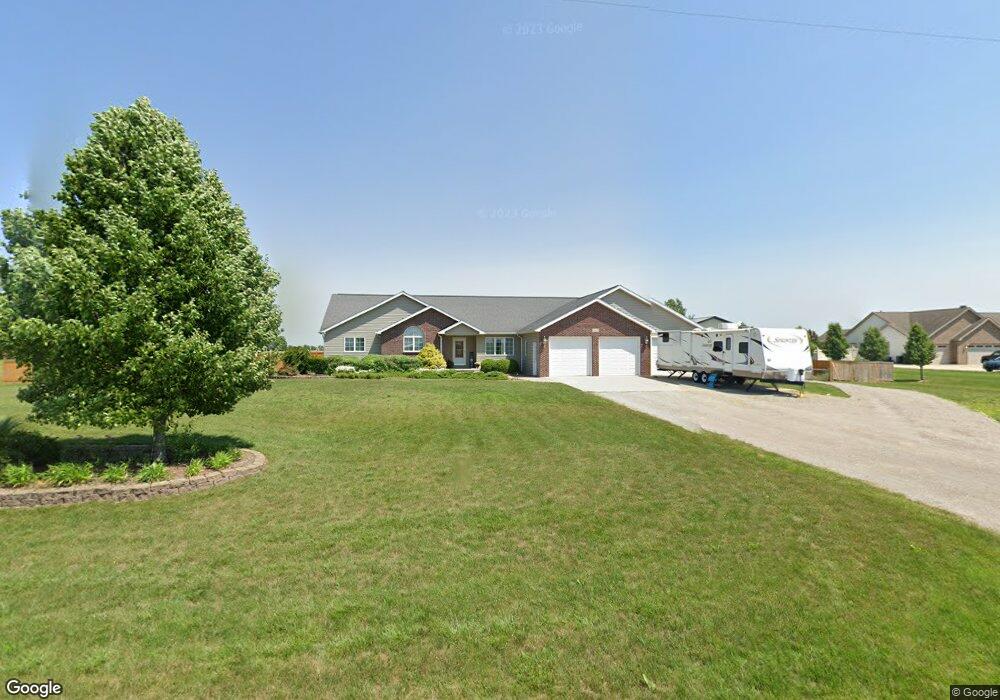
7057 Hupfer Rd Freeland, MI 48623
Estimated Value: $350,000 - $555,000
--
Bed
1
Bath
2,024
Sq Ft
$242/Sq Ft
Est. Value
About This Home
This home is located at 7057 Hupfer Rd, Freeland, MI 48623 and is currently estimated at $490,524, approximately $242 per square foot. 7057 Hupfer Rd is a home located in Bay County with nearby schools including Thrasher Attendance Center, Mackensen Elementary School, and Western Middle School.
Ownership History
Date
Name
Owned For
Owner Type
Purchase Details
Closed on
Jun 28, 2004
Sold by
Brashaw Wayne and Brashaw Kathryn
Bought by
Derocher David G and Derocher Kelly L
Current Estimated Value
Home Financials for this Owner
Home Financials are based on the most recent Mortgage that was taken out on this home.
Original Mortgage
$29,250
Interest Rate
6.37%
Mortgage Type
Purchase Money Mortgage
Purchase Details
Closed on
Jul 11, 2003
Sold by
Krauss Rudolph J and Krauss Joan E
Bought by
Brashaw Wayne and Brashaw Kathryn
Create a Home Valuation Report for This Property
The Home Valuation Report is an in-depth analysis detailing your home's value as well as a comparison with similar homes in the area
Home Values in the Area
Average Home Value in this Area
Purchase History
| Date | Buyer | Sale Price | Title Company |
|---|---|---|---|
| Derocher David G | $32,500 | Fatic | |
| Brashaw Wayne | $26,000 | -- |
Source: Public Records
Mortgage History
| Date | Status | Borrower | Loan Amount |
|---|---|---|---|
| Closed | Derocher David G | $29,250 |
Source: Public Records
Tax History Compared to Growth
Tax History
| Year | Tax Paid | Tax Assessment Tax Assessment Total Assessment is a certain percentage of the fair market value that is determined by local assessors to be the total taxable value of land and additions on the property. | Land | Improvement |
|---|---|---|---|---|
| 2025 | $5,947 | $282,550 | $0 | $0 |
| 2024 | $3,760 | $248,450 | $0 | $0 |
| 2023 | $2,956 | $208,200 | $0 | $0 |
| 2022 | $3,737 | $155,050 | $0 | $0 |
| 2021 | $3,468 | $141,100 | $141,100 | $0 |
| 2020 | $3,417 | $143,950 | $143,950 | $0 |
| 2019 | $3,234 | $135,450 | $0 | $0 |
| 2018 | $3,147 | $125,100 | $0 | $0 |
| 2017 | $3,023 | $119,450 | $0 | $0 |
| 2016 | $3,031 | $133,150 | $0 | $133,150 |
| 2015 | $2,971 | $98,100 | $0 | $98,100 |
| 2014 | $2,971 | $93,800 | $0 | $93,800 |
Source: Public Records
Map
Nearby Homes
- 9325 Hospital Rd
- 6641 Pierce Rd
- 0000 Pierce Rd
- 6790 Hospital Rd
- 4079 S 8 Mile Rd
- 3622 Sunningdale Dr N
- 2054 Kloha Rd
- 0 M-84 Westside Saginaw Rd Unit 150509
- Parcel B 2 56 Acres N Center Rd Unit Parcel B
- Parcel C 2 56 Acres N Center Rd Unit Parcel C
- 2347 Amelith Rd
- Parcel D 2 64 Acres N Center Rd Unit Parcel D
- 3101 Kochville Rd
- 3920 Kochville Rd
- 7474 Kochville Rd
- 5975 Faith Blvd
- 5977 Faith Blvd
- 5979 Faith Blvd
- 5981 Faith Blvd
- 6264 Greenview Place