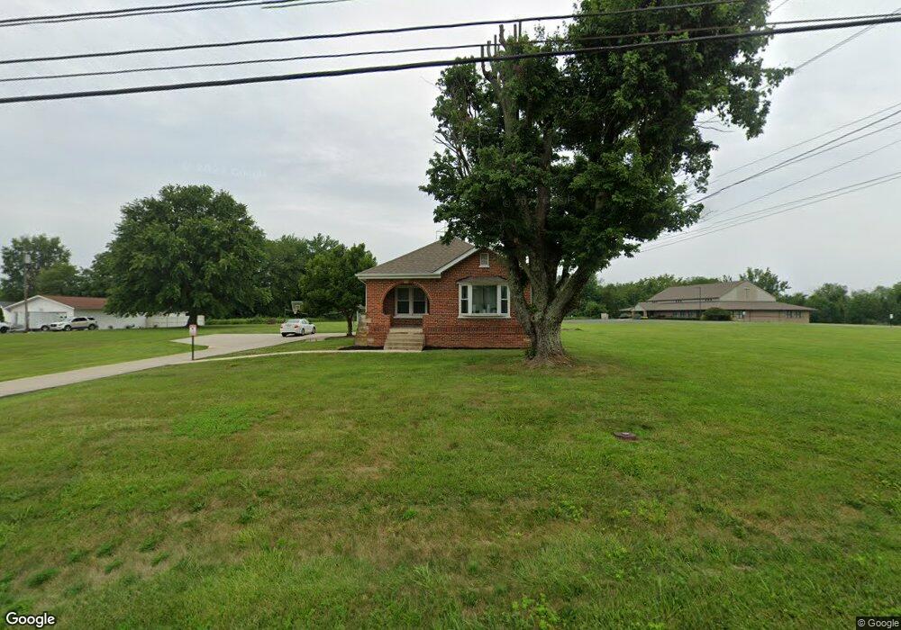
706 S High St Mount Orab, OH 45154
Estimated Value: $187,947 - $331,000
--
Bed
--
Bath
1,104
Sq Ft
$213/Sq Ft
Est. Value
About This Home
This home is located at 706 S High St, Mount Orab, OH 45154 and is currently estimated at $235,487, approximately $213 per square foot. 706 S High St is a home with nearby schools including Western Brown High School.
Ownership History
Date
Name
Owned For
Owner Type
Purchase Details
Closed on
Oct 29, 2005
Sold by
Burns Troy A and Burns Susan L
Bought by
First Baptist Church Of Mt Orab Inc
Current Estimated Value
Purchase Details
Closed on
Jul 25, 1997
Sold by
Clifton Richard M
Bought by
Burns Troy A and Burns Susan
Home Financials for this Owner
Home Financials are based on the most recent Mortgage that was taken out on this home.
Original Mortgage
$79,000
Interest Rate
7.81%
Mortgage Type
Commercial
Create a Home Valuation Report for This Property
The Home Valuation Report is an in-depth analysis detailing your home's value as well as a comparison with similar homes in the area
Home Values in the Area
Average Home Value in this Area
Purchase History
| Date | Buyer | Sale Price | Title Company |
|---|---|---|---|
| First Baptist Church Of Mt Orab Inc | $120,000 | -- | |
| Burns Troy A | $79,000 | -- |
Source: Public Records
Mortgage History
| Date | Status | Borrower | Loan Amount |
|---|---|---|---|
| Previous Owner | Burns Troy A | $79,000 |
Source: Public Records
Tax History Compared to Growth
Tax History
| Year | Tax Paid | Tax Assessment Tax Assessment Total Assessment is a certain percentage of the fair market value that is determined by local assessors to be the total taxable value of land and additions on the property. | Land | Improvement |
|---|---|---|---|---|
| 2024 | -- | $45,960 | $12,740 | $33,220 |
| 2023 | $0 | $31,280 | $5,100 | $26,180 |
| 2022 | $0 | $31,280 | $5,100 | $26,180 |
| 2021 | $0 | $31,280 | $5,100 | $26,180 |
| 2020 | $0 | $31,280 | $5,100 | $26,180 |
| 2019 | $0 | $31,280 | $5,100 | $26,180 |
| 2018 | $0 | $31,280 | $5,100 | $26,180 |
| 2017 | $0 | $24,420 | $5,100 | $19,320 |
| 2016 | -- | $24,420 | $5,100 | $19,320 |
| 2015 | -- | $24,420 | $5,100 | $19,320 |
| 2014 | -- | $24,420 | $5,100 | $19,320 |
| 2013 | -- | $24,420 | $5,100 | $19,320 |
Source: Public Records
Map
Nearby Homes
- 216 Red Bud Ln
- 781 S High St
- 408 Smith Ave
- 3524 Pleasant Hill Rd
- 108 Brookshire Way
- 424 Liming Farm Rd
- 419 Liming Farm Rd
- 301 Forest Trail
- 306 Forest Trail
- 309 1/2 Water St
- 3305 Pleasant Hill Rd
- 402 E Main St
- 329 E Main St
- 202 Gregory St
- 506 E Main St
- 208 Gregory St
- 206 Gregory St
- 210 Gregory St
- 214 Gregory St
- 108 Lonny St
- 708 S High St
- 100 Liming Farm Rd
- 712 S High St
- 118 Liming Farm Rd
- 614 S High St
- 13706 Us Highway 68
- 3788 Carpenter Rd
- 3811 Carpenter Rd
- 125 S Highmeadows Dr
- 721 S High St
- 612 S High St
- 104 James Ct
- 3778 Carpenter Rd
- 103 James Ct
- 609 S High St
- 107 Hammerstone Way
- 610 S High St
- 3768 Carpenter Rd
- 124 S Highmeadows Dr
- 124 S Highmeadows Dr