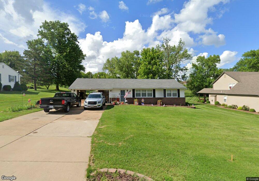
707 Connie Ln Ballwin, MO 63021
Estimated Value: $261,000 - $331,000
3
Beds
1
Bath
1,046
Sq Ft
$273/Sq Ft
Est. Value
About This Home
This home is located at 707 Connie Ln, Ballwin, MO 63021 and is currently estimated at $285,942, approximately $273 per square foot. 707 Connie Ln is a home located in St. Louis County with nearby schools including Wren Hollow Elementary School, Parkway Southwest Middle School, and Parkway South High School.
Ownership History
Date
Name
Owned For
Owner Type
Purchase Details
Closed on
Apr 29, 2025
Sold by
Welsh Kevin W and Welsh Katherine S
Bought by
Kevin And Katherine Welsh Revocable Living Tr and Welsh
Current Estimated Value
Purchase Details
Closed on
Oct 30, 2015
Sold by
The Delores C Novick Living Trust
Bought by
Welsh Kevin W and Welsh Katherine S
Home Financials for this Owner
Home Financials are based on the most recent Mortgage that was taken out on this home.
Original Mortgage
$96,000
Interest Rate
3.94%
Mortgage Type
New Conventional
Purchase Details
Closed on
Aug 28, 2001
Sold by
Dolores Bauschlicher and Dolores C D
Bought by
Novick Delores C and Delores C Novick Individual Revocable Tr
Create a Home Valuation Report for This Property
The Home Valuation Report is an in-depth analysis detailing your home's value as well as a comparison with similar homes in the area
Home Values in the Area
Average Home Value in this Area
Purchase History
| Date | Buyer | Sale Price | Title Company |
|---|---|---|---|
| Kevin And Katherine Welsh Revocable Living Tr | -- | None Listed On Document | |
| Welsh Kevin W | $120,000 | Investors Title Co Clayton | |
| The Delores C Novick Living Trust | -- | Investors Title Co Clayton | |
| Novick Delores C | -- | -- |
Source: Public Records
Mortgage History
| Date | Status | Borrower | Loan Amount |
|---|---|---|---|
| Previous Owner | Welsh Kevin W | $96,000 |
Source: Public Records
Tax History
| Year | Tax Paid | Tax Assessment Tax Assessment Total Assessment is a certain percentage of the fair market value that is determined by local assessors to be the total taxable value of land and additions on the property. | Land | Improvement |
|---|---|---|---|---|
| 2025 | $2,885 | $44,290 | $33,500 | $10,790 |
| 2024 | $2,885 | $41,900 | $25,140 | $16,760 |
| 2023 | $2,885 | $41,900 | $25,140 | $16,760 |
| 2022 | $2,900 | $38,400 | $31,120 | $7,280 |
| 2021 | $2,884 | $38,400 | $31,120 | $7,280 |
| 2020 | $2,381 | $30,250 | $27,720 | $2,530 |
| 2019 | $2,333 | $30,250 | $27,720 | $2,530 |
| 2018 | $2,336 | $28,100 | $15,180 | $12,920 |
| 2017 | $2,238 | $28,100 | $15,180 | $12,920 |
| 2016 | $1,901 | $22,130 | $12,140 | $9,990 |
| 2015 | $1,984 | $22,130 | $12,140 | $9,990 |
| 2014 | $1,762 | $21,820 | $7,700 | $14,120 |
Source: Public Records
Map
Nearby Homes
- New Build Forest J at Joyce Ann Dr
- 0 the Rainier@joyce Ann Dr
- 322 Old Meramec Station Rd
- 604 Nandale Ln
- 580 Bridgebend Rd
- 1016 Howard George Dr
- 1039 Treeline Ct
- 952 Queensbridge Rd
- 0 Unknown Unit MIS25060078
- 0 Unknown Unit MIS25060104
- 0 Unknown Unit MIS25060076
- 0 Unknown Unit MIS25060105
- 0 Unknown Unit MIS25060100
- 0 Unknown Unit MIS25060079
- 0 Unknown Unit MIS25060108
- 0 Unknown Unit MIS25060103
- 0 Unknown Unit MIS25060077
- 514 Meramec Station Rd
- 304 Wembley Ln
- 798 Canary Dr
- 709 Connie Ln
- 711 Connie Ln
- 703 Connie Ln
- 708 Connie Ln
- 2 Bb Wyndsor @ Connie Lee Acres
- 2 Bb Hampton @ Connie Lee Acres
- 710 Connie Ln
- 706 Connie Ln
- 801 Connie Ln
- 701 Connie Ln
- 712 Connie Ln
- 704 Connie Ln
- 803 Connie Ln
- 613 Connie Ln
- 802 Connie Ln
- 702 Connie Ln
- 804 Connie Ln
- 707 Joyceann Dr
- 709 Joyceann Dr
- 709 Joyce Ann Dr
Your Personal Tour Guide
Ask me questions while you tour the home.