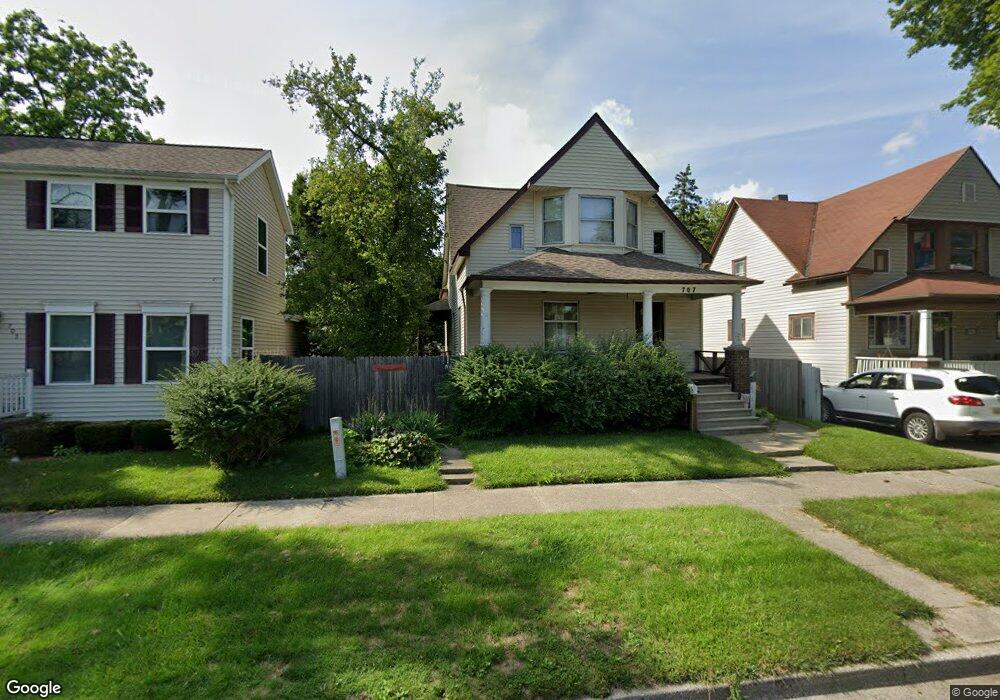
707 N Porter St Unit 1 Saginaw, MI 48602
Covenant NeighborhoodEstimated Value: $114,000 - $768,000
3
Beds
2
Baths
1,304
Sq Ft
$216/Sq Ft
Est. Value
About This Home
This home is located at 707 N Porter St Unit 1, Saginaw, MI 48602 and is currently estimated at $282,001, approximately $216 per square foot. 707 N Porter St Unit 1 is a home located in Saginaw County with nearby schools including Herig Elementary School, Thompson Middle School, and Arthur Hill High School.
Ownership History
Date
Name
Owned For
Owner Type
Purchase Details
Closed on
Feb 14, 2025
Sold by
Kraynak Mark E and Kraynak Carol G
Bought by
Whitney Kevin Richard and Daley Whitney Candace
Current Estimated Value
Home Financials for this Owner
Home Financials are based on the most recent Mortgage that was taken out on this home.
Original Mortgage
$92,800
Outstanding Balance
$92,251
Interest Rate
6.93%
Mortgage Type
New Conventional
Estimated Equity
$189,750
Purchase Details
Closed on
Nov 17, 1992
Sold by
Kraynak Carol G
Bought by
Kraynak Mark E and Kraynak Carol G
Purchase Details
Closed on
Apr 20, 1984
Sold by
Pomerville Michael D and Pomerville Sherrie L
Bought by
Gauthier Carol S
Purchase Details
Closed on
Apr 1, 1984
Create a Home Valuation Report for This Property
The Home Valuation Report is an in-depth analysis detailing your home's value as well as a comparison with similar homes in the area
Home Values in the Area
Average Home Value in this Area
Purchase History
| Date | Buyer | Sale Price | Title Company |
|---|---|---|---|
| Whitney Kevin Richard | $116,000 | Crossroads Title | |
| Kraynak Mark E | -- | -- | |
| Gauthier Carol S | $35,000 | -- | |
| -- | $35,000 | -- |
Source: Public Records
Mortgage History
| Date | Status | Borrower | Loan Amount |
|---|---|---|---|
| Open | Whitney Kevin Richard | $92,800 |
Source: Public Records
Tax History Compared to Growth
Tax History
| Year | Tax Paid | Tax Assessment Tax Assessment Total Assessment is a certain percentage of the fair market value that is determined by local assessors to be the total taxable value of land and additions on the property. | Land | Improvement |
|---|---|---|---|---|
| 2025 | $2,218 | $45,400 | $0 | $0 |
| 2024 | $1,814 | $40,700 | $0 | $0 |
| 2023 | $1,741 | $36,500 | $0 | $0 |
| 2022 | $2,035 | $30,700 | $0 | $0 |
| 2021 | $1,914 | $27,100 | $0 | $0 |
| 2020 | $1,725 | $27,100 | $0 | $0 |
| 2019 | $1,732 | $25,200 | $900 | $24,300 |
| 2018 | $1,620 | $29,359 | $0 | $0 |
| 2017 | $1,905 | $29,450 | $0 | $0 |
| 2016 | $1,908 | $29,502 | $0 | $0 |
| 2014 | -- | $28,971 | $0 | $27,889 |
| 2013 | -- | $28,971 | $0 | $0 |
Source: Public Records
Map
Nearby Homes
- 717 N Porter St
- 709 N Granger St
- 1121 Throop St
- 902 N Mason St
- 513 N Oakley St
- 513 N Webster St
- 413 N Bond St
- 401 N Porter St
- 620 Madison St
- 800 W Remington St
- 1509 Monroe St
- 1014 Hancock St
- 1603 Cooper Ave
- 203 N Webster St
- 211 N Woodbridge St
- 129 N Mason St
- 1614 Barnard St
- 1118 Court St
- 406 N Hamilton St Unit 208
- 2024 Cooper Ave
- 707 N Porter #1 St
- 707 N Porter #1 St Unit 1 Main
- 707 N Porter #2 St Unit Upper
- 707 N Porter #2 St
- 713 N Porter St
- 703 N Porter St
- 1012 Hayes St
- 706 N Porter St
- 723 N Porter St
- 702 N Porter St
- 712 N Porter St
- 716 N Porter St
- 629 N Porter St
- 712 N Bond St
- 722 N Porter St
- 706 N Bond St
- 729 N Porter St
- 718 N Bond St
- 626 N Porter St
- 1015 Throop St