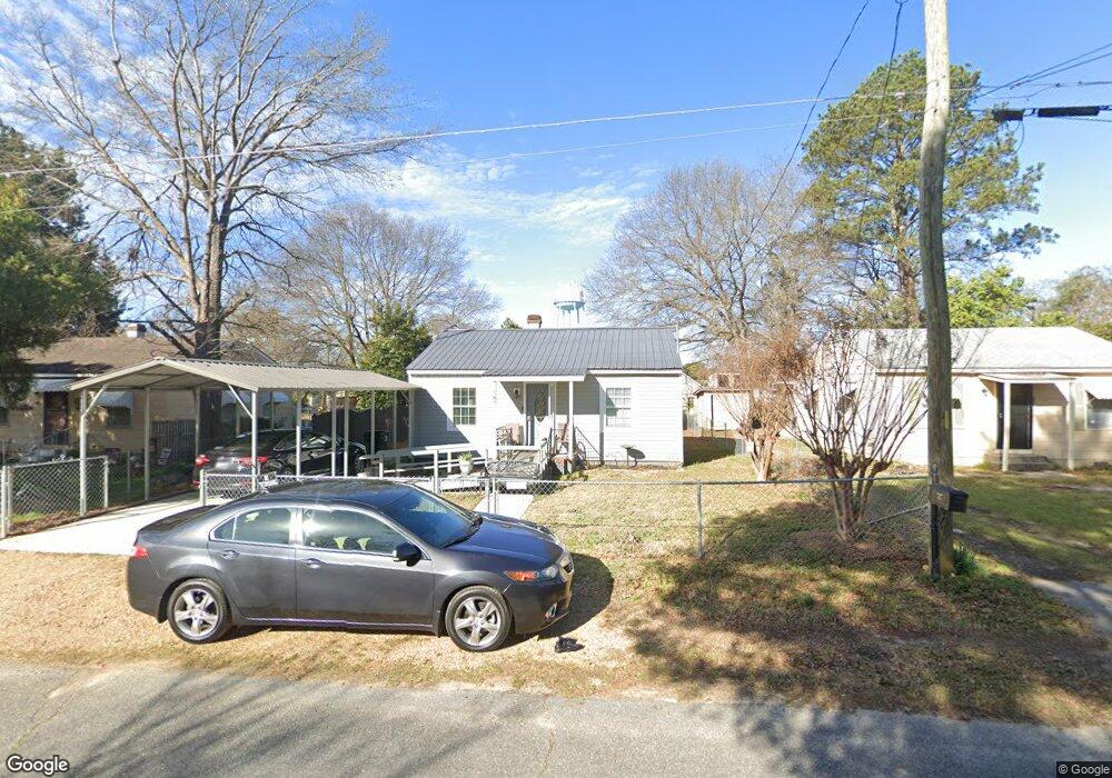
707 Paul St Warner Robins, GA 31088
Estimated Value: $66,401 - $116,000
--
Bed
1
Bath
725
Sq Ft
$133/Sq Ft
Est. Value
About This Home
This home is located at 707 Paul St, Warner Robins, GA 31088 and is currently estimated at $96,600, approximately $133 per square foot. 707 Paul St is a home located in Houston County with nearby schools including C. B. Watson Primary School, Pearl Stephens Elementary School, and Huntington Middle School.
Ownership History
Date
Name
Owned For
Owner Type
Purchase Details
Closed on
Feb 25, 2013
Sold by
Betts Rosemary Sapp
Bought by
Betts Rosemary Sapp and Sapp Michael R
Current Estimated Value
Purchase Details
Closed on
Sep 17, 2002
Sold by
Sapp David A
Bought by
Betts Rosemary Sapp
Purchase Details
Closed on
Apr 1, 1998
Sold by
Sapp David A and Sapp David L
Bought by
Sapp David A and Sapp Rosemary
Purchase Details
Closed on
Nov 8, 1995
Sold by
Himebauch Claudia Estate
Bought by
Sapp David A and Sapp David L
Purchase Details
Closed on
Oct 12, 1995
Sold by
Various Thru Qcds
Bought by
Sapp David A and Sapp David L
Purchase Details
Closed on
Jan 1, 1993
Sold by
Powell Claudia Irene
Bought by
Himebauch Claudia I P
Purchase Details
Closed on
Jan 1, 1992
Sold by
Powell Henry C and Claudia Irene
Bought by
Powell Claudia Irene
Purchase Details
Closed on
Aug 20, 1968
Sold by
Peterman Claudine
Bought by
Powell Henry C and Claudia Irene
Purchase Details
Closed on
Jan 1, 1954
Bought by
Peterman Claudine
Create a Home Valuation Report for This Property
The Home Valuation Report is an in-depth analysis detailing your home's value as well as a comparison with similar homes in the area
Home Values in the Area
Average Home Value in this Area
Purchase History
| Date | Buyer | Sale Price | Title Company |
|---|---|---|---|
| Betts Rosemary Sapp | -- | None Available | |
| Betts Rosemary Sapp | -- | -- | |
| Sapp David A | -- | -- | |
| Sapp David A | $28,000 | -- | |
| Sapp David A | -- | -- | |
| Himebauch Claudia I P | -- | -- | |
| Powell Claudia Irene | -- | -- | |
| Powell Henry C | $3,000 | -- | |
| Peterman Claudine | -- | -- |
Source: Public Records
Tax History Compared to Growth
Tax History
| Year | Tax Paid | Tax Assessment Tax Assessment Total Assessment is a certain percentage of the fair market value that is determined by local assessors to be the total taxable value of land and additions on the property. | Land | Improvement |
|---|---|---|---|---|
| 2024 | $339 | $16,720 | $3,800 | $12,920 |
| 2023 | $274 | $14,700 | $3,800 | $10,900 |
| 2022 | $310 | $13,500 | $3,800 | $9,700 |
| 2021 | $245 | $10,600 | $3,800 | $6,800 |
| 2020 | $227 | $9,760 | $3,800 | $5,960 |
| 2019 | $227 | $9,760 | $3,800 | $5,960 |
| 2018 | $227 | $9,760 | $3,800 | $5,960 |
| 2017 | $227 | $9,760 | $3,800 | $5,960 |
| 2016 | $257 | $11,040 | $3,800 | $7,240 |
| 2015 | -- | $11,040 | $3,800 | $7,240 |
| 2014 | -- | $12,760 | $3,800 | $8,960 |
| 2013 | -- | $12,760 | $3,800 | $8,960 |
Source: Public Records
Map
Nearby Homes
- 601 Paul St
- 106 Ida Ave
- 108 Ida Ave
- 213 Stratford Dr
- 908 Crestwood Terrace
- 803 Crestwood Terrace
- 104 Pleasant Hill Ct
- 509 S Pleasant Hill Rd
- 108 Southend Ave
- 603 S Davis Dr
- 310 Orchard Way
- 111 Forrester Dr
- 204 Deerwood Cir
- 212 Orchard Way
- 113 Sandra Ave
- 210 Scott Blvd
- 214 Kingsbury Cir
- 304 Wall St
- 113 Vernon Dr
- 201 Sherman St
- 705 Paul St
- 709 Paul St
- 703 Paul St
- 418 S Pleasant Hill Rd
- 0 Joseph Ave
- 701 Paul St
- 702 Paul St
- 412 S Pleasant Hill Rd
- 700 Paul St
- 1328 Joseph Ave
- 617 Paul St
- 1331 Joseph Ave
- 1319 Hartley Ave
- 1333 Joseph Ave
- 410 S Pleasant Hill Rd
- 615 Paul St
- 713 Paul St
- 1329 Joseph Ave
- 1324 Joseph Ave
- 000 S Pleasant Hill Rd