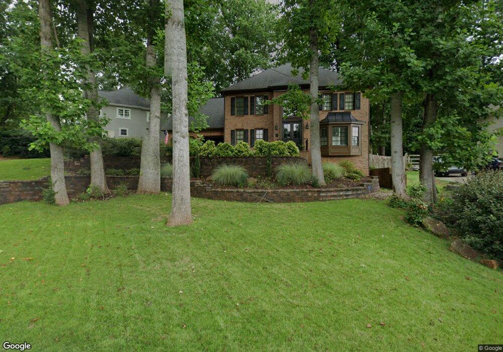
707 Robinson Farms Dr Marietta, GA 30068
Indian Hills Country Club NeighborhoodEstimated Value: $740,000 - $899,000
4
Beds
5
Baths
3,270
Sq Ft
$255/Sq Ft
Est. Value
About This Home
This home is located at 707 Robinson Farms Dr, Marietta, GA 30068 and is currently estimated at $832,423, approximately $254 per square foot. 707 Robinson Farms Dr is a home located in Cobb County with nearby schools including East Side Elementary School, Dodgen Middle School, and Walton High School.
Ownership History
Date
Name
Owned For
Owner Type
Purchase Details
Closed on
Feb 22, 2005
Sold by
Settle Settle E and Settle Connie
Bought by
Jones Christopher D
Current Estimated Value
Home Financials for this Owner
Home Financials are based on the most recent Mortgage that was taken out on this home.
Original Mortgage
$210,000
Outstanding Balance
$105,473
Interest Rate
5.57%
Mortgage Type
New Conventional
Estimated Equity
$726,950
Purchase Details
Closed on
Jun 21, 1993
Sold by
Black Tosca L
Bought by
Settle E Gary Connie H
Create a Home Valuation Report for This Property
The Home Valuation Report is an in-depth analysis detailing your home's value as well as a comparison with similar homes in the area
Home Values in the Area
Average Home Value in this Area
Purchase History
| Date | Buyer | Sale Price | Title Company |
|---|---|---|---|
| Jones Christopher D | $360,000 | -- | |
| Settle E Gary Connie H | $236,000 | -- |
Source: Public Records
Mortgage History
| Date | Status | Borrower | Loan Amount |
|---|---|---|---|
| Open | Jones Christopher D | $210,000 | |
| Closed | Settle E Gary Connie H | -- |
Source: Public Records
Tax History Compared to Growth
Tax History
| Year | Tax Paid | Tax Assessment Tax Assessment Total Assessment is a certain percentage of the fair market value that is determined by local assessors to be the total taxable value of land and additions on the property. | Land | Improvement |
|---|---|---|---|---|
| 2025 | $6,136 | $247,872 | $36,000 | $211,872 |
| 2024 | $6,141 | $247,872 | $36,000 | $211,872 |
| 2023 | $5,598 | $247,872 | $36,000 | $211,872 |
| 2022 | $4,938 | $190,720 | $36,000 | $154,720 |
| 2021 | $4,938 | $190,720 | $36,000 | $154,720 |
| 2020 | $4,938 | $190,720 | $36,000 | $154,720 |
| 2019 | $4,938 | $190,720 | $36,000 | $154,720 |
| 2018 | $4,517 | $171,504 | $38,000 | $133,504 |
| 2017 | $4,343 | $171,504 | $38,000 | $133,504 |
| 2016 | $4,215 | $165,436 | $38,000 | $127,436 |
| 2015 | $3,960 | $149,864 | $38,000 | $111,864 |
| 2014 | $3,990 | $149,864 | $0 | $0 |
Source: Public Records
Map
Nearby Homes
- 3442 Fox Hollow Dr
- 529 Greystone Trail
- 640 Maddie Way
- 3542 Clubland Dr
- 420 Greenfield Trace
- 3040 Clearbrook Dr
- 382 Greenfield Ct
- 590 Clubwood Ct
- 3506 Clubland Dr Unit 6
- 3220 Birchfield Trace
- 3760 Creekstone Way
- 3661 Clubwood Trail
- 860 Mitsy Ridge Dr
- 399 Old Canton Rd
- 3165 Brookview Dr
- 3769 High Green Dr
- 3511 Brookview Dr
- 3344 Brookview Dr
- 3830 Valley Green Dr
- 705 Robinson Farms Dr
- 711 Robinson Farms Dr
- 715 Robinson Farms Dr
- 703 Robinson Farms Dr
- 716 Robinson Farms Dr
- 714 Robinson Farms Dr
- 718 Robinson Farms Dr
- 3340 Robinson Farms Ct
- 706 Robinson Farms Dr
- 708 Robinson Farms Dr
- 712 Robinson Farms Dr
- 3342 Robinson Farms Ct
- 701 Robinson Farms Dr
- 720 Robinson Farms Dr
- 704 Robinson Farms Dr
- 710 Robinson Farms Dr
- 725 Robinson Farms Dr
- 700 Robinson Farms Dr
- 722 Robinson Farms Dr
- 3343 Greenfield Dr Unit 14