
Seller's Agent in 2026
Delton Williams
Crye-Leike REALTORS, Gentry
(479) 366-4262
26 in this area
345 Total Sales
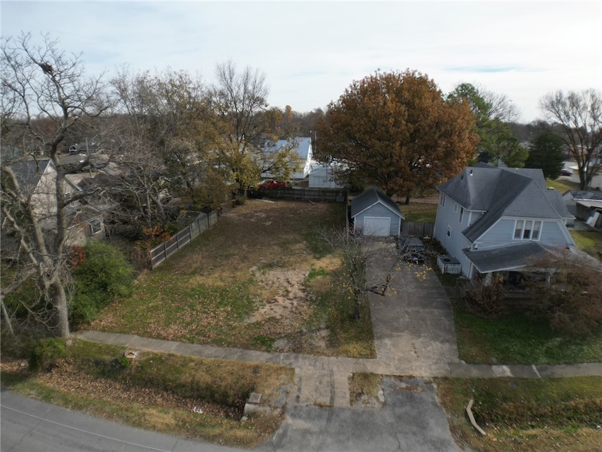
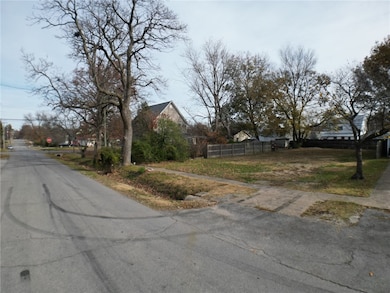
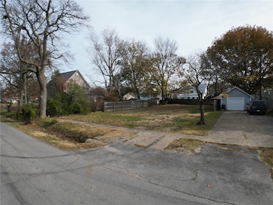
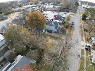
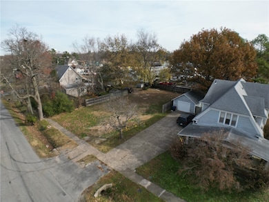
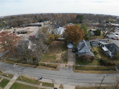
Great opportunity on this .16-acre lot tucked into a desirable Siloam Springs setting! This property is perfectly sized and ready for your vision—whether that’s a custom home, a small investment project, or a cozy getaway. You’ll love the convenient location, just a short drive from downtown Siloam Springs and only moments from Hwy 412, making daily errands, restaurants, schools, and local parks easily accessible. With its flexible potential and prime placement, this lot is an excellent choice for anyone looking to build in a growing, well-connected area.
Last Agent to Sell the Property
Crye-Leike REALTORS, Gentry Brokerage Email: deltonwilliams@me.com License #PB00054955 Listed on: 11/19/2025
| Date | Type | Sale Price | Title Company |
|---|---|---|---|
| Special Warranty Deed | -- | None Available | |
| Trustee Deed | $52,969 | None Available | |
| Warranty Deed | -- | -- | |
| Warranty Deed | $45,000 | -- | |
| Warranty Deed | $31,000 | -- | |
| Deed | -- | -- | |
| Warranty Deed | $25,000 | -- |
| Date | Event | Price | List to Sale | Price per Sq Ft |
|---|---|---|---|---|
| 03/02/2026 03/02/26 | Sold | $35,000 | -30.0% | $36 / Sq Ft |
| 02/04/2026 02/04/26 | Pending | -- | -- | -- |
| 11/19/2025 11/19/25 | For Sale | $50,000 | -- | $51 / Sq Ft |
| Year | Tax Paid | Tax Assessment Tax Assessment Total Assessment is a certain percentage of the fair market value that is determined by local assessors to be the total taxable value of land and additions on the property. | Land | Improvement |
|---|---|---|---|---|
| 2025 | $377 | $7,400 | $7,400 | -- |
| 2024 | $355 | $7,400 | $7,400 | $0 |
| 2023 | $323 | $5,600 | $5,600 | $0 |
| 2022 | $322 | $5,600 | $5,600 | $0 |
| 2021 | $405 | $12,680 | $5,600 | $7,080 |
| 2020 | $369 | $9,920 | $5,600 | $4,320 |
| 2019 | $369 | $9,920 | $5,600 | $4,320 |
| 2018 | $19 | $9,920 | $5,600 | $4,320 |
| 2017 | $19 | $9,920 | $5,600 | $4,320 |
| 2016 | $19 | $9,920 | $5,600 | $4,320 |
| 2015 | $369 | $6,400 | $1,600 | $4,800 |
| 2014 | $19 | $6,400 | $1,600 | $4,800 |
Seller's Agent in 2026
Delton Williams
Crye-Leike REALTORS, Gentry
(479) 366-4262
26 in this area
345 Total Sales
E
Buyer's Agent in 2026
Eduardo Sierra
McMullen Realty Group
(479) 236-4190
1 in this area
81 Total Sales
Source: Northwest Arkansas Board of REALTORS®
MLS Number: 1328903
APN: 03-01847-000
Disclaimer: Certain information contained herein is derived from information provided by parties other than Homes.com. All information provided is deemed reliable, but is not guaranteed to be accurate and should be independently verified.
![]() IDX information is provided exclusively for personal, non-commercial use, and may not be used for any purpose other than to identify prospective properties consumers may be interested in purchasing. Information is deemed reliable but not guaranteed.
IDX information is provided exclusively for personal, non-commercial use, and may not be used for any purpose other than to identify prospective properties consumers may be interested in purchasing. Information is deemed reliable but not guaranteed.
Ask me questions while you tour the home.