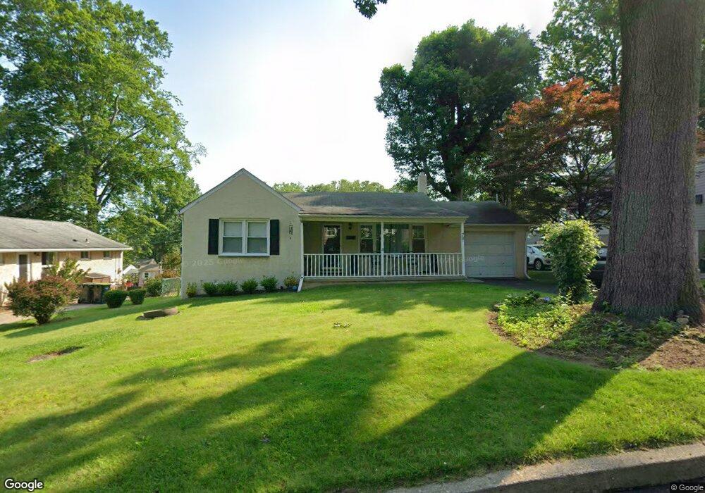
707 Sampson Ave Willow Grove, PA 19090
Estimated Value: $375,000 - $385,959
2
Beds
1
Bath
1,079
Sq Ft
$353/Sq Ft
Est. Value
About This Home
This home is located at 707 Sampson Ave, Willow Grove, PA 19090 and is currently estimated at $381,240, approximately $353 per square foot. 707 Sampson Ave is a home located in Montgomery County with nearby schools including Upper Moreland Intermediate School, Upper Moreland Primary School, and Upper Moreland Middle School.
Ownership History
Date
Name
Owned For
Owner Type
Purchase Details
Closed on
Aug 14, 2013
Sold by
Maldonado Enrique and Maldonado Jacqualine
Bought by
Maldonado Jacqualine
Current Estimated Value
Purchase Details
Closed on
Mar 21, 2003
Sold by
Celline Theresa A and Fagan Patricia A
Bought by
Maldonado Enrique and Maldonado Jacqueline
Purchase Details
Closed on
Jul 8, 1994
Sold by
Chrismar Steve and Fagan Patricia Ann
Bought by
Fagan Patricia Ann and Celline Theresa A
Create a Home Valuation Report for This Property
The Home Valuation Report is an in-depth analysis detailing your home's value as well as a comparison with similar homes in the area
Home Values in the Area
Average Home Value in this Area
Purchase History
| Date | Buyer | Sale Price | Title Company |
|---|---|---|---|
| Maldonado Jacqualine | -- | None Available | |
| Maldonado Enrique | $170,000 | -- | |
| Fagan Patricia Ann | $60,190 | -- |
Source: Public Records
Tax History Compared to Growth
Tax History
| Year | Tax Paid | Tax Assessment Tax Assessment Total Assessment is a certain percentage of the fair market value that is determined by local assessors to be the total taxable value of land and additions on the property. | Land | Improvement |
|---|---|---|---|---|
| 2025 | $5,362 | $112,820 | $47,750 | $65,070 |
| 2024 | $5,362 | $112,820 | $47,750 | $65,070 |
| 2023 | $5,140 | $112,820 | $47,750 | $65,070 |
| 2022 | $4,834 | $112,820 | $47,750 | $65,070 |
| 2021 | $4,769 | $112,820 | $47,750 | $65,070 |
| 2020 | $4,611 | $112,820 | $47,750 | $65,070 |
| 2019 | $4,510 | $112,820 | $47,750 | $65,070 |
| 2018 | $4,510 | $112,820 | $47,750 | $65,070 |
| 2017 | $4,309 | $112,820 | $47,750 | $65,070 |
| 2016 | $4,264 | $112,820 | $47,750 | $65,070 |
| 2015 | $4,167 | $112,820 | $47,750 | $65,070 |
| 2014 | $4,047 | $112,820 | $47,750 | $65,070 |
Source: Public Records
Map
Nearby Homes
- 1014 N York Rd
- 1006 N York Rd Unit 1
- 612 Brook St
- 605 Fairhill St
- 605 Crown St
- 885 N York Rd Unit 12C
- 505 Crown St
- 14 Knock N Knoll Cir Unit L-14
- 509 Lincoln Ave
- 310 Dallas Rd
- 510 Grant Ave
- 250 Lawnton Rd
- 211 Madison Rd
- 3505 Whitehall Dr
- 16 Lawnton Rd
- 204 Cowbell Rd
- 22 Fitzwatertown Rd Unit F-4
- 69 Crooked Billet Rd
- 1948 Lukens Ave
- 1972 Coolidge Ave
- 709 Sampson Ave
- 703 Sampson Ave
- 711 Sampson Ave
- 618 Beechwood Rd
- 616 Beechwood Rd
- 620 Beechwood Rd
- 710 Sampson Ave
- 701 Sampson Ave
- 902 Patterson Ave
- 714 Sampson Ave
- 622 Beechwood Rd
- 648 Sampson Ave
- 713 Sampson Ave
- 614 Beechwood Rd
- 716 Sampson Ave
- 624 Beechwood Rd
- 646 Sampson Ave
- 711 Brook St
- 626 Beechwood Rd
- 718 Sampson Ave