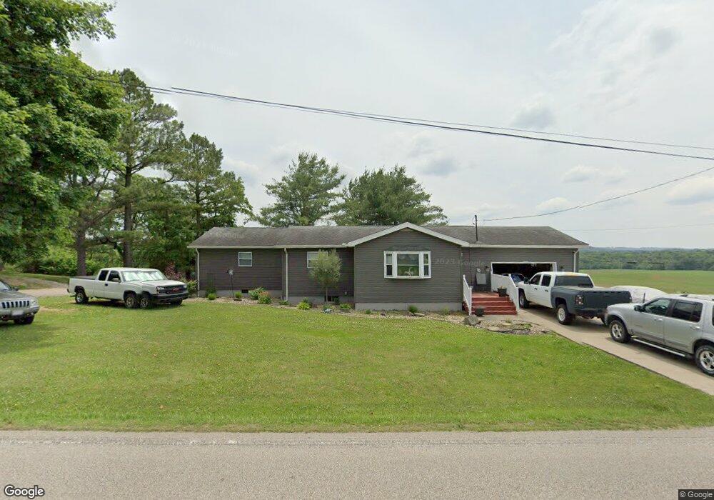
707 State Route 555 Little Hocking, OH 45742
Estimated Value: $219,000 - $250,000
3
Beds
2
Baths
1,376
Sq Ft
$166/Sq Ft
Est. Value
About This Home
This home is located at 707 State Route 555, Little Hocking, OH 45742 and is currently estimated at $228,756, approximately $166 per square foot. 707 State Route 555 is a home located in Washington County with nearby schools including Warren High School.
Ownership History
Date
Name
Owned For
Owner Type
Purchase Details
Closed on
Sep 10, 2018
Sold by
Moening Michael J and Moening Anna M
Bought by
Lilly Chester U and Lilly Tammy L
Current Estimated Value
Home Financials for this Owner
Home Financials are based on the most recent Mortgage that was taken out on this home.
Original Mortgage
$152,884
Outstanding Balance
$132,790
Interest Rate
4.6%
Mortgage Type
VA
Estimated Equity
$95,966
Purchase Details
Closed on
Oct 26, 2006
Sold by
Sloan Chad A and Sloan Heather T
Bought by
Moening Michael J and Parmiter Anna M
Purchase Details
Closed on
Aug 13, 2001
Bought by
Sloan Chad A and Sloan Heather T
Purchase Details
Closed on
Oct 26, 1995
Bought by
Williams Robert O and Williams Lynd
Purchase Details
Closed on
Nov 20, 1989
Purchase Details
Closed on
Sep 5, 1989
Create a Home Valuation Report for This Property
The Home Valuation Report is an in-depth analysis detailing your home's value as well as a comparison with similar homes in the area
Home Values in the Area
Average Home Value in this Area
Purchase History
| Date | Buyer | Sale Price | Title Company |
|---|---|---|---|
| Lilly Chester U | $148,000 | None Available | |
| Moening Michael J | $117,500 | None Available | |
| Sloan Chad A | $83,500 | -- | |
| Sloan Chad A | $83,500 | -- | |
| Williams Robert O | $66,400 | -- | |
| Williams Robert O | $66,400 | -- | |
| -- | $31,000 | -- | |
| -- | $31,000 | -- | |
| -- | -- | -- | |
| -- | -- | -- |
Source: Public Records
Mortgage History
| Date | Status | Borrower | Loan Amount |
|---|---|---|---|
| Open | Lilly Chester U | $152,884 |
Source: Public Records
Tax History Compared to Growth
Tax History
| Year | Tax Paid | Tax Assessment Tax Assessment Total Assessment is a certain percentage of the fair market value that is determined by local assessors to be the total taxable value of land and additions on the property. | Land | Improvement |
|---|---|---|---|---|
| 2024 | $2,031 | $51,770 | $8,840 | $42,930 |
| 2023 | $2,031 | $51,770 | $8,840 | $42,930 |
| 2022 | $2,022 | $51,770 | $8,840 | $42,930 |
| 2021 | $1,886 | $45,810 | $6,730 | $39,080 |
| 2020 | $1,765 | $45,810 | $6,730 | $39,080 |
| 2019 | $1,739 | $45,810 | $6,730 | $39,080 |
| 2018 | $1,628 | $41,630 | $5,860 | $35,770 |
| 2017 | $1,618 | $41,630 | $5,860 | $35,770 |
| 2016 | $1,408 | $41,630 | $5,860 | $35,770 |
| 2015 | $1,294 | $37,240 | $5,600 | $31,640 |
| 2014 | $1,827 | $36,640 | $5,600 | $31,040 |
| 2013 | $1,259 | $36,640 | $5,600 | $31,040 |
Source: Public Records
Map
Nearby Homes
- 966 State Route 555
- 0 T1309
- 00 Orchard Dr
- 72 Franklin Dr
- 950 Federal Rd
- 19 Suzanne St
- 0 Newberry Rd Unit 4279424
- 2567 State Route 555
- 0 Houston Rd
- 29500 Houston Rd
- 2853 Lake Washington Rd
- 120 Carson Ln
- 56 Carson Ln
- 5595 N Torch Rd
- 631 Short Brook Rd
- 0 Ohio 339
- 0 Mooreland Rd Unit 5174607
- 1396 State Route 339
- 1462 State Route 339
- 0 Murphy Rd Unit 2431698
- 707 Sr 555
- 707 Ohio 555
- 0 Blue Heron Unit M233447
- 635 State Route 555
- 668 State Route 555
- 625 State Route 555
- 615 State Route 555
- 573 State Route 555
- 119 Walnut Ridge Dr
- 116 Walnut Ridge
- 116 Walnut Ridge Dr
- 529 State Route 555
- 114 Walnut Ridge Dr
- 568 State Route 555
- 570 State Route 555
- 115 Walnut Ridge Dr
- 515 State Route 555
- 550 State Route 555
- 113 Walnut Ridge Dr
- 906 Sr-555