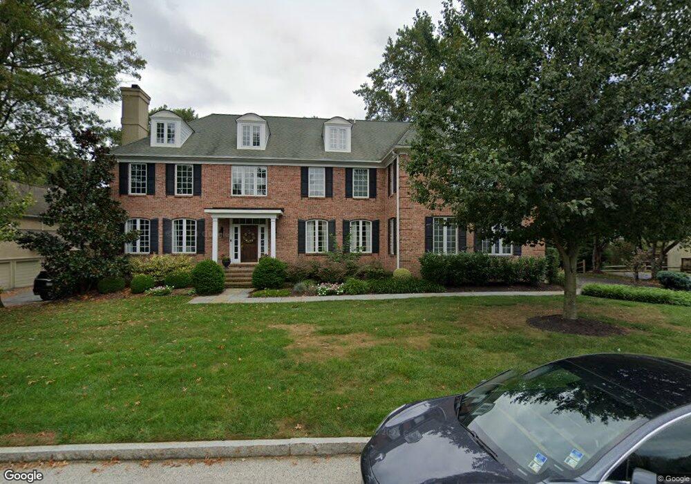
707 Sturbridge Dr Bryn Mawr, PA 19010
Estimated Value: $1,734,000 - $2,069,296
6
Beds
7
Baths
5,864
Sq Ft
$329/Sq Ft
Est. Value
About This Home
This home is located at 707 Sturbridge Dr, Bryn Mawr, PA 19010 and is currently estimated at $1,926,824, approximately $328 per square foot. 707 Sturbridge Dr is a home located in Delaware County with nearby schools including Ithan Elementary School, Radnor Middle School, and Radnor Senior High School.
Ownership History
Date
Name
Owned For
Owner Type
Purchase Details
Closed on
May 24, 2006
Sold by
Callinan Thomas D and Callinan Lisa M
Bought by
Stavropoulos S William and Stavropoulos Lata
Current Estimated Value
Home Financials for this Owner
Home Financials are based on the most recent Mortgage that was taken out on this home.
Original Mortgage
$400,000
Outstanding Balance
$233,645
Interest Rate
6.55%
Mortgage Type
Purchase Money Mortgage
Estimated Equity
$1,693,179
Purchase Details
Closed on
Jun 18, 2002
Sold by
Kazanjian Associates Inc
Bought by
Springer Raymond P and Springer Maria A
Home Financials for this Owner
Home Financials are based on the most recent Mortgage that was taken out on this home.
Original Mortgage
$750,000
Interest Rate
5.5%
Purchase Details
Closed on
Mar 23, 1994
Sold by
Stradley Catherine W
Bought by
Kazanjian Associates Inc
Home Financials for this Owner
Home Financials are based on the most recent Mortgage that was taken out on this home.
Original Mortgage
$360,000
Interest Rate
7.07%
Create a Home Valuation Report for This Property
The Home Valuation Report is an in-depth analysis detailing your home's value as well as a comparison with similar homes in the area
Home Values in the Area
Average Home Value in this Area
Purchase History
| Date | Buyer | Sale Price | Title Company |
|---|---|---|---|
| Stavropoulos S William | $1,610,000 | None Available | |
| Springer Raymond P | $1,190,000 | Commonwealth Land Title Ins | |
| Kazanjian Associates Inc | $360,000 | -- |
Source: Public Records
Mortgage History
| Date | Status | Borrower | Loan Amount |
|---|---|---|---|
| Open | Stavropoulos S William | $400,000 | |
| Previous Owner | Springer Raymond P | $750,000 | |
| Previous Owner | Kazanjian Associates Inc | $360,000 |
Source: Public Records
Tax History Compared to Growth
Tax History
| Year | Tax Paid | Tax Assessment Tax Assessment Total Assessment is a certain percentage of the fair market value that is determined by local assessors to be the total taxable value of land and additions on the property. | Land | Improvement |
|---|---|---|---|---|
| 2025 | $23,787 | $1,176,520 | $256,180 | $920,340 |
| 2024 | $23,787 | $1,176,520 | $256,180 | $920,340 |
| 2023 | $22,844 | $1,176,520 | $256,180 | $920,340 |
| 2022 | $22,595 | $1,176,520 | $256,180 | $920,340 |
| 2021 | $36,294 | $1,176,520 | $256,180 | $920,340 |
| 2020 | $32,681 | $939,450 | $237,980 | $701,470 |
| 2019 | $31,759 | $939,450 | $237,980 | $701,470 |
| 2018 | $31,136 | $939,450 | $0 | $0 |
| 2017 | $30,484 | $939,450 | $0 | $0 |
| 2016 | $5,156 | $924,010 | $0 | $0 |
| 2015 | $5,071 | $924,010 | $0 | $0 |
| 2014 | $5,071 | $924,010 | $0 | $0 |
Source: Public Records
Map
Nearby Homes
- 3920 Darby Rd
- 124 Carli Dr
- 820 Darby Paoli Rd
- 739 S Roberts Rd
- 119 Bella Dr Unit 2MD
- 117 Bella Dr Unit 3AD
- 127 Deerfield Rd
- 12 Lincoln Ln
- 560 S Bryn Mawr Ave
- 202 Barren Rd
- 633 Foxfields Rd
- 726 Darby Paoli Rd
- 2604 Cynwyd Ave
- 115 Newby Dr
- Lot 2 Cynwyd
- 6205 Parkview Dr
- Lot1 Cynwyd
- 202 Summit Dr Unit B
- 103 Summit Dr Unit B
- 307 B B000 Summit Dr Unit B
- 705 Sturbridge Dr
- 709 Sturbridge Dr
- 704 Sturbridge Dr
- 702 Sturbridge Dr
- 703 Sturbridge Dr
- 112 Leighton Dr
- 112 Leighton Dr Unit 1010 SPROUL RD
- 711 Sturbridge Dr
- 706 Sturbridge Dr
- 5017 Brittany Ln
- 5021 Brittany Ln
- 5013 Brittany Ln
- 5025 Brittany Ln
- 104 Leighton Dr
- 708 Sturbridge Dr
- 5009 Brittany Ln
- 713 Sturbridge Dr
- 5029 Brittany Ln
- 701 Sturbridge Dr
- 700 Sturbridge Dr