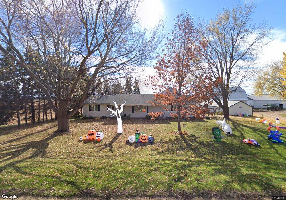
7070 150th St E Hastings, MN 55033
Estimated Value: $367,062 - $508,000
2
Beds
2
Baths
1,264
Sq Ft
$349/Sq Ft
Est. Value
About This Home
This home is located at 7070 150th St E, Hastings, MN 55033 and is currently estimated at $440,516, approximately $348 per square foot. 7070 150th St E is a home located in Dakota County with nearby schools including Christa Mcauliffe Elementary School, Hastings Middle School, and Hastings High School.
Ownership History
Date
Name
Owned For
Owner Type
Purchase Details
Closed on
Jul 13, 2016
Sold by
Bremer John C and Bremer Janet A
Bought by
Bremer John C and Roy & Karen Bremer Irrevocable Trust
Current Estimated Value
Purchase Details
Closed on
Nov 12, 2014
Sold by
Bremer John C and Bremer Janet A
Bought by
Bremer Roy R and Bremer Karen L
Create a Home Valuation Report for This Property
The Home Valuation Report is an in-depth analysis detailing your home's value as well as a comparison with similar homes in the area
Home Values in the Area
Average Home Value in this Area
Purchase History
| Date | Buyer | Sale Price | Title Company |
|---|---|---|---|
| Bremer John C | -- | Attorney | |
| Bremer John C | -- | Attorney | |
| Bremer Roy R | -- | None Available |
Source: Public Records
Tax History
| Year | Tax Paid | Tax Assessment Tax Assessment Total Assessment is a certain percentage of the fair market value that is determined by local assessors to be the total taxable value of land and additions on the property. | Land | Improvement |
|---|---|---|---|---|
| 2024 | $2,336 | $332,500 | $88,000 | $244,500 |
| 2023 | $2,336 | $331,500 | $88,000 | $243,500 |
| 2022 | $2,222 | $323,000 | $83,800 | $239,200 |
| 2021 | $2,214 | $298,000 | $83,800 | $214,200 |
| 2020 | $2,120 | $286,000 | $79,900 | $206,100 |
| 2019 | $2,055 | $261,700 | $76,000 | $185,700 |
| 2018 | $2,014 | $240,700 | $71,100 | $169,600 |
| 2017 | $1,842 | $227,900 | $66,400 | $161,500 |
| 2016 | $1,906 | $211,000 | $63,500 | $147,500 |
| 2015 | $1,767 | $195,366 | $56,669 | $138,697 |
| 2014 | -- | $178,689 | $53,670 | $125,019 |
| 2013 | -- | $153,837 | $47,476 | $106,361 |
Source: Public Records
Map
Nearby Homes
- 15775 Frame Ave
- 14028 Furlong Trail
- TBD Furlong Trail
- 1967 Sierra Dr Unit 303
- 1406 Oconnell Dr
- 1444 O'Connell Dr
- 2109 Westpointe Dr
- 2157 Westpointe Dr
- 2173 Westpointe Dr
- 2165 Westpointe Dr
- 1874 Tierney Dr
- 2120 Ridgepointe Dr
- 2160 Ridge Pointe Dr
- 1832 Ridgepointe N
- 1801 13th St W
- 1796 Cobblestone Ct
- 1458 Erickson Dr
- 15717 Clayton Ave E
- 2685 Woodcliffe Trail
- 1626 Fallbrooke Ct
- 7048 150th St E
- 7105 150th St E
- xx3 150th St E
- 7158 150th St E
- 7270 150th St E
- xx4 150th St E
- 7300 150th St E
- 7373 150th St E
- 14817 Goodwin Ave
- 7470 150th St E
- 15101 Goodwin Ave
- xxxxx Goodwin Ave
- 14690 Furlong Cir
- 15104 Goodwin Ave
- xx2 Furlong Cir
- 14700 Furlong Cir
- 15030 Goodwin Ave
- 14930 Goodwin Ave
- 15001 Fischer Ave
- 14670 Furlong Cir
Your Personal Tour Guide
Ask me questions while you tour the home.