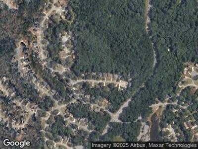
7070 Brook Side Landing Stone Mountain, GA 30087
Lithonia NeighborhoodEstimated Value: $361,000 - $404,000
4
Beds
4
Baths
2,907
Sq Ft
$130/Sq Ft
Est. Value
About This Home
This home is located at 7070 Brook Side Landing, Stone Mountain, GA 30087 and is currently estimated at $377,883, approximately $129 per square foot. 7070 Brook Side Landing is a home located in DeKalb County with nearby schools including Pine Ridge Elementary School, Stephenson Middle School, and Stephenson High School.
Ownership History
Date
Name
Owned For
Owner Type
Purchase Details
Closed on
Oct 14, 2009
Sold by
Morgan Stanley 2006-Nc1
Bought by
Mullins Jessica
Current Estimated Value
Home Financials for this Owner
Home Financials are based on the most recent Mortgage that was taken out on this home.
Original Mortgage
$133,624
Outstanding Balance
$89,906
Interest Rate
5.05%
Mortgage Type
New Conventional
Estimated Equity
$285,688
Purchase Details
Closed on
Jul 7, 2009
Sold by
Mccoy Sarah L
Bought by
Morgan Stanley Trust 2006-Nc1
Create a Home Valuation Report for This Property
The Home Valuation Report is an in-depth analysis detailing your home's value as well as a comparison with similar homes in the area
Home Values in the Area
Average Home Value in this Area
Purchase History
| Date | Buyer | Sale Price | Title Company |
|---|---|---|---|
| Mullins Jessica | $84,500 | -- | |
| Morgan Stanley Trust 2006-Nc1 | $155,188 | -- |
Source: Public Records
Mortgage History
| Date | Status | Borrower | Loan Amount |
|---|---|---|---|
| Open | Mullins Jessica | $133,624 | |
| Previous Owner | Mccoy Sarah L | $198,000 |
Source: Public Records
Tax History Compared to Growth
Tax History
| Year | Tax Paid | Tax Assessment Tax Assessment Total Assessment is a certain percentage of the fair market value that is determined by local assessors to be the total taxable value of land and additions on the property. | Land | Improvement |
|---|---|---|---|---|
| 2023 | $3,915 | $137,480 | $13,400 | $124,080 |
| 2022 | $3,444 | $119,960 | $13,400 | $106,560 |
| 2021 | $2,790 | $91,600 | $13,400 | $78,200 |
| 2020 | $2,483 | $78,080 | $13,400 | $64,680 |
| 2019 | $2,354 | $73,480 | $13,400 | $60,080 |
| 2018 | $2,196 | $73,480 | $13,400 | $60,080 |
| 2017 | $2,255 | $65,920 | $13,400 | $52,520 |
| 2016 | $1,984 | $58,960 | $13,400 | $45,560 |
| 2014 | $1,856 | $55,560 | $13,400 | $42,160 |
Source: Public Records
Map
Nearby Homes
- 7037 Waters Edge Dr
- 542 Creek Stone Ln
- 6939 Waters Edge Dr
- 6972 Sandtown Ln
- 6968 Sandtown Ln
- 5272 Cumberland Way
- 6960 Dockbridge Way
- 441 N Deshong Rd
- 433 N Deshong Rd
- 455 Registry Bluff
- 425 N Deshong Rd
- 709 Eastwood Rise
- 5260 Island Dr
- 415 N Deshong Rd
- 401 N Deshong Rd
- 6845 Gledhill Way
- 6934 Glen Cove Ln
- 508 Wynbrooke Pkwy
- 7070 Brook Side Landing
- 7076 Brook Side Landing Unit Lndg
- 7076 Brook Side Landing
- 7064 Brook Side Landing
- 0 Brook Unit Lndg 8508142
- 0 Brook Unit Lndg 8692534
- 0 Brook Unit Lndg 8926059
- 0 Brook Unit Lndg 8208946
- 0 Brook Unit Lndg 9016400
- 0 Brook Unit Landing 20004646
- 0 Brook Unit Lndg 8787552
- 0 Brook Unit Lndg 8787491
- 0 Brook Unit Lndg 2977620
- 0 Brook Unit Lndg 3122266
- 0 Brook Unit Lndg 3167374
- 0 Brook Unit Lndg 3266538
- 0 Brook Unit Lndg 3279441
- 0 Brook Unit Lndg 7221872
- 0 Brook Unit Lndg 7438348
- 0 Brook Unit Lndg 7491091
