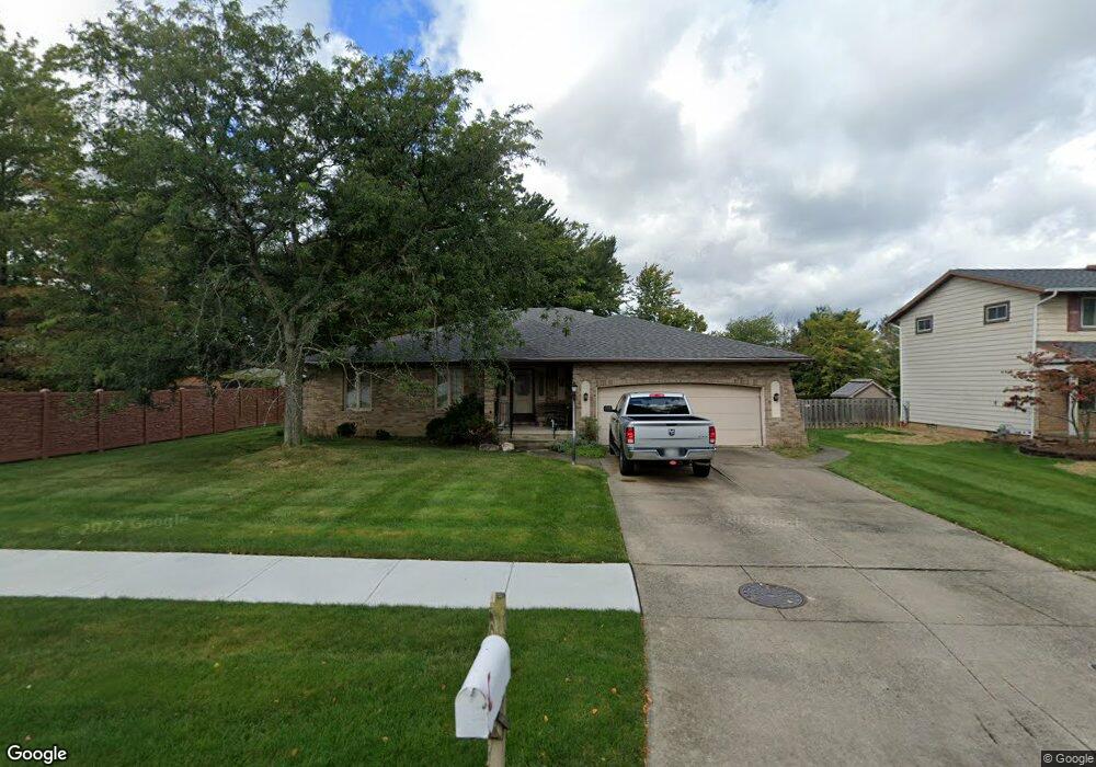
7070 Mooncrest Dr Cleveland, OH 44129
Estimated Value: $288,626 - $331,000
3
Beds
2
Baths
1,798
Sq Ft
$170/Sq Ft
Est. Value
About This Home
This home is located at 7070 Mooncrest Dr, Cleveland, OH 44129 and is currently estimated at $306,157, approximately $170 per square foot. 7070 Mooncrest Dr is a home located in Cuyahoga County with nearby schools including Dentzler Elementary School, Normandy High School, and Hillside Middle School.
Ownership History
Date
Name
Owned For
Owner Type
Purchase Details
Closed on
Feb 14, 1995
Sold by
James Prinz Trst
Bought by
Scarinzi Vince A
Current Estimated Value
Purchase Details
Closed on
Oct 11, 1983
Bought by
Prinz James H
Purchase Details
Closed on
Jan 20, 1982
Bought by
Klump George
Purchase Details
Closed on
Jan 1, 1980
Bought by
R & K Homes Inc
Create a Home Valuation Report for This Property
The Home Valuation Report is an in-depth analysis detailing your home's value as well as a comparison with similar homes in the area
Home Values in the Area
Average Home Value in this Area
Purchase History
| Date | Buyer | Sale Price | Title Company |
|---|---|---|---|
| Scarinzi Vince A | $163,000 | -- | |
| Prinz James H | $112,000 | -- | |
| Hyman Bldrs Inc | $112,000 | -- | |
| Klump George | $23,000 | -- | |
| R & K Homes Inc | -- | -- |
Source: Public Records
Tax History Compared to Growth
Tax History
| Year | Tax Paid | Tax Assessment Tax Assessment Total Assessment is a certain percentage of the fair market value that is determined by local assessors to be the total taxable value of land and additions on the property. | Land | Improvement |
|---|---|---|---|---|
| 2024 | $5,527 | $91,665 | $20,020 | $71,645 |
| 2023 | $4,998 | $71,580 | $14,740 | $56,840 |
| 2022 | $4,957 | $71,580 | $14,740 | $56,840 |
| 2021 | $5,104 | $71,580 | $14,740 | $56,840 |
| 2020 | $5,115 | $63,910 | $13,160 | $50,750 |
| 2019 | $4,929 | $182,600 | $37,600 | $145,000 |
| 2018 | $4,961 | $63,910 | $13,160 | $50,750 |
| 2017 | $4,868 | $58,630 | $10,890 | $47,740 |
| 2016 | $4,837 | $58,630 | $10,890 | $47,740 |
| 2015 | $4,809 | $58,630 | $10,890 | $47,740 |
| 2014 | $4,809 | $60,450 | $11,240 | $49,210 |
Source: Public Records
Map
Nearby Homes
- 6417 Thoreau Dr
- 5810 Ely Vista Dr
- 5602 Ely Vista Dr
- 6862 Talbot Dr
- 6882 Day Dr
- 8305 Banner Ln
- Rosecliff Plan at South Pointe - Townhomes
- 7596 S Pointe Ln
- Caroline Plan at South Pointe - Townhomes
- 7351 S Pointe Ln
- 7580 S Pointe Ln
- 8375 Royal Ridge Dr
- 8580 Royal Ridge Dr
- 8584 Newcomb Dr
- 4803 Sassafras Dr
- 6431 W Ridgewood Dr
- 5208 Orchard Park Dr
- 6963 Anthony Ln
- 5211 W Ridgewood Dr
- 6996 Greenbriar Dr
- 7060 Mooncrest Dr
- 6602 Night Vista Dr
- 6606 Night Vista Dr
- 7085 Eventide Dr
- 7075 Eventide Dr
- 6700 Night Vista Dr
- 7050 Mooncrest Dr
- 6500 Night Vista Dr
- 7065 Eventide Dr
- 7075 Mooncrest Dr
- 6708 Night Vista Dr
- 7065 Mooncrest Dr
- 7040 Mooncrest Dr
- 7055 Eventide Dr
- 7055 Mooncrest Dr
- 6416 Night Vista Dr
- 7045 Mooncrest Dr
- 7045 Eventide Dr
- 6410 Night Vista Dr
- 6603 Night Vista Dr