Estimated Value: $187,000 - $284,000
2
Beds
1
Bath
1,454
Sq Ft
$166/Sq Ft
Est. Value
About This Home
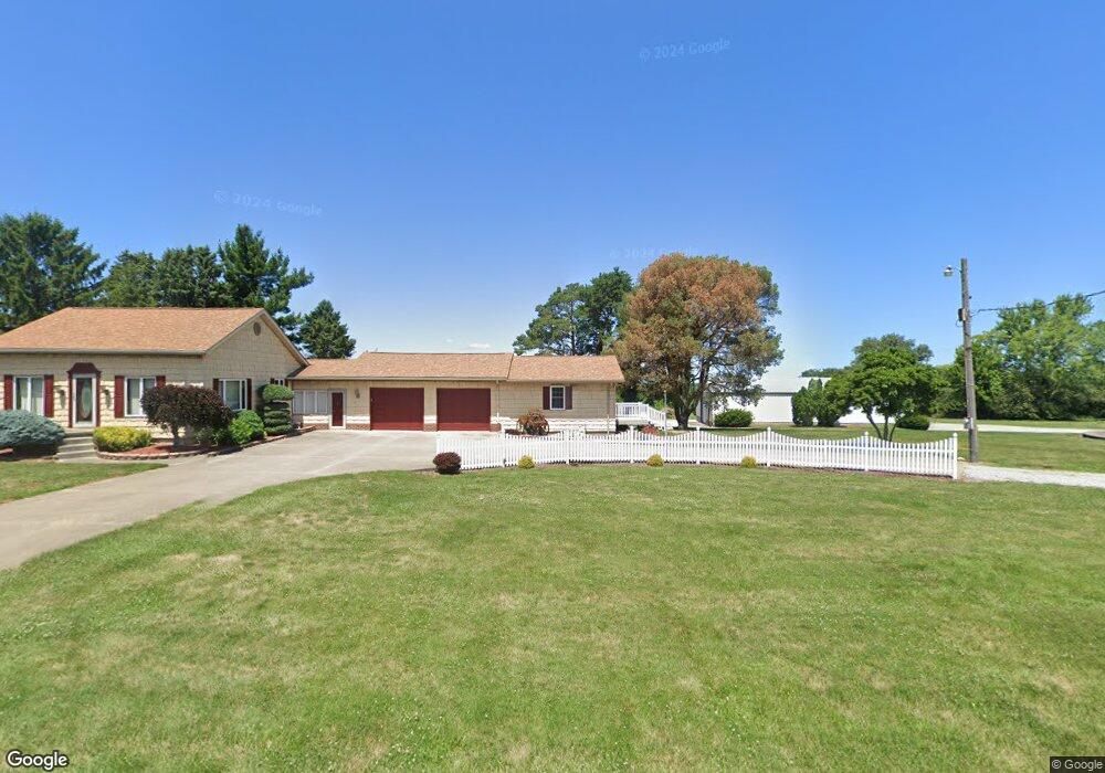
This home is located at 7070 State Route 101 E, Clyde, OH 43410 and is currently estimated at $241,667, approximately $166 per square foot. 7070 State Route 101 E is a home located in Sandusky County with nearby schools including Margaretta Elementary School and Margaretta High School.
Ownership History
Date
Name
Owned For
Owner Type
Purchase Details
Closed on
Jul 31, 2024
Sold by
Kleinoeder Henry D
Bought by
Kleinoeder Henry D
Current Estimated Value
Purchase Details
Closed on
Oct 13, 2023
Sold by
Dauch Jeremiah and Lingerfelt Nicole
Bought by
Kleinoeder Henry D
Purchase Details
Closed on
Sep 15, 2023
Sold by
David M Dauch Irrevocable Trust
Bought by
Lingerfelt Nicole and Dauch Jason
Purchase Details
Closed on
Aug 2, 2021
Sold by
Michel Kathleen A and The Dauch Living Trust
Bought by
Michel Kathleen A and The David M Dauch Irrevocable
Purchase Details
Closed on
Jun 5, 2019
Sold by
Michel Kathleen A
Bought by
Michel Kathleen A and The Dauch Living Trust
Purchase Details
Closed on
Jun 1, 1992
Bought by
Dauch Wayne P Trustee
Create a Home Valuation Report for This Property
The Home Valuation Report is an in-depth analysis detailing your home's value as well as a comparison with similar homes in the area
Purchase History
| Date | Buyer | Sale Price | Title Company |
|---|---|---|---|
| Kleinoeder Henry D | -- | Fidelity National Title | |
| Kleinoeder Henry D | -- | Fidelity National Title | |
| Kleinoeder Henry D | $260,000 | Fidelity National Title | |
| Lingerfelt Nicole | -- | None Listed On Document | |
| Lingerfelt Nicole | -- | None Listed On Document | |
| Michel Kathleen A | -- | None Available | |
| Michel Kathleen A | -- | Fidelity National Title | |
| Ag Land Ltd | $298,000 | Fidelity National Title | |
| Dauch Wayne P Trustee | -- | -- |
Source: Public Records
Tax History
| Year | Tax Paid | Tax Assessment Tax Assessment Total Assessment is a certain percentage of the fair market value that is determined by local assessors to be the total taxable value of land and additions on the property. | Land | Improvement |
|---|---|---|---|---|
| 2025 | $544 | $40,000 | $23,000 | $17,000 |
| 2024 | $544 | $13,130 | $7,210 | $5,920 |
| 2023 | $519 | $47,150 | $12,780 | $34,370 |
| 2022 | $2,048 | $47,150 | $12,780 | $34,370 |
| 2021 | $2,031 | $47,150 | $12,780 | $34,370 |
| 2020 | $1,922 | $41,970 | $11,480 | $30,490 |
| 2019 | $1,531 | $40,330 | $9,840 | $30,490 |
| 2018 | $3,121 | $108,680 | $78,190 | $30,490 |
| 2017 | $3,322 | $102,240 | $73,750 | $28,490 |
| 2016 | $3,248 | $102,240 | $73,750 | $28,490 |
| 2015 | $3,207 | $102,240 | $73,750 | $28,490 |
| 2014 | $2,516 | $89,080 | $57,960 | $31,120 |
| 2013 | $2,442 | $89,080 | $57,960 | $31,120 |
Source: Public Records
Map
Nearby Homes
- 0 312 Unit 10003540
- 4411 Ohio 269
- VL Cold Creek Ct
- 0 Susan Dr
- 6704 Parker Rd
- 5713 Billings Rd
- 0 Vl Cold Creek Ct Unit 20232610
- 5058 County Road 291
- 1420 County Road 302 Unit 14
- 8802 Mason Rd
- 0 County Rd 260 Rd Unit 5061556
- 7607 Wahl Rd
- 1107 Rainbow Ave
- 174 Centennial Dr
- 162 Centennial Dr
- 136 Centennial Dr
- 1766 County Road 260 Elm St
- 0 Auxiliary Dr
- 3716 Lima Sandusky Rd
- 1 Progress Dr
- 7044 State Route 101 E
- 7044 E St Rt 101
- 7044 Ohio 101
- 7120 E St Rt 101
- 7120 State Route 101 E
- 7041 State Route 101 E
- 7150 State Route 101 E
- 7021 Ohio 101
- 7000 State Route 101 E
- 7189 State Route 101 E
- 6991 State Route 101 E
- 6955 State Route 101 E
- 6945 State Route 101 E
- 7249 State Route 101 E
- 7249 Ohio 101
- 7250 State Route 101 E
- 7263 State Route 101 E
- 6897 State Route 101 E
- 6915 State Route 101 E
- 7170 Cr 235
Your Personal Tour Guide
Ask me questions while you tour the home.