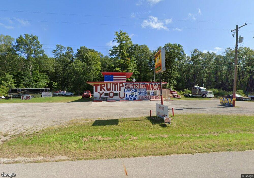
7070 U S 10 Township of Branch, MI 49402
Estimated Value: $141,083
--
Bed
--
Bath
1,500
Sq Ft
$94/Sq Ft
Est. Value
About This Home
This home is located at 7070 U S 10, Township of Branch, MI 49402 and is currently estimated at $141,083, approximately $94 per square foot. 7070 U S 10 is a home located in Mason County with nearby schools including Scottville Elementary School, Mason County Central Upper Elementary School, and Mason County Central Middle School.
Ownership History
Date
Name
Owned For
Owner Type
Purchase Details
Closed on
Oct 12, 2020
Sold by
Countryside Diner Llc
Bought by
Rieli Stephen
Current Estimated Value
Purchase Details
Closed on
Apr 29, 2016
Sold by
Empire Scott A
Bought by
Countryside Diner Llc
Purchase Details
Closed on
Aug 18, 2011
Sold by
Knapp Mary L and Huddlestun Amy L
Bought by
Empie Scott and Empie Ardith
Purchase Details
Closed on
May 1, 2001
Create a Home Valuation Report for This Property
The Home Valuation Report is an in-depth analysis detailing your home's value as well as a comparison with similar homes in the area
Home Values in the Area
Average Home Value in this Area
Purchase History
| Date | Buyer | Sale Price | Title Company |
|---|---|---|---|
| Rieli Stephen | $99,000 | Western Land Title Agency Ll | |
| Countryside Diner Llc | $50,000 | Lighthouse Title Inc | |
| Empie Scott | -- | Lighthouse Title Inc | |
| -- | $72,000 | -- |
Source: Public Records
Mortgage History
| Date | Status | Borrower | Loan Amount |
|---|---|---|---|
| Closed | Countryside Diner Llc | $0 |
Source: Public Records
Tax History Compared to Growth
Tax History
| Year | Tax Paid | Tax Assessment Tax Assessment Total Assessment is a certain percentage of the fair market value that is determined by local assessors to be the total taxable value of land and additions on the property. | Land | Improvement |
|---|---|---|---|---|
| 2025 | $1,120 | $27,100 | $16,200 | $10,900 |
| 2024 | -- | $25,200 | $12,900 | $12,300 |
| 2023 | -- | $23,500 | $8,900 | $14,600 |
| 2022 | -- | $24,300 | $0 | $0 |
| 2021 | -- | $23,800 | $0 | $0 |
| 2020 | -- | -- | $0 | $0 |
| 2019 | -- | -- | $0 | $0 |
| 2018 | -- | -- | $0 | $0 |
| 2017 | -- | -- | $0 | $0 |
| 2016 | -- | -- | $0 | $0 |
| 2015 | -- | -- | $0 | $0 |
| 2013 | -- | -- | $0 | $0 |
Source: Public Records
Map
Nearby Homes
- 9554 Highway 10 NW
- 7100 Wever Rd
- 28 N Jack Pine Rd
- 125 S Maple Rd
- 161 N Jackpine Rd
- 73 S Maple Rd
- 105 S Emerson Lake Rd
- 270 N Jack Pine Rd
- 395 N Campbell Rd
- 00 Unit N. Benson Road
- 7832 E Us Highway 10
- 193 S Emerson Dr
- 67 S Emerson Dr
- 520 N Campbell Rd
- 441 N Benson Rd
- 930 N Benson Rd
- 8570 U S 10
- 6105 U S 10
- 5535 E Pleasant View Trail
- 5535 E Pleasant View Trail
- 7070 E Us Highway 10
- 6457 U S 10
- 11971 U S 10
- 0 U S 10
- 8581 U S 10
- 8813 U S 10
- 7535 U S 10
- 7537 U S 10
- 261 S Campbell Rd
- 7052 E Us Highway 10
- 7052 E Us Highway 10
- 7115 Catherine Ave
- 7121 Catherine Ave
- 7137 Catherine Ave
- 7137 Catherine Ave
- 7011 Highway 10 NW
- 7060 E First St
- 7106 E First St
- 0 E Catherine Rd Unit M21104059
- 0 E Catherine Rd Unit 67021104059
