Estimated Value: $437,000 - $541,000
4
Beds
2
Baths
2,290
Sq Ft
$218/Sq Ft
Est. Value
About This Home
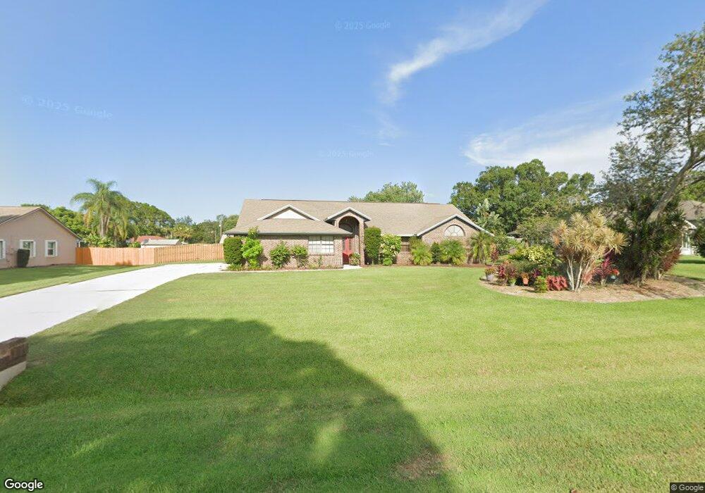
This home is located at 7075 Hundred Acre Dr, Cocoa, FL 32927 and is currently estimated at $500,038, approximately $218 per square foot. 7075 Hundred Acre Dr is a home located in Brevard County with nearby schools including Enterprise Elementary School, Space Coast Junior/Senior High School, and Sculptor Charter School.
Ownership History
Date
Name
Owned For
Owner Type
Purchase Details
Closed on
Feb 25, 1994
Sold by
Jackson Denis A and Jackson Maryann
Bought by
Merritt Richard E and Merritt Sonya D
Current Estimated Value
Home Financials for this Owner
Home Financials are based on the most recent Mortgage that was taken out on this home.
Original Mortgage
$100,000
Interest Rate
7.02%
Purchase Details
Closed on
Aug 27, 1990
Sold by
Romar Homes Inc
Bought by
Jackson Denis A and Jackson Mary Ann
Create a Home Valuation Report for This Property
The Home Valuation Report is an in-depth analysis detailing your home's value as well as a comparison with similar homes in the area
Home Values in the Area
Average Home Value in this Area
Purchase History
| Date | Buyer | Sale Price | Title Company |
|---|---|---|---|
| Merritt Richard E | $134,000 | -- | |
| Jackson Denis A | -- | -- |
Source: Public Records
Mortgage History
| Date | Status | Borrower | Loan Amount |
|---|---|---|---|
| Closed | Merritt Richard E | $100,000 |
Source: Public Records
Tax History
| Year | Tax Paid | Tax Assessment Tax Assessment Total Assessment is a certain percentage of the fair market value that is determined by local assessors to be the total taxable value of land and additions on the property. | Land | Improvement |
|---|---|---|---|---|
| 2025 | $2,566 | $187,830 | -- | -- |
| 2024 | $2,521 | $182,540 | -- | -- |
| 2023 | $2,521 | $177,230 | $0 | $0 |
| 2022 | $2,363 | $172,070 | $0 | $0 |
| 2021 | $2,399 | $167,060 | $0 | $0 |
| 2020 | $2,319 | $164,760 | $0 | $0 |
| 2019 | $2,263 | $161,060 | $0 | $0 |
| 2018 | $2,266 | $158,060 | $0 | $0 |
| 2017 | $2,278 | $154,810 | $0 | $0 |
| 2016 | $2,304 | $151,630 | $32,000 | $119,630 |
| 2015 | $2,359 | $150,580 | $32,000 | $118,580 |
| 2014 | $2,370 | $149,390 | $32,000 | $117,390 |
Source: Public Records
Map
Nearby Homes
- 7065 Hundred Acre Dr
- 6990 Bryant Rd
- 5555 Brandon St
- 6815 Bryant Rd
- 7230 Venus Ave
- 5165 Patricia St
- 7200 Oakwood Ave
- 5155 Mayflower St
- 6760 Cairo Rd
- 6615 Dock Ave
- 7635 Fringe Place
- 5075 Carter St
- 5080 Mayflower St
- 6581 Bancroft Ave
- TBD Freeport Rd
- 5200 Frisco St
- 7545 Fringe Place
- 5150 Melody St
- 5740 Friendly St
- 7419 Hackberry Rd
- 7085 Hundred Acre Dr
- 6950 Kaylor Ave
- 6940 Kaylor Ave
- 7045 Hundred Acre Dr
- 6960 Kaylor Ave
- 7070 Hundred Acre Dr
- 6930 Kaylor Ave
- 7080 Hundred Acre Dr
- 7060 Hundred Acre Dr
- 6970 Kaylor Ave
- 6920 Kaylor Ave
- 7090 Hundred Acre Dr
- 7105 Hundred Acre Dr
- 7035 Hundred Acre Dr
- 7050 Hundred Acre Dr
- 6980 Kaylor Ave
- 6985 Pluto Ave
- 6965 Pluto Ave
- 6910 Kaylor Ave
- 7100 Hundred Acre Dr
Your Personal Tour Guide
Ask me questions while you tour the home.