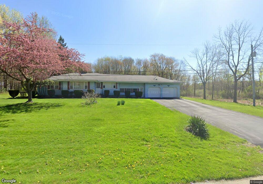
7076 Phillips Rice Rd Cortland, OH 44410
Estimated Value: $169,000 - $232,000
4
Beds
2
Baths
1,236
Sq Ft
$164/Sq Ft
Est. Value
About This Home
This home is located at 7076 Phillips Rice Rd, Cortland, OH 44410 and is currently estimated at $202,960, approximately $164 per square foot. 7076 Phillips Rice Rd is a home located in Trumbull County with nearby schools including Maplewood Middle School, Maplewood Elementary School, and Maplewood High School.
Ownership History
Date
Name
Owned For
Owner Type
Purchase Details
Closed on
Mar 8, 2005
Sold by
Davis Barbara E
Bought by
Davis Barbara E
Current Estimated Value
Purchase Details
Closed on
Feb 16, 1999
Sold by
Bowser Herbert and Bowser Herbert W
Bought by
Brainard Timothy R and Brainard Barbara E
Home Financials for this Owner
Home Financials are based on the most recent Mortgage that was taken out on this home.
Original Mortgage
$84,150
Interest Rate
6.88%
Purchase Details
Closed on
Jan 1, 1990
Bought by
Herbert Bowser
Create a Home Valuation Report for This Property
The Home Valuation Report is an in-depth analysis detailing your home's value as well as a comparison with similar homes in the area
Home Values in the Area
Average Home Value in this Area
Purchase History
| Date | Buyer | Sale Price | Title Company |
|---|---|---|---|
| Davis Barbara E | -- | -- | |
| Brainard Timothy R | $99,000 | -- | |
| Herbert Bowser | -- | -- |
Source: Public Records
Mortgage History
| Date | Status | Borrower | Loan Amount |
|---|---|---|---|
| Previous Owner | Brainard Timothy R | $84,150 |
Source: Public Records
Tax History Compared to Growth
Tax History
| Year | Tax Paid | Tax Assessment Tax Assessment Total Assessment is a certain percentage of the fair market value that is determined by local assessors to be the total taxable value of land and additions on the property. | Land | Improvement |
|---|---|---|---|---|
| 2024 | $2,278 | $59,190 | $5,150 | $54,040 |
| 2023 | $2,278 | $59,190 | $5,150 | $54,040 |
| 2022 | $1,784 | $41,200 | $4,730 | $36,470 |
| 2021 | $1,881 | $41,200 | $4,730 | $36,470 |
| 2020 | $1,841 | $41,200 | $4,730 | $36,470 |
| 2019 | $1,760 | $37,530 | $4,380 | $33,150 |
| 2018 | $1,749 | $37,530 | $4,380 | $33,150 |
| 2017 | $1,744 | $37,530 | $4,380 | $33,150 |
| 2016 | $1,611 | $34,730 | $3,960 | $30,770 |
| 2015 | $1,562 | $34,730 | $3,960 | $30,770 |
| 2014 | $1,557 | $34,730 | $3,960 | $30,770 |
| 2013 | $1,596 | $34,730 | $3,960 | $30,770 |
Source: Public Records
Map
Nearby Homes
- 6555 Love Warner Rd
- 6247 Love Warner Rd
- 2684 Griffith Dr
- 8441 State Route 46
- 5953 Warren Rd
- 6277 Youngstown Kingsville Rd
- 6990 Morrell Ray Rd
- 4366 Greenville Rd
- 6148 Youngstown Kingsville Rd
- 6498 Stoddard Hayes Rd
- 5294 Cottage Dr
- 8875 Church St
- 121 Fairway Dr
- 5626 Stoddard Hayes Rd
- 507 Tournament Trail
- 884 Housel Craft Rd
- 400 Tournament Trail Unit 400
- 5961 Sodom Hutchings Rd
- 428 Cherry Hill Ln
- 525 Sycamore Trail
- 7119 Phillips Rice Rd
- 7083 Phillips Rice Rd
- 7129 Phillips Rice Rd
- 7139 Phillips Rice Rd
- 7161 Phillips Rice Rd
- 7186 Phillips Rice Rd
- 7197 Phillips Rice Rd
- 7202 Phillips Rice Rd
- 7235 Phillips Rice Rd
- 7300 Phillips Rice Rd
- 2686 Mahan Denman Rd
- 2625 Mahan Denman Rd
- 6868 Phillips Rice Rd
- 2530 Mahan Denman Rd
- 7164 State Route 46 Unit B
- 7164 State Route 46
- 2750 Mahan Denman Rd
- 2581 Mahan Denman Rd
- 2516 Mahan Denman Rd
- 2575 Mahan Denman Rd