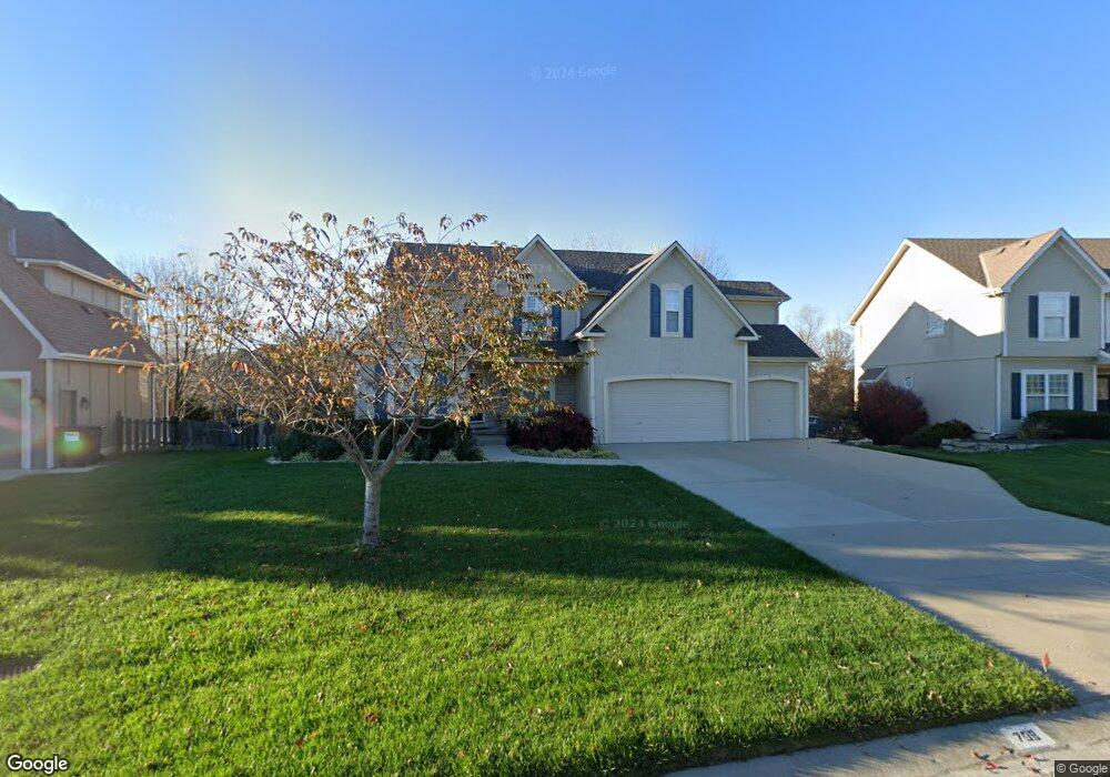
708 Canyon View Dr Lansing, KS 66043
Estimated Value: $434,000 - $460,000
4
Beds
5
Baths
2,544
Sq Ft
$174/Sq Ft
Est. Value
About This Home
This home is located at 708 Canyon View Dr, Lansing, KS 66043 and is currently estimated at $442,581, approximately $173 per square foot. 708 Canyon View Dr is a home located in Leavenworth County with nearby schools including Lansing Elementary School, Lansing Middle 6-8, and Lansing High 9-12.
Ownership History
Date
Name
Owned For
Owner Type
Purchase Details
Closed on
Mar 1, 2002
Bought by
Phillips Family Wealth
Current Estimated Value
Home Financials for this Owner
Home Financials are based on the most recent Mortgage that was taken out on this home.
Original Mortgage
$237,950
Outstanding Balance
$97,578
Interest Rate
6.8%
Mortgage Type
New Conventional
Estimated Equity
$345,003
Create a Home Valuation Report for This Property
The Home Valuation Report is an in-depth analysis detailing your home's value as well as a comparison with similar homes in the area
Home Values in the Area
Average Home Value in this Area
Purchase History
| Date | Buyer | Sale Price | Title Company |
|---|---|---|---|
| Phillips Family Wealth | $295,000 | -- |
Source: Public Records
Mortgage History
| Date | Status | Borrower | Loan Amount |
|---|---|---|---|
| Open | Phillips Family Wealth | $237,950 | |
| Closed | Phillips Family Wealth | $250,000 |
Source: Public Records
Tax History Compared to Growth
Tax History
| Year | Tax Paid | Tax Assessment Tax Assessment Total Assessment is a certain percentage of the fair market value that is determined by local assessors to be the total taxable value of land and additions on the property. | Land | Improvement |
|---|---|---|---|---|
| 2025 | $6,670 | $49,174 | $6,461 | $42,713 |
| 2024 | $6,166 | $49,174 | $6,461 | $42,713 |
| 2023 | $6,166 | $47,242 | $6,461 | $40,781 |
| 2022 | $6,076 | $43,999 | $5,431 | $38,568 |
| 2021 | $5,651 | $39,150 | $5,431 | $33,719 |
| 2020 | $5,393 | $36,777 | $5,431 | $31,346 |
| 2019 | $5,096 | $34,718 | $5,431 | $29,287 |
| 2018 | $5,030 | $34,287 | $5,431 | $28,856 |
| 2017 | $5,041 | $34,287 | $5,431 | $28,856 |
| 2016 | $5,044 | $34,287 | $5,431 | $28,856 |
| 2015 | $5,029 | $34,287 | $5,431 | $28,856 |
| 2014 | $4,926 | $34,287 | $5,431 | $28,856 |
Source: Public Records
Map
Nearby Homes
- 875 Clearview Dr
- 866 Clearview Dr
- 1322 Rock Creek Ct
- 833 Rock Creek Dr
- 1221 S Desoto Rd
- 922 Southfork St
- 811 4-H Rd
- 000 4-H Rd
- 24431 139th St
- 13965 Mc Intyre Rd
- 13788 McIntyre1 Rd
- 13788 Mcintyre Rd
- 13788 McIntyre2 Rd
- 527 S Valley Dr
- 401 W Olive St
- 104 Olive St
- 522 Forestglen Ln
- 202 S Main St
- 124 S Main St
- 546 Hithergreen Dr
- 706 Canyon View Dr
- 710 Canyon View Dr
- 712 Canyon View Dr
- 871 Clearview Dr
- 879 Clearview Dr
- 704 Canyon View Dr
- 867 Clearview Dr
- 707 Canyon View Dr
- 883 Clearview Dr
- 1398 Canyon Ln
- 714 Canyon View Dr
- 703 Canyon View Dr
- 863 Clearview Dr
- 709 Canyon View Dr
- 701 Canyon View Dr
- 859 Clearview Dr
- 1313 Summit Ln
- 1313 Summit Ln
- 711 Canyon View Dr
- 718 Canyon View Dr