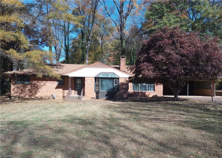
708 Rockspring Rd High Point, NC 27262
Greater High Point NeighborhoodEstimated payment $902/month
Highlights
- No HOA
- Attached Carport
- Forced Air Heating and Cooling System
About This Home
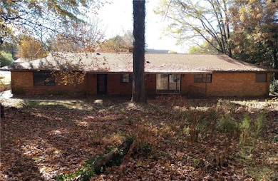
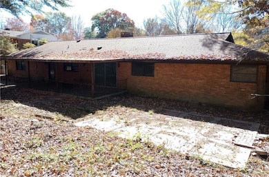
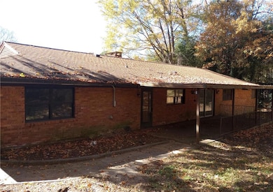
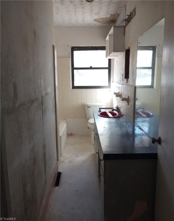
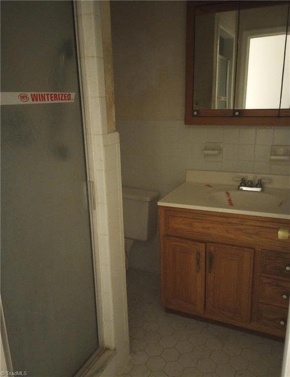
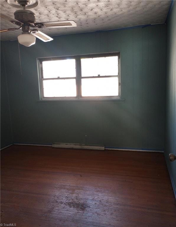
FHA Case #387-050506. 3 bedroom 2 bathroom home. Equal Housing Opportunity. Eligible for FHA Financing as IE (Insured Escrow). Within the first 10 days Eligible Bidders are Owner Occupants, Nonprofits, Government Agencies only. The Next Bid Period is open to All Bidders. Subject to Appraisal. HUD-acquired properties are sold AS-IS without warranties or repairs. Bids submitted by active HUD Registered Agents/Agencies only. Availability of home subject to Asset Manager accepting a bid from an earlier bid period or removing home from the market. (See Agent Remarks). Visit Hudhomestore.gov for FHA Insurability Code, and online bidding. Look under the Addendums Tab for the Property Condition Report, Lead Based Paint, Property Listing Disclosure, Closing FAQs, E-Signature Guide, and the Environmental Compliance record. All info believed accurate, but must be verified by buyer.
Home Details
Home Type
- Single Family
Est. Annual Taxes
- $2,487
Year Built
- Built in 1956
Lot Details
- 0.43 Acre Lot
- Property is zoned RS9
Parking
- 1 Car Garage
- Attached Carport
Home Design
- Brick Exterior Construction
Interior Spaces
- 1,849 Sq Ft Home
- Property has 1 Level
- Living Room with Fireplace
- Crawl Space
Bedrooms and Bathrooms
- 3 Bedrooms
- 2 Full Bathrooms
Utilities
- Forced Air Heating and Cooling System
- Heating System Uses Natural Gas
- Gas Water Heater
Community Details
- No Home Owners Association
Listing and Financial Details
- Assessor Parcel Number 0194360
- 1% Total Tax Rate
Map
Home Values in the Area
Average Home Value in this Area
Tax History
| Year | Tax Paid | Tax Assessment Tax Assessment Total Assessment is a certain percentage of the fair market value that is determined by local assessors to be the total taxable value of land and additions on the property. | Land | Improvement |
|---|---|---|---|---|
| 2025 | $1,244 | $180,500 | $38,000 | $142,500 |
| 2024 | $1,244 | $180,500 | $38,000 | $142,500 |
| 2023 | $1,244 | $180,500 | $38,000 | $142,500 |
| 2022 | $1,217 | $180,500 | $38,000 | $142,500 |
| 2021 | $1,022 | $148,400 | $25,000 | $123,400 |
| 2020 | $1,022 | $148,400 | $25,000 | $123,400 |
| 2019 | $1,022 | $148,400 | $0 | $0 |
| 2018 | $1,017 | $148,400 | $0 | $0 |
| 2017 | $1,022 | $148,400 | $0 | $0 |
| 2016 | $966 | $137,800 | $0 | $0 |
| 2015 | $971 | $137,800 | $0 | $0 |
| 2014 | $1,976 | $137,800 | $0 | $0 |
Property History
| Date | Event | Price | List to Sale | Price per Sq Ft |
|---|---|---|---|---|
| 12/15/2025 12/15/25 | Pending | -- | -- | -- |
| 12/05/2025 12/05/25 | For Sale | $135,000 | -- | $73 / Sq Ft |
Purchase History
| Date | Type | Sale Price | Title Company |
|---|---|---|---|
| Trustee Deed | $242,317 | None Listed On Document | |
| Warranty Deed | -- | -- | |
| Warranty Deed | -- | -- | |
| Warranty Deed | $75,000 | -- |
Source: Triad MLS
MLS Number: 1203856
APN: 0194360
Disclaimer: Certain information contained herein is derived from information provided by parties other than Homes.com. All information provided is deemed reliable, but is not guaranteed to be accurate and should be independently verified.
![]() Copyright 2026 Triad MLS, Inc. All rights reserved. IDX information is provided exclusively for personal, non-commercial use, and may not be used for any purpose other than to identify prospective properties consumers may be interested in purchasing. Information is deemed reliable but not guaranteed. This site will be monitored for ‘scraping’ and any use of search facilities of data on the site other than by potential buyers/sellers is prohibited. All Sale data is for informational purposes only and is not an indication of a market analysis or appraisal. Properties marked with the Triad MLS, Inc. icon are provided courtesy of the Triad MLS, Inc.’s, Internet Data Exchange Database.
Copyright 2026 Triad MLS, Inc. All rights reserved. IDX information is provided exclusively for personal, non-commercial use, and may not be used for any purpose other than to identify prospective properties consumers may be interested in purchasing. Information is deemed reliable but not guaranteed. This site will be monitored for ‘scraping’ and any use of search facilities of data on the site other than by potential buyers/sellers is prohibited. All Sale data is for informational purposes only and is not an indication of a market analysis or appraisal. Properties marked with the Triad MLS, Inc. icon are provided courtesy of the Triad MLS, Inc.’s, Internet Data Exchange Database.
- 607 Rockspring Rd
- 914 Flicker Ln
- 443 W Lexington Ave
- 1001 Nuthatch Ct
- 1508 Wendover Dr
- 900 W Lexington Ave
- 1101 Robin Hood Rd
- 417 Hillcrest Dr
- 427 Woodbrook Dr
- 1311 Prescott Place
- 416 Greenwood Dr
- 1616 Heathcliff Rd
- 1700 Long St
- 510 Otteray Ave
- 506 Greenwood Dr
- 510 Greenwood Dr
- 207 Hillcrest Dr
- 630 Colonial Dr
- 1312 Gilbrook Ct
- 1283 Westminster Dr

Ask me questions while you tour the home.