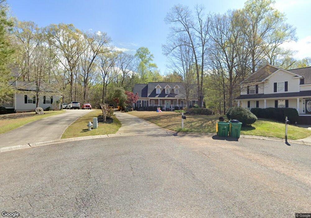
708 Sable Trace Ridge Acworth, GA 30102
Oak Grove NeighborhoodEstimated Value: $490,000 - $517,268
5
Beds
4
Baths
4,290
Sq Ft
$117/Sq Ft
Est. Value
About This Home
This home is located at 708 Sable Trace Ridge, Acworth, GA 30102 and is currently estimated at $503,634, approximately $117 per square foot. 708 Sable Trace Ridge is a home located in Cherokee County with nearby schools including Oak Grove Elementary School, E. T. Booth Middle School, and Etowah High School.
Ownership History
Date
Name
Owned For
Owner Type
Purchase Details
Closed on
Apr 30, 2021
Sold by
Whitlow Thomas Alan
Bought by
Us Property Grp Llc
Current Estimated Value
Home Financials for this Owner
Home Financials are based on the most recent Mortgage that was taken out on this home.
Original Mortgage
$426,550
Outstanding Balance
$384,913
Interest Rate
3.1%
Mortgage Type
New Conventional
Estimated Equity
$118,721
Purchase Details
Closed on
Aug 7, 2015
Sold by
Grimsley Diane T
Bought by
Whitlow Thomas Alan and Whitlow Laura Button
Purchase Details
Closed on
Jun 26, 2003
Sold by
Ware Ben L
Bought by
Grimsley Roy A and Grimsley Diane
Home Financials for this Owner
Home Financials are based on the most recent Mortgage that was taken out on this home.
Original Mortgage
$180,000
Interest Rate
5.16%
Mortgage Type
New Conventional
Create a Home Valuation Report for This Property
The Home Valuation Report is an in-depth analysis detailing your home's value as well as a comparison with similar homes in the area
Home Values in the Area
Average Home Value in this Area
Purchase History
| Date | Buyer | Sale Price | Title Company |
|---|---|---|---|
| Us Property Grp Llc | $330,000 | -- | |
| Story Jennifer L | $449,000 | -- | |
| Whitlow Thomas Alan | $305,000 | -- | |
| Grimsley Roy A | $252,300 | -- |
Source: Public Records
Mortgage History
| Date | Status | Borrower | Loan Amount |
|---|---|---|---|
| Open | Story Jennifer L | $426,550 | |
| Closed | Us Property Grp Llc | $426,550 | |
| Previous Owner | Grimsley Roy A | $180,000 |
Source: Public Records
Tax History
| Year | Tax Paid | Tax Assessment Tax Assessment Total Assessment is a certain percentage of the fair market value that is determined by local assessors to be the total taxable value of land and additions on the property. | Land | Improvement |
|---|---|---|---|---|
| 2025 | $5,594 | $218,400 | $34,000 | $184,400 |
| 2024 | $5,563 | $219,600 | $34,000 | $185,600 |
| 2023 | $6,132 | $235,960 | $34,000 | $201,960 |
| 2022 | $4,720 | $179,600 | $31,679 | $147,921 |
| 2021 | $4,950 | $174,360 | $24,000 | $150,360 |
| 2020 | $2,543 | $163,200 | $22,000 | $141,200 |
| 2019 | $4,524 | $159,200 | $22,000 | $137,200 |
| 2018 | $4,098 | $143,360 | $19,200 | $124,160 |
| 2017 | $3,552 | $353,300 | $19,200 | $122,120 |
| 2016 | $3,552 | $305,000 | $19,200 | $102,800 |
| 2015 | $3,250 | $276,400 | $15,200 | $95,360 |
| 2014 | $3,224 | $273,600 | $13,000 | $96,440 |
Source: Public Records
Map
Nearby Homes
- 736 Coventry Cove Way
- 740 Coventry Cove Way
- 744 Coventry Cove Way
- 748 Coventry Cove Way
- 752 Coventry Cove Way
- 3106 Cambridge Mill St
- 756 Coventry Cove Way
- 307 Queensbury Walk
- 321 Brighton Bend Ln
- 3102 Cambridge Mill St
- 325 Brighton Bend Ln
- 333 Brighton Bend Ln
- 337 Brighton Bend Ln
- 341 Brighton Bend Ln
- 1037 Queensbury Run
- 1030 Queensbury Run Unit 1
- 204 Queensbury Ct
- 6390 Woodstock Rd
- 170 Sable Trace Trail
- 585 Lee Dr
- 708 Sable Trace Ridge
- 706 Sable Trace Ridge
- 707 Sable Trace Ridge
- 704 Sable Trace Ridge
- 705 Sable Trace Ridge
- 703 Sable Trace Ridge
- 103 Sable Trace Trail
- 101 Sable Trace Trail
- 702 Sable Trace Ridge Unit 111
- 702 Sable Trace Ridge
- 603 Sable Trace Run
- 101 Sable Trace Tl
- 605 Sable Trace Run
- 113 Sable Trace Trail
- 701 Sable Trace Ridge
- 111 Sable Trace Trail
- 602 Sable Trace Run
- 117 Sable Trace Trail
- 105 Sable Trace Trail
- 109 Sable Trace Trail
Your Personal Tour Guide
Ask me questions while you tour the home.