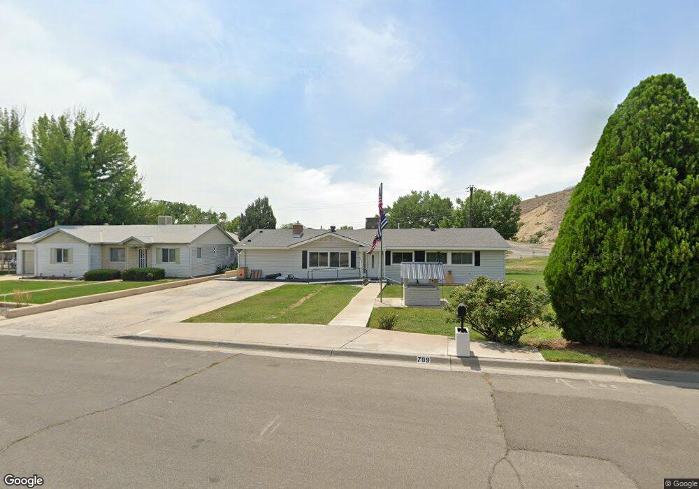
709 Ashurst Dr Farmington, NM 87401
Estimated Value: $203,000 - $291,000
--
Bed
--
Bath
2,137
Sq Ft
$119/Sq Ft
Est. Value
About This Home
This home is located at 709 Ashurst Dr, Farmington, NM 87401 and is currently estimated at $253,636, approximately $118 per square foot. 709 Ashurst Dr is a home located in San Juan County with nearby schools including Apache Elementary School, Tibbetts Middle School, and Farmington High School.
Ownership History
Date
Name
Owned For
Owner Type
Purchase Details
Closed on
Jun 10, 2025
Sold by
Haynie Louis C and Haynie Jennie Kay
Bought by
Haynie Kimberly A and Freestone Jason
Current Estimated Value
Home Financials for this Owner
Home Financials are based on the most recent Mortgage that was taken out on this home.
Original Mortgage
$8,575
Outstanding Balance
$6,053
Interest Rate
6.76%
Mortgage Type
New Conventional
Estimated Equity
$247,583
Create a Home Valuation Report for This Property
The Home Valuation Report is an in-depth analysis detailing your home's value as well as a comparison with similar homes in the area
Home Values in the Area
Average Home Value in this Area
Purchase History
| Date | Buyer | Sale Price | Title Company |
|---|---|---|---|
| Haynie Kimberly A | -- | San Juan County Abstract & Tit |
Source: Public Records
Mortgage History
| Date | Status | Borrower | Loan Amount |
|---|---|---|---|
| Open | Haynie Kimberly A | $8,575 | |
| Open | Haynie Kimberly A | $235,042 |
Source: Public Records
Tax History Compared to Growth
Tax History
| Year | Tax Paid | Tax Assessment Tax Assessment Total Assessment is a certain percentage of the fair market value that is determined by local assessors to be the total taxable value of land and additions on the property. | Land | Improvement |
|---|---|---|---|---|
| 2024 | $1,285 | $54,038 | $0 | $0 |
| 2023 | $1,285 | $52,464 | $0 | $0 |
| 2022 | $1,225 | $50,936 | $0 | $0 |
| 2021 | $1,188 | $49,818 | $0 | $0 |
| 2020 | $1,191 | $50,060 | $0 | $0 |
| 2019 | $1,183 | $50,013 | $0 | $0 |
| 2018 | $1,107 | $46,217 | $0 | $0 |
| 2017 | $1,060 | $44,871 | $0 | $0 |
| 2016 | $1,025 | $43,564 | $0 | $0 |
| 2015 | $1,007 | $43,564 | $0 | $0 |
| 2014 | $928 | $41,063 | $0 | $0 |
Source: Public Records
Map
Nearby Homes
- 636 Ridge Lea Ct
- 1805 Brenwood Dr
- 1011 N Auburn Ave
- XX Brookside Dr
- 1013 N Orchard Dr
- 195 McDonald Rd
- 212 W Sunset Place
- 2412 Pheasant Place
- LOT 4 XX W 24th St
- XX W Apache St
- 414 W Comanche St
- 621 W Apache St
- 707 W Apache St
- 2413 N Municipal Dr
- 1108 N Dustin Ave
- 511 N Behrend Ave
- 200 W 24th St
- 212 W 25th St
- 602 N Orchard Ave Unit A - F
- 712 N Dustin Ave
- 707 Ashurst Dr
- 1301 Mossey Cup Dr
- 704 Ashurst Dr
- 707 W Boyd Dr
- 711 W Boyd Dr
- 1218 Mossey Cup Dr
- 707 W Gladden Dr
- 700 Ashurst Dr
- 1216 Mossey Cup Dr
- 701 W Boyd Dr
- 705 W Gladden Dr
- 702 Ashurst Dr
- 1214 Mossey Cup Dr
- 1306 Mossey Cup Dr
- 708 W Boyd Dr
- 710 W Boyd Dr
- 706 W Boyd Dr
- 620 Ashurst Dr
- 619 Ashurst Dr
- 1402 1/2 Mossey Cup Dr