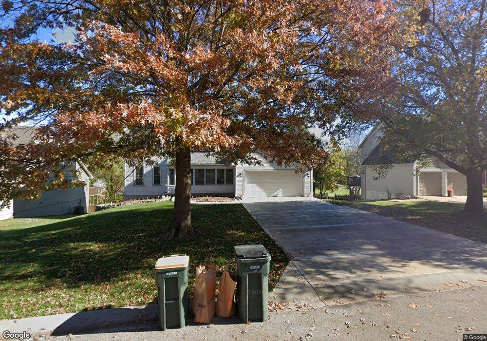
709 Bittersweet Rd Lansing, KS 66043
Estimated Value: $337,000 - $384,000
4
Beds
4
Baths
1,956
Sq Ft
$183/Sq Ft
Est. Value
About This Home
This home is located at 709 Bittersweet Rd, Lansing, KS 66043 and is currently estimated at $357,303, approximately $182 per square foot. 709 Bittersweet Rd is a home located in Leavenworth County with nearby schools including Lansing Elementary School, Lansing Middle 6-8, and Lansing High 9-12.
Ownership History
Date
Name
Owned For
Owner Type
Purchase Details
Closed on
Mar 27, 2009
Sold by
Diamond Jerry W and Diamond Victoria
Bought by
Dlugopolski Michael and Dlugopolski Pamela D
Current Estimated Value
Home Financials for this Owner
Home Financials are based on the most recent Mortgage that was taken out on this home.
Original Mortgage
$224,677
Interest Rate
3.6%
Mortgage Type
VA
Create a Home Valuation Report for This Property
The Home Valuation Report is an in-depth analysis detailing your home's value as well as a comparison with similar homes in the area
Home Values in the Area
Average Home Value in this Area
Purchase History
| Date | Buyer | Sale Price | Title Company |
|---|---|---|---|
| Dlugopolski Michael | $220,183 | Tri-County Title & Abstract Ll |
Source: Public Records
Mortgage History
| Date | Status | Borrower | Loan Amount |
|---|---|---|---|
| Previous Owner | Dlugopolski Michael | $224,677 |
Source: Public Records
Tax History
| Year | Tax Paid | Tax Assessment Tax Assessment Total Assessment is a certain percentage of the fair market value that is determined by local assessors to be the total taxable value of land and additions on the property. | Land | Improvement |
|---|---|---|---|---|
| 2025 | $4,748 | $39,707 | $5,520 | $34,187 |
| 2024 | $4,748 | $38,180 | $4,370 | $33,810 |
| 2023 | $4,748 | $36,546 | $4,370 | $32,176 |
| 2022 | $4,280 | $33,224 | $3,340 | $29,884 |
| 2021 | $4,280 | $29,728 | $3,340 | $26,388 |
| 2020 | $4,147 | $28,348 | $3,340 | $25,008 |
| 2019 | $4,055 | $27,692 | $3,340 | $24,352 |
| 2018 | $3,701 | $25,312 | $2,760 | $22,552 |
| 2017 | $3,573 | $24,392 | $2,760 | $21,632 |
| 2016 | $3,469 | $23,679 | $2,760 | $20,919 |
| 2015 | $3,459 | $23,679 | $2,760 | $20,919 |
| 2014 | $3,244 | $22,690 | $2,760 | $19,930 |
Source: Public Records
Map
Nearby Homes
- 922 Southfork St
- 811 4-H Rd
- 503 S 1st St
- 202 S Main St
- 124 S Main St
- 111 Southfork Rd
- 26731 147th St
- 215 E Mary St
- 20958 Ida St
- 218 E Kay St
- 875 Clearview Dr
- 189 Canyon View Dr
- 1221 S Desoto Rd
- 1322 Rock Creek Ct
- 712 Rock Creek Dr
- 898 Clearview Dr
- 1313 Stone Ln
- 00000 Brookwood St
- 530 Holiday Ct
- 950 Holiday Dr
- 705 S Bittersweet Ct
- 711 Bittersweet Rd
- 705 Bittersweet Rd
- 329 Maple Ln
- 701 Bittersweet Rd
- 712 Bittersweet Rd
- 706 Bittersweet Rd
- 715 Bittersweet Rd
- 327 Maple Ln
- 700 Bittersweet Rd
- 831 Blueberry St
- 325 Maple Ln
- 625 Bittersweet Rd
- 625 S Bittersweet Ln
- 718 Bittersweet Rd
- 718 S Bittersweet Ct
- 722 Bittersweet Rd
- 00000 Maple Ln
- 829 Blueberry St
- 624 Bittersweet Rd
Your Personal Tour Guide
Ask me questions while you tour the home.