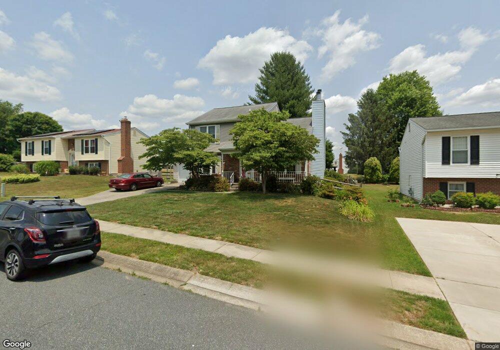
709 Deep Ridge Rd Bel Air, MD 21014
Estimated Value: $449,922 - $524,000
--
Bed
3
Baths
1,858
Sq Ft
$260/Sq Ft
Est. Value
About This Home
This home is located at 709 Deep Ridge Rd, Bel Air, MD 21014 and is currently estimated at $483,481, approximately $260 per square foot. 709 Deep Ridge Rd is a home located in Harford County with nearby schools including Homestead-Wakefield Elementary School, Bel Air Middle School, and Bel Air High School.
Ownership History
Date
Name
Owned For
Owner Type
Purchase Details
Closed on
Jun 30, 1986
Sold by
Security Management Corporation
Bought by
Cedrone Daniel C and Cedrone Kathleen
Current Estimated Value
Home Financials for this Owner
Home Financials are based on the most recent Mortgage that was taken out on this home.
Original Mortgage
$69,900
Interest Rate
10.62%
Create a Home Valuation Report for This Property
The Home Valuation Report is an in-depth analysis detailing your home's value as well as a comparison with similar homes in the area
Home Values in the Area
Average Home Value in this Area
Purchase History
| Date | Buyer | Sale Price | Title Company |
|---|---|---|---|
| Cedrone Daniel C | $90,200 | -- |
Source: Public Records
Mortgage History
| Date | Status | Borrower | Loan Amount |
|---|---|---|---|
| Closed | Cedrone Daniel C | $69,900 |
Source: Public Records
Tax History Compared to Growth
Tax History
| Year | Tax Paid | Tax Assessment Tax Assessment Total Assessment is a certain percentage of the fair market value that is determined by local assessors to be the total taxable value of land and additions on the property. | Land | Improvement |
|---|---|---|---|---|
| 2025 | $3,680 | $372,200 | $93,300 | $278,900 |
| 2024 | $3,680 | $349,800 | $0 | $0 |
| 2023 | $3,498 | $327,400 | $0 | $0 |
| 2022 | $3,324 | $305,000 | $93,300 | $211,700 |
| 2021 | $6,648 | $298,533 | $0 | $0 |
| 2020 | $3,370 | $292,067 | $0 | $0 |
| 2019 | $3,296 | $285,600 | $112,100 | $173,500 |
| 2018 | $3,231 | $282,567 | $0 | $0 |
| 2017 | $3,197 | $285,600 | $0 | $0 |
| 2016 | -- | $276,500 | $0 | $0 |
| 2015 | $3,083 | $274,200 | $0 | $0 |
| 2014 | $3,083 | $271,900 | $0 | $0 |
Source: Public Records
Map
Nearby Homes
- 1055 Sansa Ct
- 638 Iron Gate Rd
- 726 Iron Gate Rd
- 804 Grady Ct
- 600 Harvest Ct
- 515 W Ring Factory Rd
- 412 Viola Ct N
- 632 Camelot Dr
- 608 Squire Ln Unit B
- 606 Squire Ln Unit 606-A
- 601 Thames Way Unit E
- 0 Winter Park Rd
- 1504 Houndslow Ct
- 603 Bishop Ln
- 600 Squire Ln Unit 2J
- 3 Forest Dr
- 298 Canterbury Rd Unit 298-D
- 231 E Belcrest Rd
- 204 Chaucer Ln Unit D
- 204 Chaucer Ln Unit O
- 711 Deep Ridge Rd
- 707 Deep Ridge Rd
- 747 Danville Cir
- 749 Danville Cir
- 745 Danville Cir
- 713 Deep Ridge Rd
- 710 Deep Ridge Rd
- 708 Deep Ridge Rd
- 705 Deep Ridge Rd
- 715 Deep Ridge Rd
- 728 Fairwind Dr
- 712 Deep Ridge Rd
- 743 Danville Cir
- 706 Deep Ridge Rd
- 748 Danville Cir
- 726 Fairwind Dr
- 714 Deep Ridge Rd
- 746 Danville Cir
- 704 Deep Ridge Rd
- 703 Deep Ridge Rd