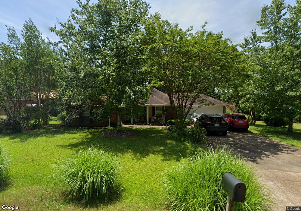
709 Deerfield Dr Oxford, MS 38655
Estimated Value: $289,000 - $358,000
3
Beds
2
Baths
1,500
Sq Ft
$212/Sq Ft
Est. Value
About This Home
This home is located at 709 Deerfield Dr, Oxford, MS 38655 and is currently estimated at $317,925, approximately $211 per square foot. 709 Deerfield Dr is a home located in Lafayette County with nearby schools including Lafayette Elementary School, Lafayette Upper Elementary School, and Lafayette Middle School.
Ownership History
Date
Name
Owned For
Owner Type
Purchase Details
Closed on
Jul 9, 2015
Sold by
Newsome Virginia Furr
Bought by
Furr Harrell Danny and Furr Harrell Virginia
Current Estimated Value
Home Financials for this Owner
Home Financials are based on the most recent Mortgage that was taken out on this home.
Original Mortgage
$95,000
Outstanding Balance
$35,132
Interest Rate
3.92%
Mortgage Type
New Conventional
Estimated Equity
$282,793
Purchase Details
Closed on
Jul 12, 2005
Sold by
Newsome David W
Bought by
Newsome Virginia Furr
Create a Home Valuation Report for This Property
The Home Valuation Report is an in-depth analysis detailing your home's value as well as a comparison with similar homes in the area
Purchase History
| Date | Buyer | Sale Price | Title Company |
|---|---|---|---|
| Furr Harrell Danny | -- | Oxford Title Llc | |
| Newsome Virginia Furr | -- | None Available |
Source: Public Records
Mortgage History
| Date | Status | Borrower | Loan Amount |
|---|---|---|---|
| Open | Furr Harrell Danny | $95,000 |
Source: Public Records
Tax History
| Year | Tax Paid | Tax Assessment Tax Assessment Total Assessment is a certain percentage of the fair market value that is determined by local assessors to be the total taxable value of land and additions on the property. | Land | Improvement |
|---|---|---|---|---|
| 2025 | $486 | $14,139 | $0 | $0 |
| 2024 | $486 | $12,202 | $0 | $0 |
| 2023 | $503 | $12,232 | $0 | $0 |
| 2022 | $484 | $12,232 | $0 | $0 |
| 2021 | $492 | $12,232 | $0 | $0 |
| 2020 | $481 | $12,037 | $0 | $0 |
| 2019 | $481 | $12,037 | $0 | $0 |
| 2018 | $483 | $12,037 | $0 | $0 |
| 2017 | $483 | $12,037 | $0 | $0 |
| 2016 | $428 | $11,570 | $0 | $0 |
| 2015 | $249 | $11,570 | $0 | $0 |
| 2014 | $220 | $11,570 | $0 | $0 |
Source: Public Records
Map
Nearby Homes
- 29 County Road 140
- 808 Deerfield Dr
- 3048 Oxford Way
- 3060 Oxford Way
- 1020 Scarlett Dr
- 607 Happy Ln
- 110 Heights Dr
- 1823 Atlanta Ave
- 1914 Mitchell Cove
- 1306 Midland Cove
- 632 Northwoods Trail
- 524 Shreve Oak Cir
- 624 Northwoods Trail
- 204 Town Center Dr
- 230 Town Center Dr
- 701 Ironwood Ln
- 723 Ironwood Ln
- 704 Savannah Dr
- 108 Cedar Hill Dr
- 406 O'Hara Dr
- 707 Deerfield Dr
- 711 Deerfield Dr
- 705 Deerfield Dr
- 28 County Road 140
- 710 Deerfield Dr
- 708 Deerfield Dr
- 0 Cr 140 (Levee Road)
- 712 Deerfield Dr
- 30 County Road 140
- 706 Deerfield Dr
- 801 Deerfield Dr
- 619 Huntington Place
- 617 Huntington Place
- 704 Deerfield Dr
- 703 Deerfield Dr
- 615 Huntington Place
- 800 Deerfield Dr
- 618 Huntington Place
- 620 Huntington Place
- 702 Deerfield Dr
Your Personal Tour Guide
Ask me questions while you tour the home.