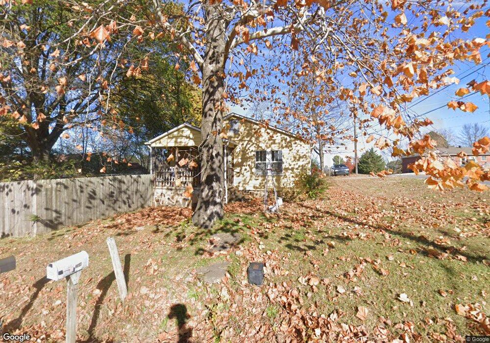
709 E Rock St Morrilton, AR 72110
Estimated Value: $72,675 - $132,000
Studio
1
Bath
979
Sq Ft
$105/Sq Ft
Est. Value
About This Home
This home is located at 709 E Rock St, Morrilton, AR 72110 and is currently estimated at $103,169, approximately $105 per square foot. 709 E Rock St is a home located in Conway County with nearby schools including Morrilton Primary School, Morrilton Elementary School, and Morrilton Intermediate School.
Ownership History
Date
Name
Owned For
Owner Type
Purchase Details
Closed on
May 22, 2006
Sold by
Kersten Paul Derek and Kersten Jessica
Bought by
Tanner Sherry
Current Estimated Value
Home Financials for this Owner
Home Financials are based on the most recent Mortgage that was taken out on this home.
Original Mortgage
$27,814
Interest Rate
6.5%
Purchase Details
Closed on
Apr 16, 2002
Bought by
Kersten Paul Derek
Purchase Details
Closed on
May 1, 1996
Bought by
Kersten Paul Dennis and Kersten Connie
Purchase Details
Closed on
Jan 1, 1984
Bought by
Kersten Kersten F and Kersten P
Create a Home Valuation Report for This Property
The Home Valuation Report is an in-depth analysis detailing your home's value as well as a comparison with similar homes in the area
Home Values in the Area
Average Home Value in this Area
Purchase History
| Date | Buyer | Sale Price | Title Company |
|---|---|---|---|
| Tanner Sherry | -- | -- | |
| Kersten Paul Derek | -- | -- | |
| Kersten Paul Dennis | -- | -- | |
| Kersten Kersten F | -- | -- |
Source: Public Records
Mortgage History
| Date | Status | Borrower | Loan Amount |
|---|---|---|---|
| Open | Kersten Kersten F | $39,635 | |
| Closed | Tanner Sherry | $27,814 |
Source: Public Records
Tax History
| Year | Tax Paid | Tax Assessment Tax Assessment Total Assessment is a certain percentage of the fair market value that is determined by local assessors to be the total taxable value of land and additions on the property. | Land | Improvement |
|---|---|---|---|---|
| 2025 | -- | $8,760 | $1,400 | $7,360 |
| 2024 | $18 | $8,760 | $1,400 | $7,360 |
| 2023 | $18 | $8,760 | $1,400 | $7,360 |
| 2022 | $48 | $8,760 | $1,400 | $7,360 |
| 2021 | $28 | $7,450 | $1,880 | $5,570 |
| 2020 | $28 | $7,450 | $1,880 | $5,570 |
| 2019 | $28 | $7,450 | $1,880 | $5,570 |
| 2018 | $53 | $7,450 | $1,880 | $5,570 |
| 2017 | $53 | $7,450 | $1,880 | $5,570 |
| 2016 | $41 | $7,320 | $1,880 | $5,440 |
| 2015 | $12 | $7,320 | $1,880 | $5,440 |
| 2014 | -- | $7,320 | $1,880 | $5,440 |
Source: Public Records
Map
Nearby Homes
- 1207 E Rock St
- 7 Sunset Blvd
- 701 N Moose St
- 705 E Commerce St
- 1310 Branch St
- 600 Oaklawn Dr
- 603 N Division St
- 710 N Oak St
- 1100 Carruthers Dr
- 104 Arthur St
- 402 N Morrill St
- 305 Parkway Ave
- 607 N Morrill St
- 303 Parkway Ave
- 409 N West St
- 303 S Saint Joseph St
- 601 Green St
- 709 N Griffin St
- 209 N Griffin St
- 401 Lane St
- 510 E Childress St
- 710 E Rock St
- 708 E Rock St
- 707 E Rock St
- 801 E Rock St
- 704 E Rock St
- 802 E Childress St
- 503 E Childress St
- 503 E Childress St
- E Childress
- 701 Miller St
- E Miller St
- 707 Miller St
- 609 Miller St
- 714 Saint Vincent St
- 607 Miller St
- 171 Will St
- 803 E Childress St
- 809 E Rock St
- 605 Miller St
Your Personal Tour Guide
Ask me questions while you tour the home.