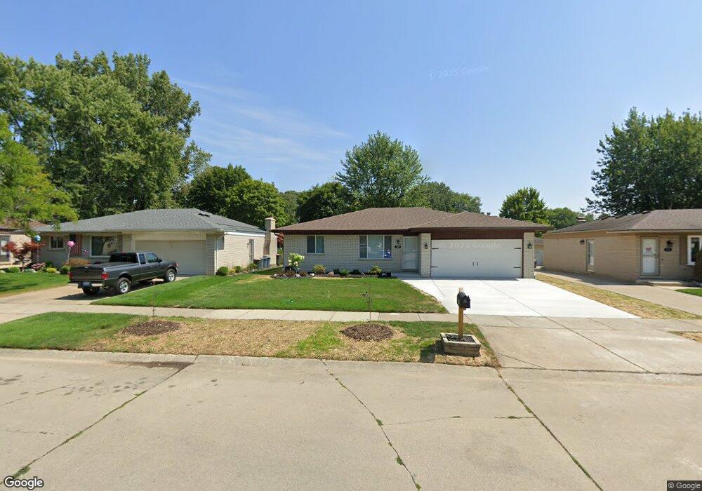
709 Foothill Dr Canton, MI 48188
Estimated Value: $283,000 - $329,000
Studio
2
Baths
1,289
Sq Ft
$235/Sq Ft
Est. Value
About This Home
This home is located at 709 Foothill Dr, Canton, MI 48188 and is currently estimated at $302,304, approximately $234 per square foot. 709 Foothill Dr is a home located in Wayne County with nearby schools including Canton High School, Salem High School, and Plymouth High School.
Ownership History
Date
Name
Owned For
Owner Type
Purchase Details
Closed on
Jan 13, 2025
Sold by
Baker Michael and Baker Amie
Bought by
709 Foothill Llc
Current Estimated Value
Purchase Details
Closed on
Jun 18, 2024
Sold by
Wilkerson Robert and Wilkerson John
Bought by
Baker Michael and Baker Amie
Home Financials for this Owner
Home Financials are based on the most recent Mortgage that was taken out on this home.
Original Mortgage
$198,750
Interest Rate
6.99%
Mortgage Type
New Conventional
Purchase Details
Closed on
Apr 21, 2014
Sold by
Wilkerson Robert W
Bought by
Wilkerson Robert W
Purchase Details
Closed on
Sep 30, 2013
Sold by
Neill Barbara L O and Wilkerson Barbara L
Bought by
Wilkerson Robert W
Create a Home Valuation Report for This Property
The Home Valuation Report is an in-depth analysis detailing your home's value as well as a comparison with similar homes in the area
Home Values in the Area
Average Home Value in this Area
Purchase History
| Date | Buyer | Sale Price | Title Company |
|---|---|---|---|
| 709 Foothill Llc | -- | Reputation First Title | |
| Baker Michael | $265,000 | Reputation First Title | |
| Wilkerson Robert W | -- | None Available | |
| Wilkerson Robert W | -- | None Available | |
| Wilkerson Robert W | $15,000 | None Available |
Source: Public Records
Mortgage History
| Date | Status | Borrower | Loan Amount |
|---|---|---|---|
| Previous Owner | Baker Michael | $198,750 |
Source: Public Records
Tax History
| Year | Tax Paid | Tax Assessment Tax Assessment Total Assessment is a certain percentage of the fair market value that is determined by local assessors to be the total taxable value of land and additions on the property. | Land | Improvement |
|---|---|---|---|---|
| 2025 | $4,886 | $135,000 | $0 | $0 |
| 2024 | $1,694 | $142,900 | $0 | $0 |
| 2023 | $1,615 | $130,300 | $0 | $0 |
| 2022 | $3,575 | $119,800 | $0 | $0 |
| 2021 | $3,469 | $117,100 | $0 | $0 |
| 2020 | $3,425 | $111,500 | $0 | $0 |
| 2019 | $3,369 | $106,080 | $0 | $0 |
| 2018 | $1,373 | $105,340 | $0 | $0 |
| 2017 | $3,466 | $108,700 | $0 | $0 |
| 2016 | $3,064 | $107,200 | $0 | $0 |
| 2015 | $7,544 | $94,440 | $0 | $0 |
| 2013 | $7,308 | $74,720 | $0 | $0 |
| 2010 | -- | $81,900 | $33,533 | $48,367 |
Source: Public Records
Map
Nearby Homes
- 43149 Wilderness Dr
- 39288 Nottingham St
- 39258 Avondale St
- 1040 Wildwood Ln
- 39234 Gloucester St
- 1829 Pebble Creek Dr Unit 6
- 1786 Daisey Ln Unit 32
- 1639 Tulip Ln
- 00000 Avondale St
- 545 S Marie St
- 40049 Rolling Green Ct
- 0 Cherry Hill Unit 16924
- 1803 Pinecroft Dr Unit 171
- 41060 Northwind Dr
- 2393 Arcadia Dr
- 2087 Arcadia Dr Unit 65
- 1890 Cedar Valley Dr Unit 38
- 312 Brookfield Dr Unit 4
- 285 Carson Dr Unit 156
- 41226 Southwind Dr Unit 138
- 697 Foothill Dr
- 721 Foothill Dr
- 685 Foothill Dr
- 720 Scottsdale Ct
- 732 Scottsdale Ct
- 39814 Scottsdale Dr
- 696 Foothill Dr
- 39794 Scottsdale Dr
- 720 Foothill Dr
- 708 Scottsdale Ct
- 684 Foothill Dr
- 39811 Deepwood St
- 39797 Deepwood St
- 39782 Scottsdale Dr
- 39785 Deepwood St
- 732 Foothill Dr
- 39831 Deepwood St
- 39775 Deepwood St
- 39900 Finley Dr
- 744 Foothill Dr