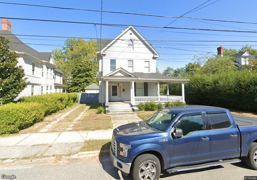
709 Locust St Cambridge, MD 21613
Estimated Value: $301,985 - $338,000
--
Bed
3
Baths
2,802
Sq Ft
$117/Sq Ft
Est. Value
About This Home
This home is located at 709 Locust St, Cambridge, MD 21613 and is currently estimated at $327,746, approximately $116 per square foot. 709 Locust St is a home located in Dorchester County with nearby schools including Sandy Hill Elementary School, Mace's Lane Middle School, and Cambridge-South Dorchester High School.
Ownership History
Date
Name
Owned For
Owner Type
Purchase Details
Closed on
Apr 21, 2016
Sold by
Robins John B
Bought by
Armond Hayward Ii Revocable Deed Of Trus and Hayward Ii Armond
Current Estimated Value
Purchase Details
Closed on
Jan 7, 2012
Sold by
Hayward Armond
Bought by
Ragle Brian and Archer Deborah
Home Financials for this Owner
Home Financials are based on the most recent Mortgage that was taken out on this home.
Original Mortgage
$145,000
Interest Rate
3.98%
Mortgage Type
Purchase Money Mortgage
Purchase Details
Closed on
Jun 29, 2004
Sold by
Hayward Armond Brenda P
Bought by
Hayward Ii Armond Brenda P
Purchase Details
Closed on
Mar 11, 1998
Sold by
Hayward Hazel L L I
Bought by
Hayward Ii Armond and Hayward Brenda P
Create a Home Valuation Report for This Property
The Home Valuation Report is an in-depth analysis detailing your home's value as well as a comparison with similar homes in the area
Home Values in the Area
Average Home Value in this Area
Purchase History
| Date | Buyer | Sale Price | Title Company |
|---|---|---|---|
| Armond Hayward Ii Revocable Deed Of Trus | $125,000 | Attorney | |
| Ragle Brian | $150,000 | Cambridge Title Company Llc | |
| Hayward Ii Armond Brenda P | -- | -- | |
| Hayward Ii Armond And | -- | -- | |
| Hayward Ii Armond | -- | -- |
Source: Public Records
Mortgage History
| Date | Status | Borrower | Loan Amount |
|---|---|---|---|
| Previous Owner | Ragle Brian | $145,000 |
Source: Public Records
Tax History Compared to Growth
Tax History
| Year | Tax Paid | Tax Assessment Tax Assessment Total Assessment is a certain percentage of the fair market value that is determined by local assessors to be the total taxable value of land and additions on the property. | Land | Improvement |
|---|---|---|---|---|
| 2025 | $3,636 | $193,600 | $30,700 | $162,900 |
| 2024 | $3,152 | $182,067 | $0 | $0 |
| 2023 | $3,152 | $170,533 | $0 | $0 |
| 2022 | $2,939 | $159,000 | $30,700 | $128,300 |
| 2021 | $2,824 | $154,367 | $0 | $0 |
| 2020 | $2,824 | $149,733 | $0 | $0 |
| 2019 | $2,766 | $145,100 | $21,600 | $123,500 |
| 2018 | $2,633 | $141,800 | $0 | $0 |
| 2017 | $2,571 | $138,500 | $0 | $0 |
| 2016 | -- | $135,200 | $0 | $0 |
| 2015 | $2,418 | $132,700 | $0 | $0 |
| 2014 | $2,418 | $130,200 | $0 | $0 |
Source: Public Records
Map
Nearby Homes
- 706 Locust St
- 810 Locust St
- 722 Glasgow St
- 817 Locust St
- 422 Willis St
- 211 Choptank Ave
- 453 Willis St
- 0 Edgewood Ave Unit MDDO2010918
- 0 Edgewood Ave Unit MDDO2010930
- 0 Edgewood Ave Unit MDDO2010928
- 0 Edgewood Ave Unit MDDO2010924
- 0 Edgewood Ave Unit MDDO2010926
- 0 Edgewood Ave Unit MDDO2010932
- 306 Oakley St
- 429 Camper St
- 123 Choptank Ave
- 122 Vue de Leau St
- 0 Park Ln
- 314 Belvedere Ave
- 832 Park Ln