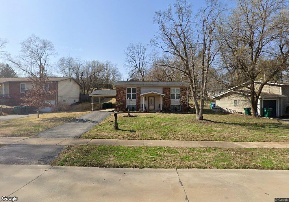
709 Lorraine Davis Ln Saint Louis, MO 63119
Estimated Value: $242,060 - $318,000
3
Beds
2
Baths
900
Sq Ft
$311/Sq Ft
Est. Value
About This Home
This home is located at 709 Lorraine Davis Ln, Saint Louis, MO 63119 and is currently estimated at $279,765, approximately $310 per square foot. 709 Lorraine Davis Ln is a home located in St. Louis County with nearby schools including Avery Elementary School, Hixson Middle School, and Webster Groves High School.
Ownership History
Date
Name
Owned For
Owner Type
Purchase Details
Closed on
Sep 23, 2013
Sold by
Shell Anthoine and Shell Ava L
Bought by
Shell Ava L
Current Estimated Value
Purchase Details
Closed on
Mar 16, 1999
Sold by
Sabados Rick and Sabados Tracy
Bought by
Shell Anthoine and Shell Ava L
Purchase Details
Closed on
Sep 17, 1998
Sold by
S & P Properties
Bought by
Sabados Rick and Sabados Tracy
Home Financials for this Owner
Home Financials are based on the most recent Mortgage that was taken out on this home.
Original Mortgage
$54,500
Interest Rate
6.91%
Mortgage Type
Seller Take Back
Purchase Details
Closed on
Jun 8, 1998
Sold by
Martinez Ethel C and Martinez Marcus
Bought by
S & P Properties Inc
Create a Home Valuation Report for This Property
The Home Valuation Report is an in-depth analysis detailing your home's value as well as a comparison with similar homes in the area
Home Values in the Area
Average Home Value in this Area
Purchase History
| Date | Buyer | Sale Price | Title Company |
|---|---|---|---|
| Shell Ava L | -- | None Available | |
| Shell Anthoine | $75,000 | -- | |
| Sabados Rick | -- | -- | |
| S & P Properties Inc | $49,500 | -- |
Source: Public Records
Mortgage History
| Date | Status | Borrower | Loan Amount |
|---|---|---|---|
| Previous Owner | Sabados Rick | $54,500 |
Source: Public Records
Tax History Compared to Growth
Tax History
| Year | Tax Paid | Tax Assessment Tax Assessment Total Assessment is a certain percentage of the fair market value that is determined by local assessors to be the total taxable value of land and additions on the property. | Land | Improvement |
|---|---|---|---|---|
| 2025 | $2,785 | $45,520 | $21,660 | $23,860 |
| 2024 | $2,785 | $39,680 | $16,250 | $23,430 |
| 2023 | $2,785 | $39,680 | $16,250 | $23,430 |
| 2022 | $2,387 | $31,640 | $13,530 | $18,110 |
| 2021 | $2,379 | $31,640 | $13,530 | $18,110 |
| 2020 | $2,246 | $27,800 | $10,830 | $16,970 |
| 2019 | $2,230 | $27,800 | $10,830 | $16,970 |
| 2018 | $2,285 | $25,310 | $6,970 | $18,340 |
| 2017 | $2,270 | $25,310 | $6,970 | $18,340 |
| 2016 | $1,919 | $20,460 | $6,020 | $14,440 |
| 2015 | $1,920 | $20,460 | $6,020 | $14,440 |
| 2014 | $2,133 | $22,160 | $8,040 | $14,120 |
Source: Public Records
Map
Nearby Homes
- 814 Holland Ave
- 546 Holland Ave
- 827 Cornell Ave
- 617 N Elm Ave
- 112 Oakwood Ave
- 1013 Bell Ave
- 901 Ennis Ave
- 218 Euclid Ave
- 441 Park Rd
- 8908 W Pendleton Ave
- 2904 Collier Ave
- 2911 Brazeau Ave
- 610 Cornelia Ave
- 330 Lithia Ave
- 2935 Greentop Ct
- 2918 Wingate Ct
- 2829 Brazeau Ave
- 136 N Gore Ave
- 619 N Bompart Ave
- 9239 Merritt Ave
- 705 Lorraine Davis Ln
- 715 Lorraine Davis Ln
- 110 E Thornton Ave
- 621 Lorraine Davis Ln
- 708 Holland Ave
- 712 Holland Ave
- 725 Lorraine Davis Ln
- 702 Holland Ave
- 617 Lorraine Davis Ln
- 617 Lorraine Davis Ln
- 620 Holland Ave
- 614 Holland Ave
- 105 E Thornton Ave
- 611 Lorraine Davis Ln
- 802 Holland Ave
- 610 Holland Ave
- 806 Holland Ave
- 711 Holland Ave
- 3197 S Brentwood Blvd
- 707 Holland Ave