Estimated Value: $78,616 - $117,000
2
Beds
1
Bath
736
Sq Ft
$136/Sq Ft
Est. Value
About This Home
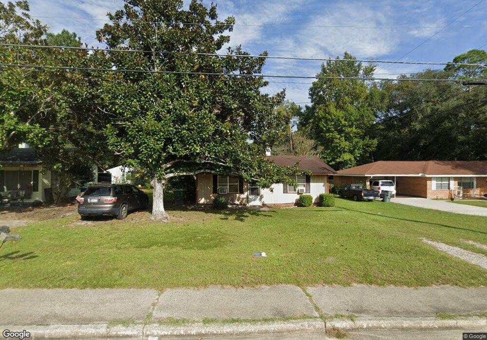
This home is located at 709 N 4th St, Jesup, GA 31545 and is currently estimated at $100,404, approximately $136 per square foot. 709 N 4th St is a home located in Wayne County with nearby schools including Martha Rawls Smith Elementary School, Martha Puckett Middle School, and Wayne County High School.
Ownership History
Date
Name
Owned For
Owner Type
Purchase Details
Closed on
May 9, 2016
Sold by
Smith Charles W
Bought by
Little Anthony and Little Tyra S
Current Estimated Value
Home Financials for this Owner
Home Financials are based on the most recent Mortgage that was taken out on this home.
Original Mortgage
$10,000,000
Outstanding Balance
$7,942,490
Interest Rate
3.59%
Mortgage Type
New Conventional
Estimated Equity
-$7,842,086
Purchase Details
Closed on
Oct 1, 1955
Bought by
Smith Charles W and Smith Martha H
Create a Home Valuation Report for This Property
The Home Valuation Report is an in-depth analysis detailing your home's value as well as a comparison with similar homes in the area
Home Values in the Area
Average Home Value in this Area
Purchase History
| Date | Buyer | Sale Price | Title Company |
|---|---|---|---|
| Little Anthony | $17,500 | -- | |
| Smith Charles W | -- | -- | |
| Smith Charles W | -- | -- |
Source: Public Records
Mortgage History
| Date | Status | Borrower | Loan Amount |
|---|---|---|---|
| Open | Smith Charles W | $10,000,000 | |
| Closed | Little Anthony | $10,000,000 |
Source: Public Records
Tax History Compared to Growth
Tax History
| Year | Tax Paid | Tax Assessment Tax Assessment Total Assessment is a certain percentage of the fair market value that is determined by local assessors to be the total taxable value of land and additions on the property. | Land | Improvement |
|---|---|---|---|---|
| 2024 | $479 | $15,657 | $1,375 | $14,282 |
| 2023 | $290 | $8,197 | $1,353 | $6,844 |
| 2022 | $258 | $8,197 | $1,353 | $6,844 |
| 2021 | $276 | $8,197 | $1,353 | $6,844 |
| 2020 | $286 | $8,197 | $1,353 | $6,844 |
| 2019 | $294 | $8,197 | $1,353 | $6,844 |
| 2018 | $294 | $8,197 | $1,353 | $6,844 |
| 2017 | $216 | $8,197 | $1,353 | $6,844 |
| 2016 | $245 | $8,197 | $1,353 | $6,844 |
| 2014 | $246 | $8,197 | $1,353 | $6,844 |
| 2013 | -- | $8,196 | $1,353 | $6,843 |
Source: Public Records
Map
Nearby Homes
- 0000 N Fourth St
- 0 N Fourth St Unit 159403
- 0 N Fourth St Unit 1652040
- 0 N 3rd Ln
- 356 N 4th St
- 356 N Fourth St
- 0 N 4th St
- 0 N 4th St Unit 10414401
- 344 N Fourth St
- 447 NE Broad St
- 0 U S 84
- 498 NE Broad St
- 196 Pine Ridge Dr
- 197 NW Broad St
- 436-441 Brunswick St
- 9474 Us Hwy 301
- 106 Mangrove Ct
- 113 Mangrove Ct
- 00 84 Hwy
- 207 E Pine St
- 705 N 4th St
- 711 N 4th St
- 612 Robinson Dr
- 618 Robinson Dr
- 687 N 4th St
- 713 N 4th St
- 0 N Fourth St Unit 22675943
- 0 N Fourth St Unit 10118288
- N N Fourth St
- 0 N Fourth St
- 624 Robinson Dr
- 611 Robinson Dr
- 673 N 4th St
- 632 Robinson Dr
- 617 Robinson Dr
- 623 Robinson Dr
- 638 Robinson Dr
- 631 Robinson Dr
- 611 N 4th St
- 642 W Poplar St