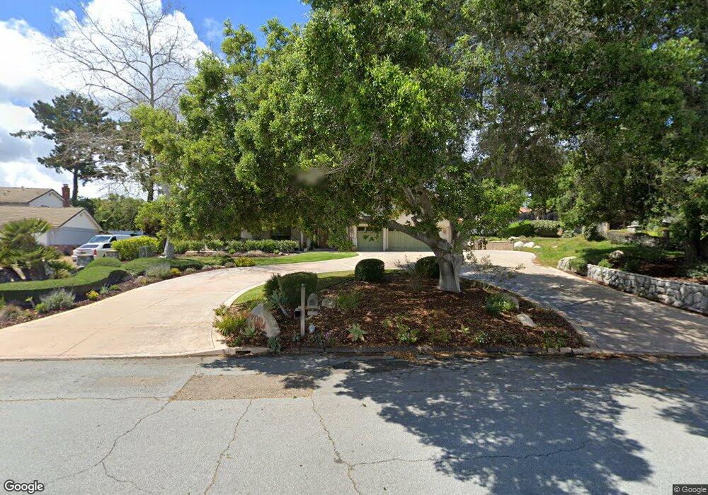
709 Saint Andrews Way Unit 2 Lompoc, CA 93436
Estimated Value: $1,072,000 - $1,290,000
3
Beds
3
Baths
3,144
Sq Ft
$368/Sq Ft
Est. Value
About This Home
This home is located at 709 Saint Andrews Way Unit 2, Lompoc, CA 93436 and is currently estimated at $1,158,263, approximately $368 per square foot. 709 Saint Andrews Way Unit 2 is a home located in Santa Barbara County with nearby schools including Buena Vista Elementary School and Cabrillo High School.
Ownership History
Date
Name
Owned For
Owner Type
Purchase Details
Closed on
Aug 4, 2000
Sold by
Moorhead Charles E and Moorhead Betty S
Bought by
Barto Joseph Richard and The Joseph Richard Barto Trust
Current Estimated Value
Home Financials for this Owner
Home Financials are based on the most recent Mortgage that was taken out on this home.
Original Mortgage
$252,700
Interest Rate
8.13%
Purchase Details
Closed on
Jul 27, 2000
Sold by
Revoc Thompson Patricia M and Revoc Patricia M Thompson 1993
Bought by
Chang Wun Thong and Chang Yi Chy
Home Financials for this Owner
Home Financials are based on the most recent Mortgage that was taken out on this home.
Original Mortgage
$252,700
Interest Rate
8.13%
Purchase Details
Closed on
Aug 16, 1993
Sold by
Gilchrist James and Gilchrist Beretta R
Bought by
Moorhead Charles E and Moorhead Betty S
Home Financials for this Owner
Home Financials are based on the most recent Mortgage that was taken out on this home.
Original Mortgage
$65,000
Interest Rate
7.21%
Create a Home Valuation Report for This Property
The Home Valuation Report is an in-depth analysis detailing your home's value as well as a comparison with similar homes in the area
Home Values in the Area
Average Home Value in this Area
Purchase History
| Date | Buyer | Sale Price | Title Company |
|---|---|---|---|
| Barto Joseph Richard | $320,000 | Chicago Title Co | |
| Chang Wun Thong | $810,000 | Fidelity National Title Co | |
| Moorhead Charles E | $285,000 | -- |
Source: Public Records
Mortgage History
| Date | Status | Borrower | Loan Amount |
|---|---|---|---|
| Closed | Barto Joseph Richard | $252,700 | |
| Open | Chang Wun Thong | $552,000 | |
| Previous Owner | Moorhead Charles E | $65,000 |
Source: Public Records
Tax History Compared to Growth
Tax History
| Year | Tax Paid | Tax Assessment Tax Assessment Total Assessment is a certain percentage of the fair market value that is determined by local assessors to be the total taxable value of land and additions on the property. | Land | Improvement |
|---|---|---|---|---|
| 2025 | $9,360 | $841,348 | $195,878 | $645,470 |
| 2023 | $9,360 | $808,679 | $188,273 | $620,406 |
| 2022 | $9,207 | $792,824 | $184,582 | $608,242 |
| 2021 | $9,310 | $777,279 | $180,963 | $596,316 |
| 2020 | $7,909 | $657,000 | $218,000 | $439,000 |
| 2019 | $7,785 | $644,000 | $214,000 | $430,000 |
| 2018 | $7,666 | $631,000 | $210,000 | $421,000 |
| 2017 | $7,236 | $601,000 | $200,000 | $401,000 |
| 2016 | $6,331 | $546,000 | $182,000 | $364,000 |
| 2014 | $5,810 | $495,000 | $165,000 | $330,000 |
Source: Public Records
Map
Nearby Homes
- 445 Firestone Way
- 4464 Greenbrier Rd
- 579 Saint Andrews Way
- 0 Oak Hill Dr Unit 24-783
- 52 Stanford Cir
- 240 Oak Hill Dr
- 210 Oak Hill Dr
- 4021 Muirfield Place
- 298 Saint Andrews Way
- 384 Falcon Crest Dr
- 113 Gemini Ave
- 129 Hercules Ave
- 4490 Sirius Ave
- 4139 Constellation Rd Unit 2
- 4108 Constellation Rd
- 252 Pegasus Ave
- 3951 Mesa Circle Dr
- 1445 Calle Marana
- 3939 Saturn Ave
- 3878 Via Mondo
- 707 Saint Andrews Way
- 480 Firestone Way
- 711 Saint Andrews Way Unit 2
- 142 La Costa Ln
- 456 Firestone Way
- 705 Saint Andrews Way
- 141 La Costa Ln
- 710 Saint Andrews Way
- 706 Saint Andrews Way
- 442 Firestone Way
- 712 Saint Andrews Way Unit 2
- 701 Saint Andrews Way
- 481 Oak Hill Dr
- 700 Saint Andrews Way
- 485 Firestone Way
- 463 Firestone Way
- 137 La Costa Ln
- 717 Saint Andrews Way Unit 2
- 714 Saint Andrews Way