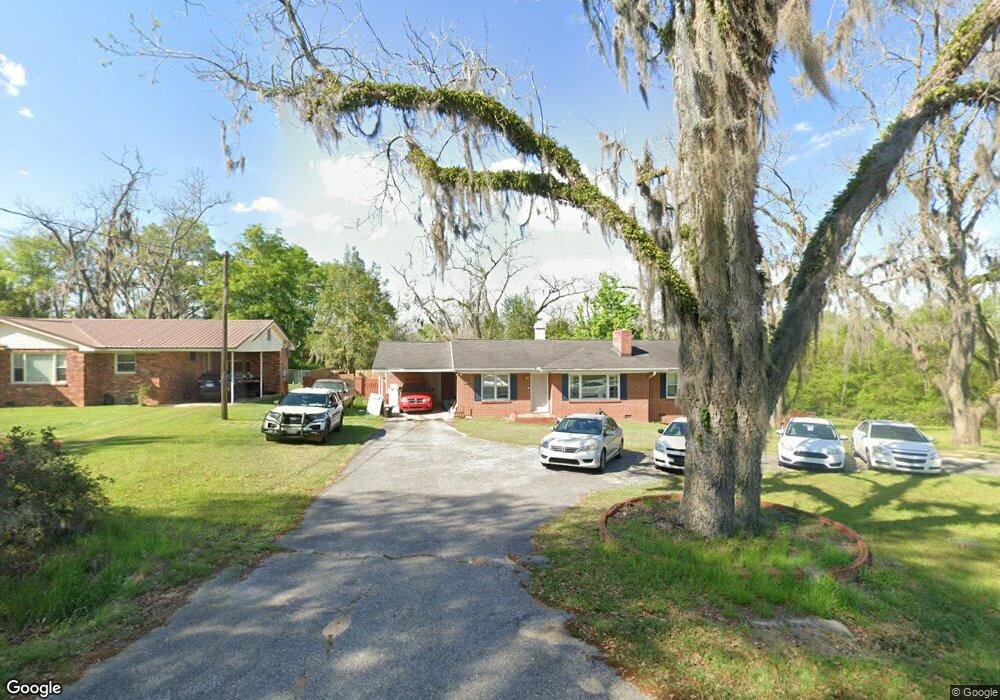
709 Sapp Ave SW Pelham, GA 31779
Estimated Value: $164,296 - $221,000
--
Bed
1
Bath
2,046
Sq Ft
$93/Sq Ft
Est. Value
About This Home
This home is located at 709 Sapp Ave SW, Pelham, GA 31779 and is currently estimated at $190,574, approximately $93 per square foot. 709 Sapp Ave SW is a home located in Mitchell County with nearby schools including Pelham Elementary School, Pelham City Middle School, and Pelham High School.
Ownership History
Date
Name
Owned For
Owner Type
Purchase Details
Closed on
Apr 27, 2018
Sold by
Pollock Jameson
Bought by
Carlton Travis R and Carlton Chelsea R
Current Estimated Value
Home Financials for this Owner
Home Financials are based on the most recent Mortgage that was taken out on this home.
Original Mortgage
$88,369
Outstanding Balance
$76,263
Interest Rate
4.5%
Mortgage Type
FHA
Estimated Equity
$114,311
Purchase Details
Closed on
Jun 13, 2012
Sold by
Humphries Dewain
Bought by
Pollock Jameson and Pollock Tiffany
Create a Home Valuation Report for This Property
The Home Valuation Report is an in-depth analysis detailing your home's value as well as a comparison with similar homes in the area
Home Values in the Area
Average Home Value in this Area
Purchase History
| Date | Buyer | Sale Price | Title Company |
|---|---|---|---|
| Carlton Travis R | $90,000 | -- | |
| Pollock Jameson | $92,000 | -- |
Source: Public Records
Mortgage History
| Date | Status | Borrower | Loan Amount |
|---|---|---|---|
| Open | Carlton Travis R | $88,369 |
Source: Public Records
Tax History Compared to Growth
Tax History
| Year | Tax Paid | Tax Assessment Tax Assessment Total Assessment is a certain percentage of the fair market value that is determined by local assessors to be the total taxable value of land and additions on the property. | Land | Improvement |
|---|---|---|---|---|
| 2024 | $2,321 | $54,400 | $680 | $53,720 |
| 2023 | $2,395 | $54,400 | $680 | $53,720 |
| 2022 | $1,829 | $41,240 | $680 | $40,560 |
| 2021 | $1,488 | $34,400 | $680 | $33,720 |
| 2020 | $1,428 | $34,400 | $680 | $33,720 |
| 2019 | $1,459 | $34,400 | $680 | $33,720 |
| 2018 | $1,555 | $34,400 | $680 | $33,720 |
| 2017 | $756 | $40,424 | $2,856 | $37,568 |
| 2016 | $711 | $40,424 | $2,856 | $37,568 |
| 2015 | $711 | $40,424 | $2,856 | $37,568 |
| 2014 | $711 | $40,424 | $2,856 | $37,568 |
| 2013 | $711 | $40,424 | $2,856 | $37,568 |
Source: Public Records
Map
Nearby Homes
- 5854 Mount Olive Rd
- 425 Hollis St SW
- 0 Old Ga Highway 3
- 410 Hollis St SW
- 389 Stewart St SW
- 443 Stewart St SW
- 277 Saunders St SW
- 354 Bennett St NW
- 209 McDonald St SW
- 212 Hand Ave W
- 210 Castleberry St NW
- 233 Cannon St NW
- 135 Baggs Ave SE
- 3** Youngs Mill Rd
- 183 Baggs Ave SE
- 199 Carroll St NE
- 589 Liberia St NW
- 653 Liberia St NW
- 323 Curry St NE
- 375 Baggs Ave SE
- 717 Sapp Ave SW
- 729 Sapp Ave SW
- 00 Mount Olive Rd (11ac)
- 4256 Mount Olive Rd
- 625 Sapp Ave SW
- 5188 Mount Olive Rd
- XXX Mt Olive Rd Whitfield Property (+ -92 88 Acres)
- 4268 Mount Olive Rd
- 615 Sapp Ave SW
- 4286 Mount Olive Rd
- 4298 Mount Olive Rd
- 600 Sapp Ave SW
- 4279 Mount Olive Rd
- 570 Sapp Ave SW
- 560 Sapp Ave SW
- 498 Hollis St SW
- 401 Sapp Ave SW
- 530 Burum St SW
- 540 Burum St SW
- 550 Burum St SW