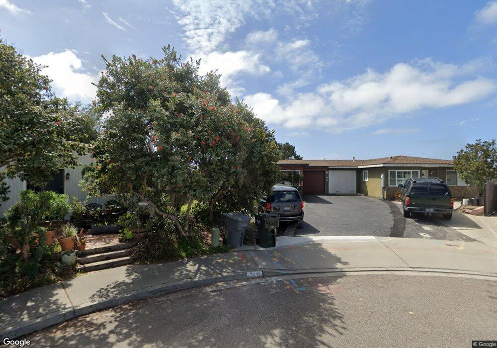
709 Snapdragon St Encinitas, CA 92024
Central Encinitas NeighborhoodEstimated Value: $1,023,429 - $1,197,000
2
Beds
1
Bath
827
Sq Ft
$1,354/Sq Ft
Est. Value
About This Home
This home is located at 709 Snapdragon St, Encinitas, CA 92024 and is currently estimated at $1,119,857, approximately $1,354 per square foot. 709 Snapdragon St is a home located in San Diego County with nearby schools including Park Dale Lane Elementary, Oak Crest Middle School, and La Costa Canyon High School.
Ownership History
Date
Name
Owned For
Owner Type
Purchase Details
Closed on
May 13, 2025
Sold by
David Pardo Trust and Thomas Deborah
Bought by
Dgtl Trust and Thomas
Current Estimated Value
Purchase Details
Closed on
Jul 23, 2024
Sold by
Thomas Deborah J and Pardo David
Bought by
Dgtl Trust and David Pardo Trust
Purchase Details
Closed on
Jan 2, 1992
Bought by
9% Thomas Deborah J Smns1% Pardo
Create a Home Valuation Report for This Property
The Home Valuation Report is an in-depth analysis detailing your home's value as well as a comparison with similar homes in the area
Home Values in the Area
Average Home Value in this Area
Purchase History
We collect this data history from publicly available records. To have your information removed, we recommend requesting removal directly through your county’s website.
| Date | Buyer | Sale Price | Title Company |
|---|---|---|---|
| Dgtl Trust | -- | Gateway Title | |
| Dgtl Trust | -- | Gateway Title | |
| 9% Thomas Deborah J Smns1% Pardo | $120,500 | -- |
Source: Public Records
Tax History
| Year | Tax Paid | Tax Assessment Tax Assessment Total Assessment is a certain percentage of the fair market value that is determined by local assessors to be the total taxable value of land and additions on the property. | Land | Improvement |
|---|---|---|---|---|
| 2025 | $2,532 | $213,052 | $142,038 | $71,014 |
| 2024 | $2,532 | $208,875 | $139,253 | $69,622 |
| 2023 | $2,427 | $204,780 | $136,523 | $68,257 |
| 2022 | $2,380 | $200,766 | $133,847 | $66,919 |
| 2021 | $2,351 | $196,830 | $131,223 | $65,607 |
| 2020 | $2,330 | $194,813 | $129,878 | $64,935 |
| 2019 | $2,286 | $190,994 | $127,332 | $63,662 |
| 2018 | $2,274 | $187,250 | $124,836 | $62,414 |
| 2017 | $2,237 | $183,580 | $122,389 | $61,191 |
| 2016 | $2,165 | $179,982 | $119,990 | $59,992 |
| 2015 | $2,135 | $177,279 | $118,188 | $59,091 |
| 2014 | $2,096 | $173,807 | $115,873 | $57,934 |
Source: Public Records
Map
Nearby Homes
- 760 Encinitas Blvd Unit 101
- 0 Mays Hollow Ln
- 248 Coneflower St
- 155 Rosebay Dr Unit 37
- 935 Encinitas Blvd
- 185 Saxony Rd
- 676 Manzanita Ln
- 752 Bracero Rd
- 103 Mangano Cir
- 106 Mangano Cir
- 410 Pipes Ln
- 824 Conestoga Ct
- 828 Conestoga Ct
- 889-91 Bracero Rd
- 623 Quail Gardens Ln
- 921 Regal Rd
- 661 Union St
- 1044 Arcadia Rd
- 444 N El Camino Real Unit 2
- 444 N El Camino Real Unit 129
- 707 Snapdragon St
- 700 Snapdragon St
- 702 Snapdragon St
- 706 Teaberry St
- 708 Teaberry St
- 713 Snapdragon St
- 715 Snapdragon St
- 712 Teaberry St
- 714 Teaberry St
- 708 Snapdragon St
- 706 Snapdragon St
- 719 Snapdragon St
- 721 Snapdragon St
- 797 Mays Hollow Ln
- 700 Teaberry St
- 702 Teaberry St
- 712 Snapdragon St
- 714 Snapdragon St
- 718 Teaberry St
- 720 Teaberry St
Your Personal Tour Guide
Ask me questions while you tour the home.