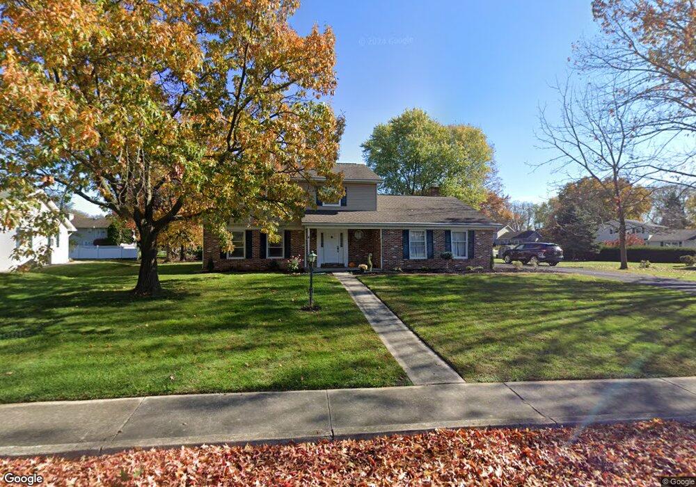
709 Sutton Dr Carlisle, PA 17013
Estimated Value: $476,000 - $511,500
4
Beds
4
Baths
3,253
Sq Ft
$151/Sq Ft
Est. Value
About This Home
This home is located at 709 Sutton Dr, Carlisle, PA 17013 and is currently estimated at $490,375, approximately $150 per square foot. 709 Sutton Dr is a home located in Cumberland County with nearby schools including Mooreland Elementary School, Lamberton Middle School, and Carlisle Area High School.
Ownership History
Date
Name
Owned For
Owner Type
Purchase Details
Closed on
Jun 11, 2010
Sold by
Fish Chester B
Bought by
Shevlin Michael C
Current Estimated Value
Home Financials for this Owner
Home Financials are based on the most recent Mortgage that was taken out on this home.
Original Mortgage
$271,246
Outstanding Balance
$179,816
Interest Rate
4.75%
Mortgage Type
FHA
Estimated Equity
$310,559
Create a Home Valuation Report for This Property
The Home Valuation Report is an in-depth analysis detailing your home's value as well as a comparison with similar homes in the area
Home Values in the Area
Average Home Value in this Area
Purchase History
| Date | Buyer | Sale Price | Title Company |
|---|---|---|---|
| Shevlin Michael C | $274,900 | -- |
Source: Public Records
Mortgage History
| Date | Status | Borrower | Loan Amount |
|---|---|---|---|
| Open | Shevlin Michael C | $271,246 |
Source: Public Records
Tax History Compared to Growth
Tax History
| Year | Tax Paid | Tax Assessment Tax Assessment Total Assessment is a certain percentage of the fair market value that is determined by local assessors to be the total taxable value of land and additions on the property. | Land | Improvement |
|---|---|---|---|---|
| 2025 | $7,413 | $314,800 | $74,700 | $240,100 |
| 2024 | $7,200 | $314,800 | $74,700 | $240,100 |
| 2023 | $6,872 | $314,800 | $74,700 | $240,100 |
| 2022 | $6,773 | $314,800 | $74,700 | $240,100 |
| 2021 | $6,677 | $314,800 | $74,700 | $240,100 |
| 2020 | $6,536 | $314,800 | $74,700 | $240,100 |
| 2019 | $6,399 | $314,800 | $74,700 | $240,100 |
| 2018 | $6,262 | $314,800 | $74,700 | $240,100 |
| 2017 | $6,138 | $314,800 | $74,700 | $240,100 |
| 2016 | -- | $314,800 | $74,700 | $240,100 |
| 2015 | -- | $314,800 | $74,700 | $240,100 |
| 2014 | -- | $314,800 | $74,700 | $240,100 |
Source: Public Records
Map
Nearby Homes
- 808 Wellington Dr
- 628 Belvedere St
- 1003 Rockledge Dr
- 500 Belvedere St
- 6 Rockledge Ct
- 1322 Georgetown Cir
- 808 Walnut Ln
- 300 Acre Dr
- 48 Strawberry Dr
- 250 Mooreland Ave
- 229 Mooreland Ave
- 310 Touchstone Dr
- 124 Conway St
- Corby Plan at Grange - Single Family
- Ashby Plan at Grange - Single Family
- Darby Plan at Grange - Single Family
- Elgin Plan at Grange - Single Family
- Royston Plan at Grange - Single Family
- Dundee Plan at Grange - Single Family
- Anders Plan at Grange - Single Family
- 715 Sutton Dr
- 705 Sutton Dr
- 704 Sutton Dr
- 1104 Regent Ct
- 710 Sutton Dr
- 738 Sherwood Dr
- 1105 Regent Ct
- 1120 Stratford Dr
- 734 Sherwood Dr
- 716 Sutton Dr
- 719 Sutton Dr
- 1200 Stratford Dr
- 1116 Stratford Dr
- 1305 Windsor Ct
- 730 Sherwood Dr
- 720 Sutton Dr
- 1206 Stratford Dr
- 1311 Windsor Ct
- 726 Sherwood Dr
- 1106 Stratford Dr