Estimated Value: $497,325 - $595,000
4
Beds
4
Baths
2,924
Sq Ft
$185/Sq Ft
Est. Value
About This Home
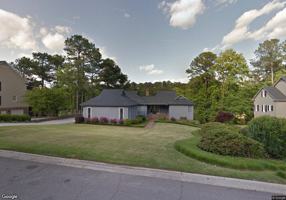
This home is located at 709 Whittingtons Ridge, Evans, GA 30809 and is currently estimated at $539,581, approximately $184 per square foot. 709 Whittingtons Ridge is a home located in Columbia County with nearby schools including Northmore Elementary School, Lincoln Elementary School, and Blue Ridge Elementary School.
Ownership History
Date
Name
Owned For
Owner Type
Purchase Details
Closed on
Aug 8, 2002
Sold by
A B & W Properties Llc
Bought by
Bourne Charles D
Current Estimated Value
Home Financials for this Owner
Home Financials are based on the most recent Mortgage that was taken out on this home.
Original Mortgage
$288,800
Interest Rate
6.53%
Mortgage Type
Purchase Money Mortgage
Create a Home Valuation Report for This Property
The Home Valuation Report is an in-depth analysis detailing your home's value as well as a comparison with similar homes in the area
Home Values in the Area
Average Home Value in this Area
Purchase History
| Date | Buyer | Sale Price | Title Company |
|---|---|---|---|
| Bourne Charles D | $39,500 | -- |
Source: Public Records
Mortgage History
| Date | Status | Borrower | Loan Amount |
|---|---|---|---|
| Closed | Bourne Charles D | $288,800 |
Source: Public Records
Tax History Compared to Growth
Tax History
| Year | Tax Paid | Tax Assessment Tax Assessment Total Assessment is a certain percentage of the fair market value that is determined by local assessors to be the total taxable value of land and additions on the property. | Land | Improvement |
|---|---|---|---|---|
| 2025 | $5,107 | $211,720 | $46,804 | $164,916 |
| 2024 | $1,758 | $217,534 | $41,304 | $176,230 |
| 2023 | $1,758 | $198,221 | $39,204 | $159,017 |
| 2022 | $1,505 | $169,536 | $42,804 | $126,732 |
| 2021 | $1,519 | $162,682 | $49,924 | $112,758 |
| 2020 | $1,476 | $151,664 | $48,484 | $103,180 |
| 2019 | $1,424 | $146,216 | $46,884 | $99,332 |
| 2018 | $1,424 | $144,735 | $45,764 | $98,971 |
| 2017 | $1,464 | $147,464 | $47,044 | $100,420 |
| 2016 | $1,296 | $145,009 | $48,300 | $96,709 |
| 2015 | $1,273 | $142,459 | $49,420 | $93,039 |
| 2014 | $1,239 | $136,552 | $47,180 | $89,372 |
Source: Public Records
Map
Nearby Homes
- 4110 Heritage Ridge
- 2025 Grace Ave
- 735 Michaels Creek
- 7304 Malton Ct
- 1009 Barrett Dr
- 652 King Taylor Rd
- 4444 Peregrine Place
- 0 Osprey Ln Unit 546209
- 519 Seminole Place
- 4213 Blue Heron Ln
- 798 Osprey Ln
- 210 Oleander Trail
- 4172 Tindall Dr
- 516 McKinnes Park
- 207 Oleander Trail
- 701 Fosters Ct
- 593 Blue Ridge Crossing
- 905 Nerium Trail
- 846 Willow Lake
- 4116 Dunes Dr
- 707 Whittingtons Ridge
- 711 Whittingtons Ridge
- 706 Whittingtons Ridge
- 708 Whittingtons Ridge
- 704 Whittingtons Ridge
- 710 Whittingtons Ridge
- 712 Whittingtons Ridge
- 703 Whittingtons Ridge
- 725 Jones Creek
- 723 Jones Creek
- 727 Jones Creek
- 721 Jones Creek
- 705 Michaels Creek
- 707 Michaels Creek
- 729 Jones Creek
- 701 Whittingtons Ridge
- 703 Michaels Creek
- 4121 Heritage Ridge
- 4123 Heritage Ridge
- 4125 Heritage Ridge