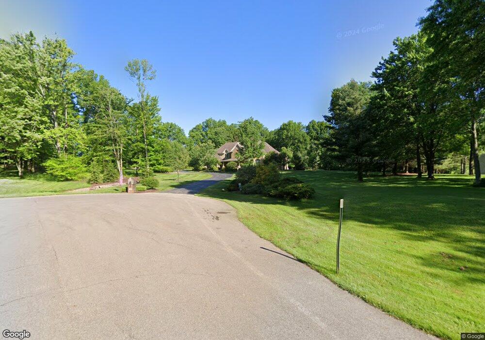
7092 Killdeer Dr Canfield, OH 44406
Estimated Value: $927,000
5
Beds
6
Baths
5,722
Sq Ft
$162/Sq Ft
Est. Value
About This Home
This home is located at 7092 Killdeer Dr, Canfield, OH 44406 and is currently priced at $927,000, approximately $162 per square foot. 7092 Killdeer Dr is a home located in Mahoning County with nearby schools including Canfield Village Middle School and Canfield High School.
Ownership History
Date
Name
Owned For
Owner Type
Purchase Details
Closed on
Dec 7, 2016
Sold by
Jamison Jamie M
Bought by
Jamison James P
Current Estimated Value
Purchase Details
Closed on
Apr 30, 2009
Sold by
Jamison James P and Jamison Jamie M
Bought by
Jamison Jamie M
Purchase Details
Closed on
May 24, 2001
Sold by
Downey Anne Marie and Tinkler Anne Marie
Bought by
Jamison James P and Jamison Jamie M
Home Financials for this Owner
Home Financials are based on the most recent Mortgage that was taken out on this home.
Original Mortgage
$22,000
Interest Rate
7.18%
Mortgage Type
Purchase Money Mortgage
Purchase Details
Closed on
Jul 7, 2000
Sold by
Tinkler Daniel C
Bought by
Tinkler Anne Marie
Purchase Details
Closed on
Dec 14, 1990
Bought by
Tinkler Daniel C
Create a Home Valuation Report for This Property
The Home Valuation Report is an in-depth analysis detailing your home's value as well as a comparison with similar homes in the area
Home Values in the Area
Average Home Value in this Area
Purchase History
| Date | Buyer | Sale Price | Title Company |
|---|---|---|---|
| Jamison James P | -- | None Available | |
| Jamison Jamie M | -- | Reliable Title | |
| Jamison James P | $70,000 | -- | |
| Tinkler Anne Marie | -- | -- | |
| Tinkler Daniel C | $47,000 | -- |
Source: Public Records
Mortgage History
| Date | Status | Borrower | Loan Amount |
|---|---|---|---|
| Closed | Jamison James P | $22,000 |
Source: Public Records
Tax History
| Year | Tax Paid | Tax Assessment Tax Assessment Total Assessment is a certain percentage of the fair market value that is determined by local assessors to be the total taxable value of land and additions on the property. | Land | Improvement |
|---|---|---|---|---|
| 2025 | $10,704 | $262,720 | $30,800 | $231,920 |
| 2024 | $10,707 | $262,720 | $30,800 | $231,920 |
| 2023 | $10,527 | $262,720 | $30,800 | $231,920 |
| 2022 | $11,548 | $230,380 | $25,030 | $205,350 |
| 2021 | $11,186 | $230,380 | $25,030 | $205,350 |
| 2020 | $11,234 | $230,380 | $25,030 | $205,350 |
| 2019 | $11,804 | $218,760 | $25,030 | $193,730 |
| 2018 | $11,493 | $218,760 | $25,030 | $193,730 |
| 2017 | $11,490 | $218,760 | $25,030 | $193,730 |
| 2016 | $11,753 | $213,100 | $25,030 | $188,070 |
| 2015 | $12,067 | $213,100 | $25,030 | $188,070 |
| 2014 | -- | $213,100 | $25,030 | $188,070 |
| 2013 | $11,119 | $213,100 | $25,030 | $188,070 |
Source: Public Records
Map
Nearby Homes
- 8015 Briarwood Ct Unit 6
- 6605 Covington Cove
- 8131 Leffingwell Rd
- 8099 W Western Reserve Rd
- 24 Hunters Woods Blvd Unit D
- 18 Hunters Woods Blvd Unit C
- 6020 (LOT #39) Century Blvd
- 7120 (LOT #32) S Palmyra Rd
- 6080 (LOT 44) Century Blvd
- 6090 Century Blvd
- 7060 (LOT #29) S Palmyra Rd
- 6025 (LOT #54) Century Blvd
- 6135 (LOT #65) Century Blvd
- 7040 (LOT #28) S Palmyra Rd
- 124 Wadsworth St
- 315 W Main St
- 223 Fairview Ave
- 30 Newton Square Dr Unit 3
- 30 Newton Square Dr Unit 1
- 331 Verdant Ln
- 7062 Killdeer Dr
- 7091 Killdeer Dr
- 7038 Killdeer Dr
- 7037 Killdeer Dr
- 8125 Youngstown Salem Rd
- 6952 Killdeer Dr
- 6916 Killdeer Dr
- 8011 Youngstown Salem Rd
- 8011 Youngstown Salem Rd
- 8130 Leffingwell Ct
- 8130 Leffingwell Rd
- 8375 Youngstown Salem Rd
- 8050 Camden Way
- 8080 Leffingwell Ct
- 8160 Leffingwell Rd
- 8160 Leffingwell Ct
- 8051 Youngstown Salem Rd
- 8048 Camden Way
- 8105 Leffingwell Ct
- 8105 Leffingwell Rd
Your Personal Tour Guide
Ask me questions while you tour the home.