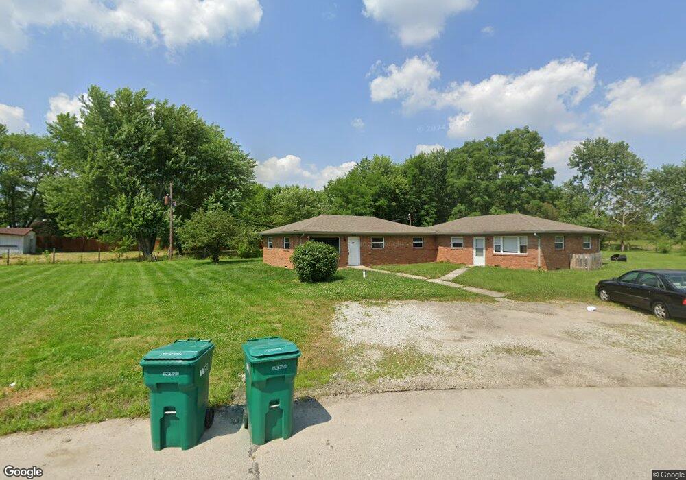
7092 N Manor Dr Unit 709 Brownsburg, IN 46112
Estimated Value: $177,861 - $259,000
2
Beds
1
Bath
899
Sq Ft
$252/Sq Ft
Est. Value
About This Home
This home is located at 7092 N Manor Dr Unit 709, Brownsburg, IN 46112 and is currently estimated at $226,965, approximately $252 per square foot. 7092 N Manor Dr Unit 709 is a home located in Hendricks County with nearby schools including Cardinal Elementary School, Brownsburg West Middle School, and Brownsburg High School.
Ownership History
Date
Name
Owned For
Owner Type
Purchase Details
Closed on
May 29, 2015
Sold by
Hyde Michael J
Bought by
100 Acre Investments Llc
Current Estimated Value
Home Financials for this Owner
Home Financials are based on the most recent Mortgage that was taken out on this home.
Original Mortgage
$150,000
Outstanding Balance
$86,675
Interest Rate
3.65%
Mortgage Type
Commercial
Estimated Equity
$140,290
Create a Home Valuation Report for This Property
The Home Valuation Report is an in-depth analysis detailing your home's value as well as a comparison with similar homes in the area
Home Values in the Area
Average Home Value in this Area
Purchase History
| Date | Buyer | Sale Price | Title Company |
|---|---|---|---|
| 100 Acre Investments Llc | -- | -- | |
| Hyde Michael J | -- | -- |
Source: Public Records
Mortgage History
| Date | Status | Borrower | Loan Amount |
|---|---|---|---|
| Open | Hyde Michael J | $150,000 | |
| Closed | 100 Acre Investments Llc | $150,000 |
Source: Public Records
Tax History Compared to Growth
Tax History
| Year | Tax Paid | Tax Assessment Tax Assessment Total Assessment is a certain percentage of the fair market value that is determined by local assessors to be the total taxable value of land and additions on the property. | Land | Improvement |
|---|---|---|---|---|
| 2024 | $2,700 | $148,500 | $35,100 | $113,400 |
| 2023 | $2,861 | $142,800 | $33,600 | $109,200 |
| 2022 | $2,325 | $116,200 | $27,500 | $88,700 |
| 2021 | $2,326 | $116,200 | $30,400 | $85,800 |
| 2020 | $2,507 | $125,200 | $32,200 | $93,000 |
| 2019 | $2,209 | $110,400 | $30,600 | $79,800 |
| 2018 | $2,137 | $106,800 | $28,800 | $78,000 |
| 2017 | $2,159 | $107,900 | $29,400 | $78,500 |
| 2016 | $2,113 | $105,600 | $29,400 | $76,200 |
| 2014 | $1,978 | $98,800 | $27,800 | $71,000 |
| 2013 | $2,086 | $104,200 | $27,800 | $76,400 |
Source: Public Records
Map
Nearby Homes
- 6 Rosecrans Ct
- 202 Sugar Bush Ln S
- 1390 Holiday Ln E
- 1432 Hideaway Cir
- T1600 Plan at Trailside
- T1500 Plan at Trailside
- 4531 Tolleston Ave
- T1800 Plan at Trailside
- 1247 Holiday Ln E
- 4475 Yellowwood Ave
- 4504 Yellowwood Ave
- 4472 Yellowwood Ave
- 4415 Tolleston Ave
- 4508 Yellowwood Ave
- 4407 Tolleston Ave
- 4476 Yellowwood Ave
- 4481 Yellowwood Ave
- 7107 Pate Hollow Dr
- 4411 Tolleston Ave
- 1290 Hideaway Ln
- 7092 N Manor Dr Unit 7094
- 7092 N Manor Dr
- 7064 N Manor Dr
- 7110 Pin Oak St
- 7110 Pin Oak St Unit 7112
- 3855 N State Road 267
- 7063 N Manor Dr Unit 7061
- 7130 Pin Oak Dr
- 7130 Pin Oak St
- 7101 Pin Oak St Unit 7109
- 7060 S Manor Dr
- 3885 N State Road 267
- 7014 N Manor Dr
- 7131 Pin Oak St
- 7014 N Manor Dr
- 7015 N Manor Dr Unit 7017
- 7097 S Manor Dr
- 7061 N Manor Dr
- 7059 S Manor Dr
- 7018-7020 S Manor Dr