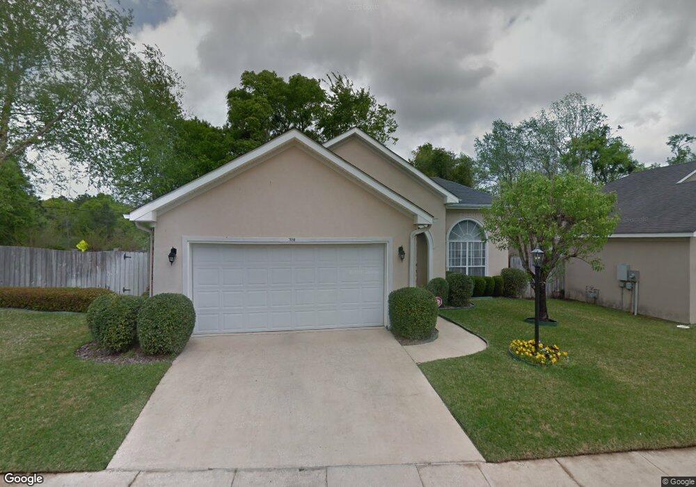
7098 Crown Pointe Dr Mobile, AL 36695
Thornhill NeighborhoodEstimated Value: $234,883 - $315,000
3
Beds
2
Baths
2,180
Sq Ft
$121/Sq Ft
Est. Value
About This Home
This home is located at 7098 Crown Pointe Dr, Mobile, AL 36695 and is currently estimated at $264,721, approximately $121 per square foot. 7098 Crown Pointe Dr is a home located in Mobile County with nearby schools including ER Dickson Elementary School, Burns Middle School, and WP Davidson High School.
Ownership History
Date
Name
Owned For
Owner Type
Purchase Details
Closed on
Aug 10, 2020
Sold by
Jackson Mary E
Bought by
Moon Joyce Jackson and Moon Mary Ernestine
Current Estimated Value
Purchase Details
Closed on
Jun 12, 1998
Sold by
Crown Pointe Inc
Bought by
Jackson George W and Jackson Mary E
Home Financials for this Owner
Home Financials are based on the most recent Mortgage that was taken out on this home.
Original Mortgage
$110,000
Interest Rate
7.23%
Mortgage Type
Purchase Money Mortgage
Create a Home Valuation Report for This Property
The Home Valuation Report is an in-depth analysis detailing your home's value as well as a comparison with similar homes in the area
Home Values in the Area
Average Home Value in this Area
Purchase History
| Date | Buyer | Sale Price | Title Company |
|---|---|---|---|
| Moon Joyce Jackson | $193,700 | None Available | |
| Jackson George W | -- | -- |
Source: Public Records
Mortgage History
| Date | Status | Borrower | Loan Amount |
|---|---|---|---|
| Previous Owner | Jackson George W | $110,000 |
Source: Public Records
Tax History
| Year | Tax Paid | Tax Assessment Tax Assessment Total Assessment is a certain percentage of the fair market value that is determined by local assessors to be the total taxable value of land and additions on the property. | Land | Improvement |
|---|---|---|---|---|
| 2025 | $922 | $40,740 | $7,000 | $33,740 |
| 2024 | $922 | $40,540 | $7,000 | $33,540 |
| 2023 | $916 | $19,450 | $3,200 | $16,250 |
| 2022 | $871 | $19,660 | $3,200 | $16,460 |
| 2021 | $0 | $19,170 | $3,200 | $15,970 |
| 2020 | $0 | $19,370 | $3,200 | $16,170 |
| 2019 | $848 | $19,260 | $0 | $0 |
| 2018 | $859 | $19,460 | $0 | $0 |
| 2017 | $818 | $18,740 | $0 | $0 |
| 2016 | -- | $19,120 | $0 | $0 |
| 2013 | -- | $18,400 | $0 | $0 |
Source: Public Records
Map
Nearby Homes
- 1263 Smithfield Rd E
- 6939 Johnston Ln
- 1130 Jonathan Ct
- 1361 Dellwyn Ct
- 7310 Cheryl Ct
- 6701 Somerby Ln
- 7311 Carson Rd S Unit 2
- 6617 Somerby Ln
- 1000 Choctaw Bluff Rd
- 1484 Pebble Creek Dr
- 6605 Somerby Ln
- 1218 Stratford Ct S
- 7229 Hawkins Manor
- 7394 Hawkins W
- 7224 Hawkins Manor
- 7232 Hawkins Manor
- 7228 Hawkins Manor
- 7382 Hawkins Manor
- 7183 Pine Barren Ct
- 7328 Hawkins Manor S
- 7094 Crown Pointe Dr
- 7090 Crown Pointe Dr
- 7097 Crown Pointe Dr
- 7093 Crown Pointe Dr
- 7086 Crown Pointe Dr
- 7089 Crown Pointe Dr
- 1209 Smithfield Rd E
- 7085 Crown Pointe Dr
- 7082 Crown Pointe Dr
- 1205 Smithfield Rd E
- 1217 Smithfield Rd E
- 1211 Smithfield Rd E
- 1153 Cody Rd S
- 1215 Smithfield Rd E
- 7081 Crown Pointe Dr
- 7078 Crown Pointe Dr
- 1221 Smithfield Rd E
- 7077 Crown Pointe Dr
- 7074 Crown Pointe Dr
- 1229 Smithfield Rd E
Your Personal Tour Guide
Ask me questions while you tour the home.