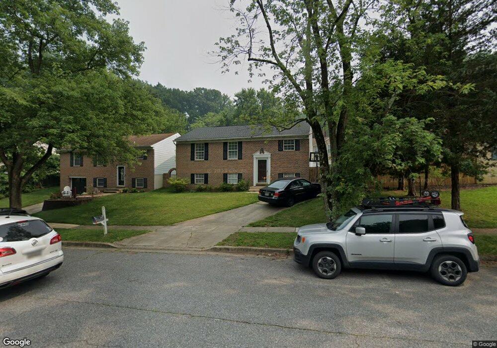
71 Barrensdale Dr Severna Park, MD 21146
Estimated Value: $404,000 - $504,000
--
Bed
1
Bath
988
Sq Ft
$468/Sq Ft
Est. Value
About This Home
This home is located at 71 Barrensdale Dr, Severna Park, MD 21146 and is currently estimated at $462,010, approximately $467 per square foot. 71 Barrensdale Dr is a home located in Anne Arundel County with nearby schools including Jones Elementary School, Severna Park Middle School, and Severna Park High School.
Ownership History
Date
Name
Owned For
Owner Type
Purchase Details
Closed on
Sep 23, 1997
Sold by
Household Bank F S B
Bought by
Pereira Julio R and Pereira Deanna D
Current Estimated Value
Purchase Details
Closed on
Aug 9, 1996
Sold by
Gunnison William C
Bought by
Household Bank F S B
Purchase Details
Closed on
Jul 16, 1987
Sold by
William O Hugel Inc
Bought by
Gunnison William C
Home Financials for this Owner
Home Financials are based on the most recent Mortgage that was taken out on this home.
Original Mortgage
$91,240
Interest Rate
10.3%
Create a Home Valuation Report for This Property
The Home Valuation Report is an in-depth analysis detailing your home's value as well as a comparison with similar homes in the area
Home Values in the Area
Average Home Value in this Area
Purchase History
| Date | Buyer | Sale Price | Title Company |
|---|---|---|---|
| Pereira Julio R | $127,000 | -- | |
| Household Bank F S B | $98,000 | -- | |
| Gunnison William C | $87,900 | -- |
Source: Public Records
Mortgage History
| Date | Status | Borrower | Loan Amount |
|---|---|---|---|
| Previous Owner | Gunnison William C | $91,240 | |
| Closed | Pereira Julio R | -- |
Source: Public Records
Tax History Compared to Growth
Tax History
| Year | Tax Paid | Tax Assessment Tax Assessment Total Assessment is a certain percentage of the fair market value that is determined by local assessors to be the total taxable value of land and additions on the property. | Land | Improvement |
|---|---|---|---|---|
| 2025 | $2,776 | $388,067 | -- | -- |
| 2024 | $2,776 | $364,300 | $228,000 | $136,300 |
| 2023 | $2,691 | $351,833 | $0 | $0 |
| 2022 | $2,512 | $339,367 | $0 | $0 |
| 2021 | $2,381 | $326,900 | $203,000 | $123,900 |
| 2020 | $2,381 | $317,833 | $0 | $0 |
| 2019 | $2,340 | $308,767 | $0 | $0 |
| 2018 | $2,239 | $299,700 | $171,700 | $128,000 |
| 2017 | $2,192 | $276,967 | $0 | $0 |
| 2016 | -- | $254,233 | $0 | $0 |
| 2015 | -- | $231,500 | $0 | $0 |
| 2014 | -- | $231,500 | $0 | $0 |
Source: Public Records
Map
Nearby Homes
- 939 Kinhart Ct
- 1394 Baltimore and Annapolis Trail
- 36 Hoyle Ln
- 880 Baltimore Annapolis Blvd
- 626 Old County Rd
- 812 Birch Run Terrace
- 67 Dividing Creek Ct
- 981 Ritchie Hwy
- 774 Dividing Creek Rd
- 44 Jones Station Rd
- 765 Baltimore Annapolis Blvd
- 716 Magothy Rd
- 100 Rustic Ridge Rd
- 134 Club Rd
- 100 Asquithoaks Ln
- 197 Cypress Creek Rd
- 1277 Ritchie Hwy Unit 195
- 1199 Asquithpines Place
- 0 Magothy Rd Unit 9G MDAA2101266
- 360 Magothy Rd Unit 8H
- 69 Barrensdale Dr
- 73 Barrensdale Dr
- 929 Kinhart Ct
- 927 Kinhart Ct
- 931 Kinhart Ct
- 933 Kinhart Ct
- 67 Barrensdale Dr
- 935 Kinhart Ct
- 58 Wohl Ct
- 65 Barrensdale Dr
- 56 Barrensdale Dr
- 72 Barrensdale Dr
- 70 Barrensdale Dr
- 937 Kinhart Ct
- 60 Wohl Ct
- 63 Barrensdale Dr
- 68 Wohl Ct
- 924 Kinhart Ct
- 54 Barrensdale Dr
- 932 Kinhart Ct