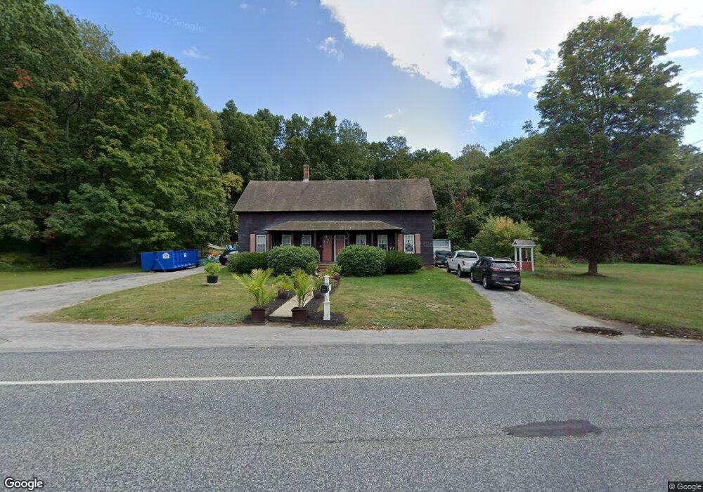
71 Boston Rd Sutton, MA 01590
Estimated Value: $491,000 - $650,000
4
Beds
2
Baths
2,440
Sq Ft
$232/Sq Ft
Est. Value
About This Home
This home is located at 71 Boston Rd, Sutton, MA 01590 and is currently estimated at $566,912, approximately $232 per square foot. 71 Boston Rd is a home located in Worcester County with nearby schools including Sutton Elementary School, Sutton Middle School, and Sutton High School.
Ownership History
Date
Name
Owned For
Owner Type
Purchase Details
Closed on
Jun 9, 2021
Sold by
Lange Gregory P and Lange Cheri A
Bought by
Lange Jamie C and Lange Gregory P
Current Estimated Value
Purchase Details
Closed on
Mar 30, 2012
Sold by
Lange William J
Bought by
Lange Cheri A and Lange Gregory P
Create a Home Valuation Report for This Property
The Home Valuation Report is an in-depth analysis detailing your home's value as well as a comparison with similar homes in the area
Home Values in the Area
Average Home Value in this Area
Purchase History
| Date | Buyer | Sale Price | Title Company |
|---|---|---|---|
| Lange Jamie C | -- | None Available | |
| Lange Cheri A | -- | -- |
Source: Public Records
Tax History
| Year | Tax Paid | Tax Assessment Tax Assessment Total Assessment is a certain percentage of the fair market value that is determined by local assessors to be the total taxable value of land and additions on the property. | Land | Improvement |
|---|---|---|---|---|
| 2025 | $5,933 | $476,200 | $200,800 | $275,400 |
| 2024 | $5,360 | $415,800 | $190,500 | $225,300 |
| 2023 | $5,028 | $357,100 | $173,700 | $183,400 |
| 2022 | $4,752 | $306,200 | $134,700 | $171,500 |
| 2021 | $4,430 | $271,300 | $134,700 | $136,600 |
| 2020 | $4,436 | $271,300 | $134,700 | $136,600 |
| 2019 | $4,666 | $275,100 | $134,700 | $140,400 |
| 2018 | $4,547 | $267,300 | $134,700 | $132,600 |
| 2017 | $4,310 | $254,100 | $119,500 | $134,600 |
| 2016 | $4,257 | $248,200 | $119,500 | $128,700 |
| 2015 | $4,212 | $246,300 | $119,500 | $126,800 |
| 2014 | $4,330 | $248,300 | $125,700 | $122,600 |
Source: Public Records
Map
Nearby Homes
- 20 Millers Way Unit C
- 66 Buttonwood Ave
- 229 Worcester-Providence Turnpike
- 175 Armsby Rd
- 5 Wildflower Dr
- 150 Ariel Cir
- 90 Leland Hill Rd
- 82 Central Turnpike
- 99 Burbank Road Lot 182
- 99 Burbank Rd
- 1 Burbank Rd
- 53 Fisherville Terrace
- 64 Fisherville Terrace
- 62 Fisherville Terrace
- 58 Fisherville Terrace
- 5 Mogren Dr
- 168 Burbank Rd
- 191 Hartness Rd
- 2 Jessica j Dr
- 4 Jessica j Dr
- 74 Boston Rd
- 72 Boston Rd
- 2 Bashaw Rd
- 68 Boston Rd
- 7 Miller's Way Unit C
- 9 C Millers Way Unit 9C
- 9 Millers Way Unit D
- 9 Millers Way Unit C
- 9 Millers Way Unit B
- 9 Millers Way Unit A
- 4 Bashaw Rd
- 5 Burke Ln
- 11 Millers Way Unit D
- 11 Millers Way Unit C
- 11 Millers Way Unit B
- 11 Millers Way Unit A
- 11A Millers Way Unit 11A
- 11A Millers Way
- 11A Millers Way Unit A
- 11 Miller's Way Unit A
Your Personal Tour Guide
Ask me questions while you tour the home.