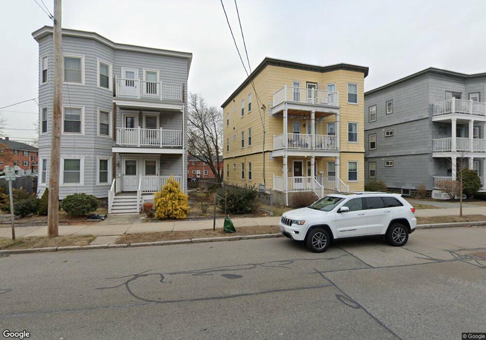
71 Broadway Unit 1 Arlington, MA 02474
East Arlington NeighborhoodEstimated Value: $753,000 - $790,000
2
Beds
2
Baths
1,973
Sq Ft
$392/Sq Ft
Est. Value
About This Home
This home is located at 71 Broadway Unit 1, Arlington, MA 02474 and is currently estimated at $773,269, approximately $391 per square foot. 71 Broadway Unit 1 is a home located in Middlesex County with nearby schools including Thompson School, Ottoson Middle School, and Arlington High School.
Ownership History
Date
Name
Owned For
Owner Type
Purchase Details
Closed on
Mar 24, 2017
Sold by
Brown Michael F
Bought by
Nathan Lance E and Nathan Michelle D
Current Estimated Value
Home Financials for this Owner
Home Financials are based on the most recent Mortgage that was taken out on this home.
Original Mortgage
$380,000
Interest Rate
4.17%
Mortgage Type
New Conventional
Purchase Details
Closed on
May 11, 2009
Sold by
Osullivan Robert J
Bought by
Brown Michael F
Home Financials for this Owner
Home Financials are based on the most recent Mortgage that was taken out on this home.
Original Mortgage
$210,000
Interest Rate
4.9%
Mortgage Type
Purchase Money Mortgage
Create a Home Valuation Report for This Property
The Home Valuation Report is an in-depth analysis detailing your home's value as well as a comparison with similar homes in the area
Home Values in the Area
Average Home Value in this Area
Purchase History
| Date | Buyer | Sale Price | Title Company |
|---|---|---|---|
| Nathan Lance E | $475,000 | -- | |
| Brown Michael F | $280,000 | -- |
Source: Public Records
Mortgage History
| Date | Status | Borrower | Loan Amount |
|---|---|---|---|
| Open | Nathan Lance E | $380,000 | |
| Previous Owner | Brown Michael F | $210,000 |
Source: Public Records
Tax History Compared to Growth
Tax History
| Year | Tax Paid | Tax Assessment Tax Assessment Total Assessment is a certain percentage of the fair market value that is determined by local assessors to be the total taxable value of land and additions on the property. | Land | Improvement |
|---|---|---|---|---|
| 2025 | $5,170 | $480,000 | $0 | $480,000 |
| 2024 | $4,940 | $466,500 | $0 | $466,500 |
| 2023 | $5,046 | $450,100 | $0 | $450,100 |
| 2022 | $4,996 | $437,500 | $0 | $437,500 |
| 2021 | $4,817 | $424,800 | $0 | $424,800 |
| 2020 | $4,629 | $418,500 | $0 | $418,500 |
| 2019 | $4,926 | $437,500 | $0 | $437,500 |
| 2018 | $4,139 | $341,200 | $0 | $341,200 |
| 2017 | $3,884 | $309,200 | $0 | $309,200 |
| 2016 | $3,958 | $309,200 | $0 | $309,200 |
| 2015 | $3,873 | $285,800 | $0 | $285,800 |
Source: Public Records
Map
Nearby Homes
- 80 Broadway Unit 4C
- 80 Broadway Unit PH
- 2 Norcross Cir Unit 4
- 65 Marathon St Unit L
- 63 Marathon St Unit R
- 54 Marathon St Unit 1
- 78 Everett St
- 62-64 Waldo Rd
- 215 Massachusetts Ave Unit 19 (34)
- 48-50 Amsden St
- 48-50 Amsden St Unit 50
- 48-50 Amsden St Unit 48
- 6 Gordon Rd
- 45 Teel St
- 327 Alewife Brook Pkwy Unit A
- 94 Rawson Rd Unit 94
- 25-27 Adams St
- 69 Sterling St
- 24 Park St Unit 2
- 79 Fairfax St Unit 79
- 71 Broadway Unit 71
- 73 Broadway Unit 2
- 73 Broadway Unit 1
- 69 Broadway
- 69 Broadway Unit 3
- 69 Broadway Unit 1
- 75 Broadway Unit 77
- 67 Broadway
- 67 Broadway Unit 1
- 79 Broadway Unit A
- 65 Broadway
- 65 Broadway Unit 1
- 65 Broadway Unit 3
- 65 Broadway Unit 2
- 81 Broadway Unit 83
- 35 Hilton St Unit 37
- 35 Hilton St
- 37 Hilton St Unit 1
- 35 Hilton St Unit 2
- 35 Hilton St Unit 35